
 Live Science Plus


Southwestern United States Spied from Space

published
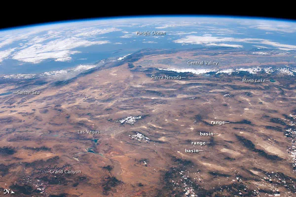
The Southwestern United States as seen from the International Space Station.
(Image credit: Expedition 24 crew.)
This panoramic view of the southwestern United States and Pacific Ocean was taken by an astronaut onboard the International Space Station (ISS).
While most unmanned satellites view the Earth from a nadir perspective collecting data while looking "straight down" astronauts on the ISS can acquire imagery at a wide range of viewing angles using handheld digital cameras. The spacecraft was located directly above northwestern Arizona, approximately 160 miles (260 kilometers) to the east-southeast, when this picture was taken.

TOPICS
