Quadruple volcanoes on secret Soviet military base linked to climate-altering eruption 200 years ago — Earth from space
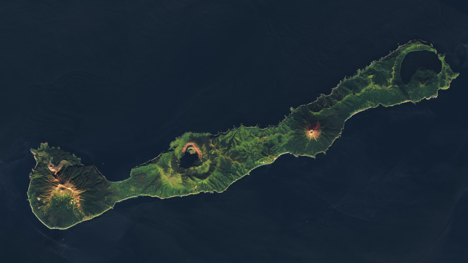
A 2024 satellite photo shows four end-to-end volcanoes perfectly spaced out along the Russian island of Simushir. One of these peaks was the site of a surprise eruption that temporarily cooled the Northern Hemisphere in 1831.

Where is it? Simushir, Kuril Islands [46.9590781, 152.0396667]
What's in the photo? The lofty peaks of four volcanoes standing side-by-side
Which satellite took the photo? Landsat 8
When was it taken? Sept. 12, 2024
This eye-catching satellite photo shows Simushir, a little-known Russian island and former Soviet naval base, featuring four end-to-end volcanoes that are evenly spaced and in a surprisingly straight line. One of the four peaks was the site of one of the largest eruptions in recorded history, which significantly altered Earth's climate around 200 years ago.
Simushir is one of the Kuril Islands — a Russian-controlled archipelago of more than 50 volcanic islands in the North Pacific Ocean. Like the rest of the Kuril Islands, the sovereignty of Simushir has been passed back and forth between two nearby countries, Russia and Japan, several times over the last 400 years. It was most recently used as a secret Soviet nuclear submarine base until 1994, but is now uninhabited.
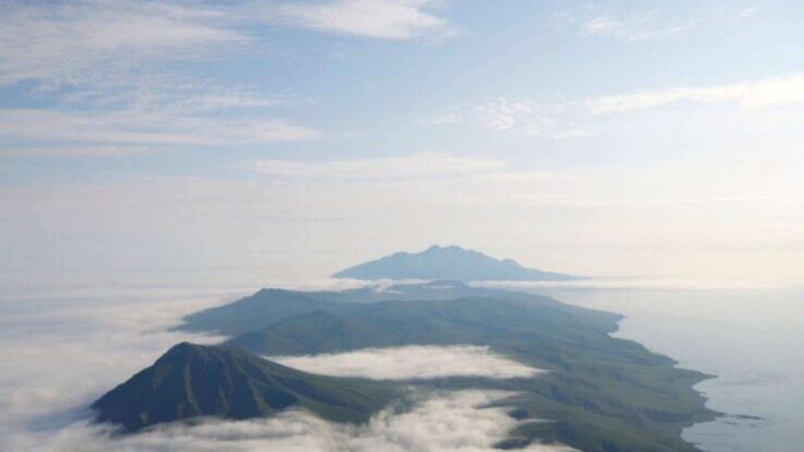
The 5-mile-long (8 kilometer) landmass is home to four major volcanoes that can be seen from space. These towering structures are, from southeast to northwest (left to right): Milna, Zavaritski, Prevo and Uratman.
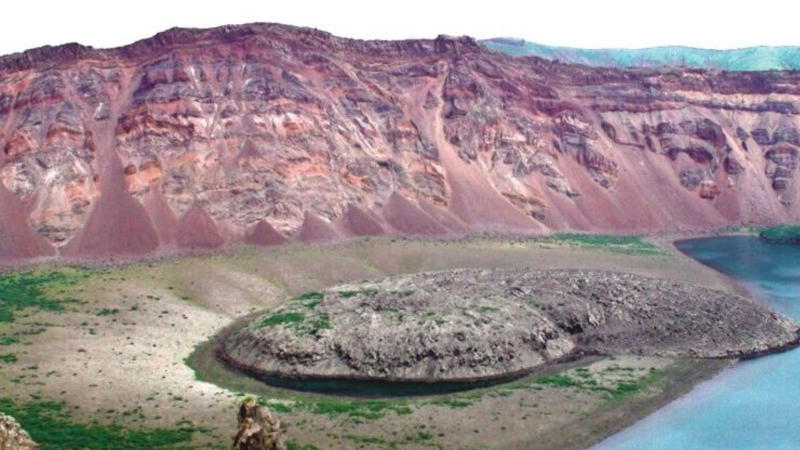
Milna is the tallest of the four at 5,050 feet (1,540 meters) tall and last erupted in 1914. Next to it lies Zavaritzki, also known as Zavaritskogo, which stands around 2,047 feet (624 m) above sea level, and last blew its top in 1957, leaving behind a largely hollowed-out crater.
Prevo, which is 4,460 feet (1,360 m) tall, last erupted in 1825. Meanwhile Uratman, which stands at 2,224 feet (678 m), shows no signs of having erupted for at least 12,000 years. A deep lagoon, known as Brouton Bay, can also be seen surrounding Uratman. This was where the Soviets stored some of their nuclear submarines.
Related: See all the best images of Earth from space

There's a smaller fifth volcano on the island, named Goriaschaia Sopka, which is located on the northeast flank of Milna, but it’s indiscernible from the larger volcanoes in satellite photos. Despite being classed as individual volcanoes, Goriaschaia Sopka and Milna are closely linked to one another.
Get the world’s most fascinating discoveries delivered straight to your inbox.
Simushir and the other Kuril Islands are hotspots for volcanic activity because they're located within what experts call the "Ring of Fire" — a 25,000-mile-long (40,000 km) arc located above tectonic plate boundaries surrounding the outer edge of the Pacific Ocean, according to NASA's Earth Observatory. This region contains around two-thirds of the world's terrestrial volcanoes and is the site of around 90% of all earthquakes.
The big one
In 1831, the Northern Hemisphere's climate cooled by an average of about 1.8 degrees Fahrenheit (1 degree Celsius), coinciding with reports of gloomy, bleak weather and the sun turning different colors.
Scientists knew a massive eruption caused this strange event, but the volcano responsible has remained a mystery.

But in December 2024, a new study revealed that Zavaritzki was the culprit after matching ash deposits in polar ice cores to the volcano.
This finding was a surprise to the researchers because there had been no prior evidence of any eruption on Simushir in 1831, likely due to its remote location and the lack of any potential witnesses on surrounding islands.
"We had no idea this volcano was responsible [for the dramatic eruption]," study lead author William Hutchison, a volcanologist at the University of St Andrews in Scotland, previously told Live Science. "It was completely off the radar."

Harry is a U.K.-based senior staff writer at Live Science. He studied marine biology at the University of Exeter before training to become a journalist. He covers a wide range of topics including space exploration, planetary science, space weather, climate change, animal behavior and paleontology. His recent work on the solar maximum won "best space submission" at the 2024 Aerospace Media Awards and was shortlisted in the "top scoop" category at the NCTJ Awards for Excellence in 2023. He also writes Live Science's weekly Earth from space series.
You must confirm your public display name before commenting
Please logout and then login again, you will then be prompted to enter your display name.
 Live Science Plus


