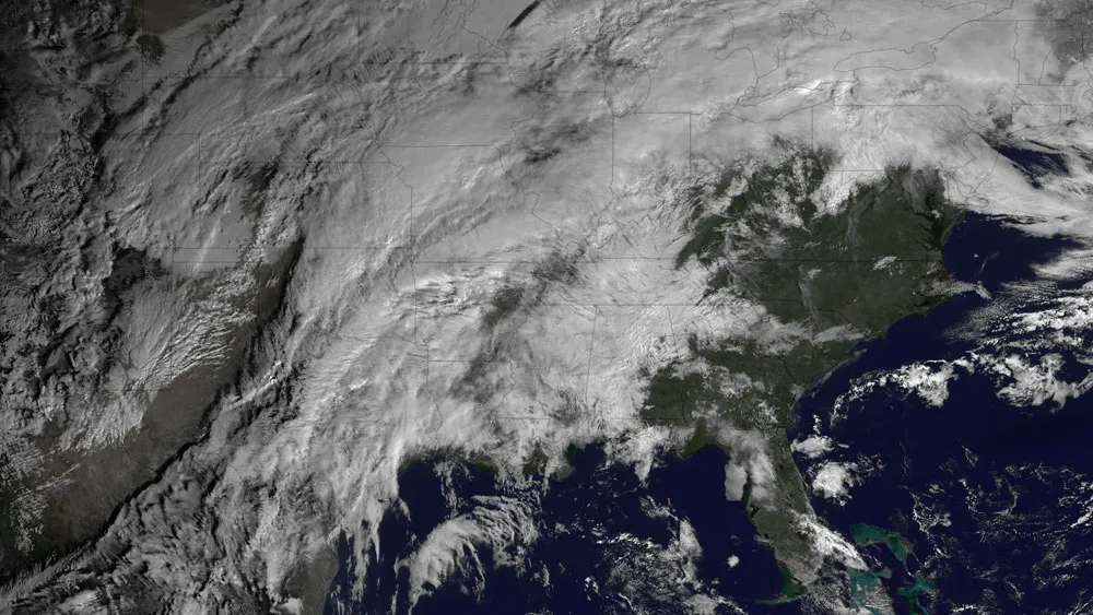
After an Arctic blast left much of the United States out in the cold, a new system is bringing the threat of severe weather to the central portions of the country this evening and through the night. A satellite snapped an image of the system earlier this morning (Jan. 29).
The National Weather Service's (NWS) Storm Prediction Center, located in Norman, Okla., has forecast severe thunderstorms, with damaging winds and hail — and possibly even tornadoes — for the lower Ohio Valley, the mid-South and the lower Mississippi Valley. The SPC says the threat will increase through the night, with squall lines (or long lines of thunderstorms) and individual storms rolling through along with a cold front.
Nighttime storms and tornadoes can be particularly deadly, as people tend to be in bed and unaware of warnings and the storms are harder to see as they bear down. A 2008 study in the American Meteorological Society's journal Weather and Forecasting found that nighttime tornadoes were 2.5 times as likely to cause a death as those that occurred in the daytime. The threat of deadly nighttime tornadoes is exacerbated in the winter with the season's shorter daylight hours. [5 Deadliest Tornado Years in U.S. History]
Latest Videos From
Tennessee leads the nation in the proportion of nighttime tornadoes it sees, with nearly half of the twisters in its borders striking after dark. Western Tennessee is one of the places that could see severe weather in this latest bout, along with most of Arkansas, and parts of Louisiana, Kentucky, Missouri, Mississippi, Illinois, Indiana and Oklahoma.
The National Weather Service has issued several tornado watches and severe storm warnings and alerted residents to the possibility of large hail and high winds, as well as lightning strikes. The Weather Channel reported on its Twitter account that as of 2 p.m. ET, 24 severe weather reports, 10 severe wind reports, 14 hail reports and no tornado reports had been made. It also reported unconfirmed reports of a funnel cloud to the west of Jefferson City, Mo.
The GOES East satellite (run by NASA and the National Oceanic and Atmospheric Administration, the parent organization of the NWS), snapped an image of the cold front and accompanying stormy conditions at 10:15 a.m. ET.
The cold front will sweep eastward on Wednesday and could bring severe weather to parts of the East Coast, from the Gulf Coast northward. By Wednesday evening, it could impact Washington, D.C., and New York City.
This story was provided by OurAmazingPlanet, a sister site to LiveScience. Follow OurAmazingPlanet on Twitter @OAPlanet. We're also on Facebook and Google+.

 Live Science Plus