Heads up, East Coast. El Niño-related weather could get even worse in the future, according to a new study.
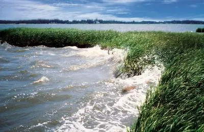
The coastal communities, already threatened by rising sea levels due to climate change, may also see more destructive storm surges from these higher waters in future El Niño years, a new study by the National Oceanic and Atmospheric Administration (NOAA) says. A destructive storm surge is where storms cause water levels to rapidly increase by at least 1 foot (0.3 meters).
The study was prompted by an unusual number of destructive storm surges along the East Coast during the 2009-2010 El Niño-dominated winter.
Latest Videos From
"High-water events are already a concern for coastal communities," said study author Bill Sweet of NOAA. "Studies like this may better prepare local officials who plan for or respond to conditions that may impact their communities. For instance, city planners may consider reinforcing the primary dunes to mitigate for erosion at their beaches and protecting vulnerable structures like city docks by October during a strong El Niñoyear."
El Niño conditions are characterized by unusually warm temperatures in the equatorial Pacific that normally peak during the Northern Hemisphere "cool season" of October to April. They occur every three to five years with stronger events generally occurring every 10-15 years. El Niño conditions have important consequences for global weather patterns, and in the U.S. often cause wetter-than-average conditions and cooler-than-normal temperatures across much of the South.
The new study examined water levels and storm surges during the cool season for the past five decades at four sites representative of much of the East Coast: Boston; Atlantic City, N.J.; Norfolk, Va., and Charleston, S.C.
From 1961 to 2010, the study found that in strong El Niño years, these coastal areas experienced nearly three times the number of storm surges seen in an average year. The researchers also found that waters in those areas saw a third-of-a-foot elevation in mean sea level above predicted conditions.
The study builds on previous ocean-atmospheric research, which has concluded that during El Niño, Nor'easter windstorms are more frequent along the East Coast during the cool season.
El Niño and its impacts usually fade in the warmer months, and may transition into La Niña conditions, which are generally opposite to those of El Niño. However, a similar connection between La Niña conditions and depressed East Coast sea levels was not found.
The new study is detailed in the journal Monthly Weather Review.
This story was provided by OurAmazingPlanet, a sister site to LiveScience.