Earth As Art
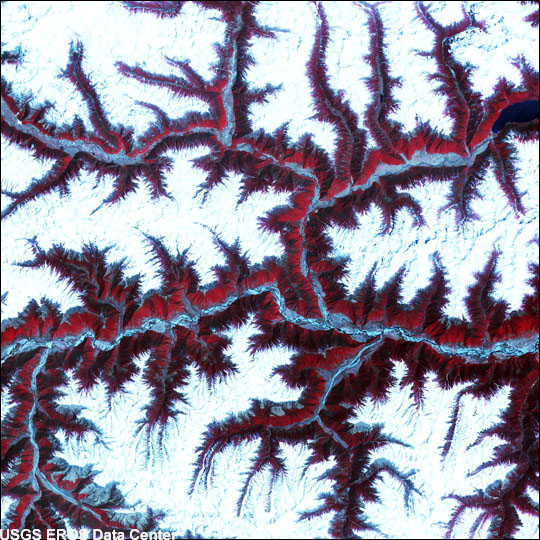
Himalaya Mountains

Soaring, snow-capped peaks and ridges of the eastern Himalaya Mountains create an irregular white-on-red patchwork between major rivers in southwestern China. The Himalaya are made up of three parallel mountain ranges that together extend more than 2,900 kilometers. This scene was acquired by the Advanced Spaceborne Thermal Emission and Reflection Radiometer (ASTER), flying aboard NASA’s Terra satellite, on February 27, 2002.
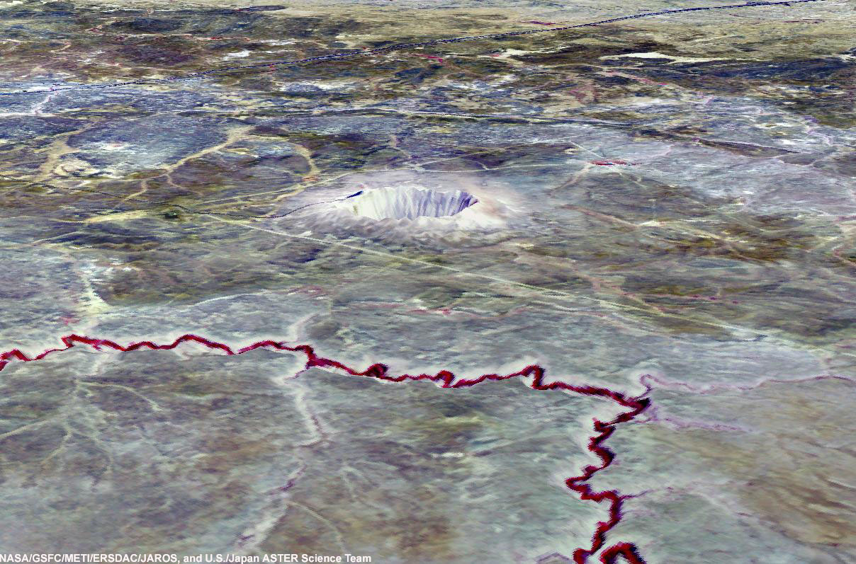
The Barringer Meteorite Crater

The Barringer Meteorite Crater (also known as Meteor Crater) is a gigantic hole in the middle of the arid sandstone of the Arizona desert. A rim of smashed and jumbled boulders, some of them the size of small houses, rises 50 m above the level of the surrounding plain. The crater itself is nearly a 1500 m wide, and 180 m deep. When Europeans first discovered the crater, the plain around it was covered with chunks of meteoritic iron - over 30 tons of it, scattered over an area 12 to 15 km in diameter. Scientists now believe that the crater was created approximately 50,000 years ago. The meteorite, which made it, was composed almost entirely of nickel-iron, suggesting that it may have originated in the interior of a small planet. It was 50 m across, weighed roughly 300,000 tons, and was traveling at a speed of 65,000 km per hour. Draping an ASTER bands 3-2-1 image over a digital elevation model from the US Geological Survey National Elevation Dataset created this ASTER 3-D perspective view. The data were acquired May 17, 2001, and the image covers an area of about 15 x 30 km.
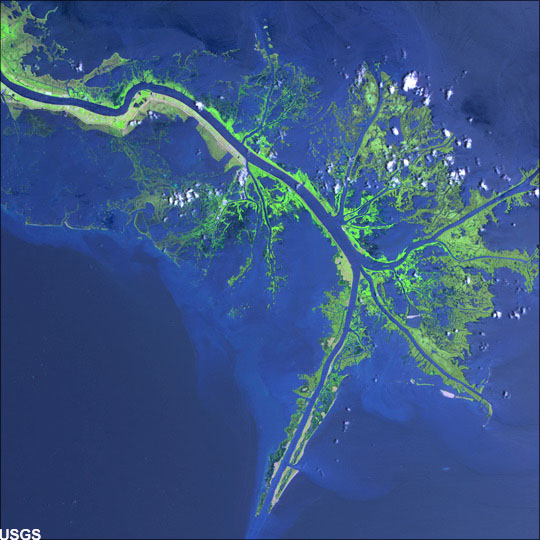
Mississippi River Delta

Turbid waters spill out into the Gulf of Mexico where their suspended sediment is deposited to form the Mississippi River Delta. Like the webbing on a duck’s foot, marshes and mudflats prevail between the shipping channels that have been cut into the delta. The ASTER instrument on NASA’s Terra satellite acquired this scene on May 24, 2001.
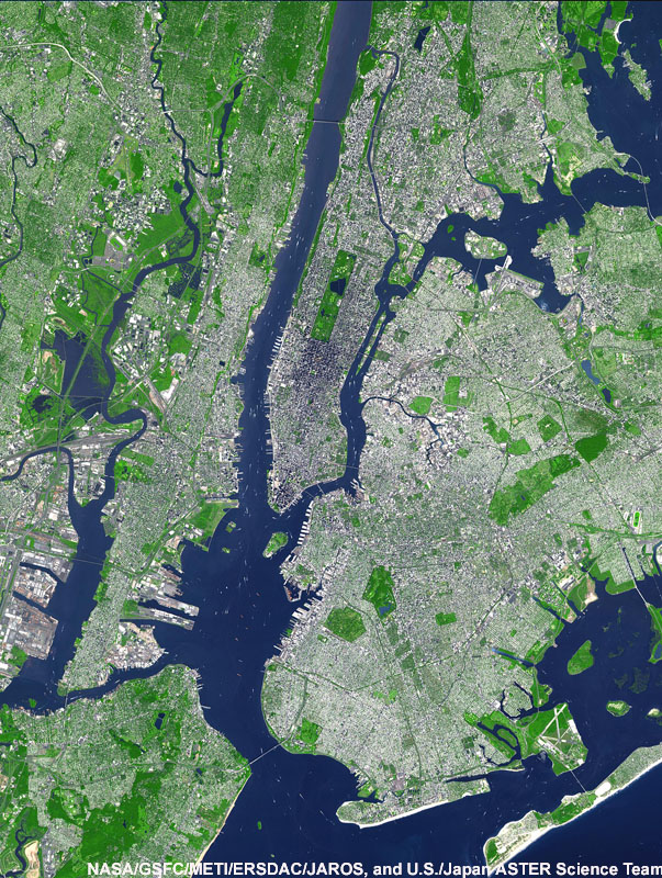
New York City

This ASTER image shows New York City and the Island of Manhattan, bordered by the Hudson and East Rivers. Parts of Long Island and Staten Island are also visible. Two of New York's major airports (Newark and La Guardia) are within the image. In the middle of Manhattan, Central Park appears as a long green rectangle with a large lake in the middle. The image covers an area of 27 x 37 km, and was acquired September 8, 2002.
Get the world’s most fascinating discoveries delivered straight to your inbox.


