


Could New York City Handle a Hurricane?
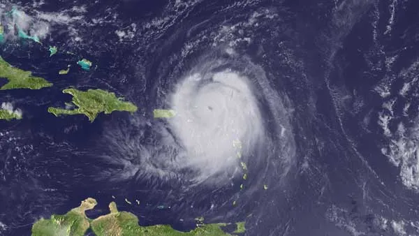
The National Hurricane Center warns that Hurricane Earl may swing by dangerously close to the U.S. East Coast before curving back out to sea. While the odds are it won't strike New York City directly, such an event is not unprecedented, and the city has plans in place to evacuate — and to hunker down — if need be.
Problem is, there would be precious little time to prepare. And while the forecast suggests it is very unlikely Hurricane Earl will strike Manhattan with more than a glancing blow, a direct hit by a hurricane is ultimately inevitable, scientists say.
Because hurricanes move more quickly and become very difficult to predict once they head north of the Carolinas, experts say there might be just hours to issue evacuation warnings before a storm hits.

Compounding this, the Big Apple has one of highest population densities in the nation – more than 8 million people live in New York City. Based on studies by the Army Corps of Engineers, officials have determined that vulnerable, low-lying areas in and around New York City and metropolitan New Jersey would need to start heading out sooner than what is typically ordered in Florida and other hurricane-prone states.
Frankly put: There would not be enough time to get everyone out. Disaster plans for New York City focus therefore on getting people out of low-lying areas that might be inundated by storm surges, and having others stay put or move to safe locations within the city.
History as a lesson
Since records have been kept in the 1700s, dozens of hurricanes have affected the greater New York City area. A handful were major events. Scientists have geologic evidence that other major hurricanes have hit the region in prehistory.
Get the world’s most fascinating discoveries delivered straight to your inbox.
One event, in 1821, offers a telling lesson. On Sept. 3 that year, a major hurricane slammed without warning into Manhattan. "Everything was flooded south of Canal Street," according to historical accounts. The East River and the Hudson River converged over lower Manhattan, but that part of the island had not yet been built up. The storm hit at low tide. Had the tide been high, the flooding would have been far worse, researchers say.
Late in the summer of 1938, a storm that started off the coast of Africa arrived unexpectedly along the coast of New Jersey, where 140 mph (225 kph) winds tore up boardwalks. The storm raced north at more than 50 mph (80 kph) and uprooted trees and destroyed houses on Long Island. Since no warnings were issued, people fled only when they saw the storm approaching, and by the time the storm tore through much of the northeast, an estimated 682 to 800 people were killed, according to "Sudden Sea: The Great Hurricane of 1938" (Back Bay, 2004).
More recently, Hurricane Carol made landfall as a Category 3 storm on Long Island and Connecticut in 1954. In 1960, Hurricane Donna created an 11-foot (3.4 meters) storm surge in New York Harbor, causing extensive pier damage, according to the New York City Office of Emergency Management. Hurricane Gloria in 1985 would have been "catastrophic" if it had hit at high tide and been just slightly closer to the city. There have been several other near-misses in the past six decades.
Scientists note that since so few hurricanes actually strike the New York area, it's hard to say when it will happen again. But history suggests it is only a matter of time before a major hurricane makes a direct hit on Manhattan.
What would happen
The Army Corps has thoroughly mapped what areas could flood. New York Harbor would act like a funnel for an incoming storm surge, and water would have nowhere to go and could be pushed up as high as a 3-story building.
"A major hurricane could push more than 30 feet of storm surge into some parts of New York City," according to the Office of Emergency Management.
The region's major airports are among the locations that could find themselves submerged by the sea. Nursing homes on Coney Island — challenging facilities to evacuate — are at great risk.
New York City has plans in place that, if necessary, would call for evacuations by zones, at the direction of the mayor. [Residents can find their zone here.] The plan focuses on early use of mass transit and discourages evacuation by car. Complicating evacuations is this simple fact: High winds and flooding can precede a major hurricane by hours, bringing a halt to evacuation efforts well before the center of a storm arrives.
If a hurricane or severe storm hits, the Federal Emergency Management Agency offers these tips for staying safe:
- Listen to the radio or TV for information.
- Secure your home, close storm shutters, and secure outdoor objects or bring them indoors.
- Turn off utilities if instructed to do so. Otherwise, turn the refrigerator thermostat to its coldest setting and keep its doors closed.
- Turn off propane tanks.
- Avoid using the phone, except for serious emergencies.
- Moor your boat if time permits.
- Ensure a supply of water for sanitary purposes, such as cleaning and flushing toilets. Fill the bathtub and other large containers with water.
Could get worse
Today, with climate change and rising seas levels, the effects of a hurricane could be even worse for New York City, and could become increasingly devastating as time goes on.
A 2001 study conducted by Columbia University scientists looked at several impacts of climate change on the New York metropolitan area. The researchers projected a rise in sea level of 11.8 to 37.5 inches (29.9 to 95.2 centimeters) in New York City and 9.5 to 42.5 inches (24.1 to 107.9 cm) in the metropolitan area by the 2080s.
"With sea level at these higher levels, flooding by major storms would inundate many low-lying neighborhoods and shut down the entire metropolitan transportation system with much greater frequency," said Vivien Gornitz, one of the Columbia University scientists working with the New York City Department of Environmental Protection to better understand what hurricanes would do to the city.
While a hurricane would undoubtedly spell disaster for the city, Manhattan is currently better prepared to face a heavy storm than it has been in previous years, according to Nicholas Coch, a Coastal and Estuarine Geology professor at the City University of New York and an expert on natural disaster preparedness.
"City officials definitely have an improved perception of how to handle a hurricane, especially regarding evacuation plans," Coch told Life's Little Mysteries.
If a hurricane were to hit Manhattan, the island would not necessarily have to be evacuated, said Coch, who reasons that moving people from the lowest areas to higher ground would suffice in keeping them safe – although this should ideally be done the day before the anticipated storm.
In fact, if Earl does come New York's way, it is most likely that beach communities in Suffolk, Long Island, would be hit the hardest, Coch said. Both Suffolk and Nassau county officials say that preparations have been made in case Earl strikes, with updated evacuation plans, potential shelter sites and a new, high-speed notification 'Code RED' system that alerts residents of impending weather emergencies by phone, e-mail and/or text messages.
This article was provided by Life's Little Mysteries, a sister site to Live Science.