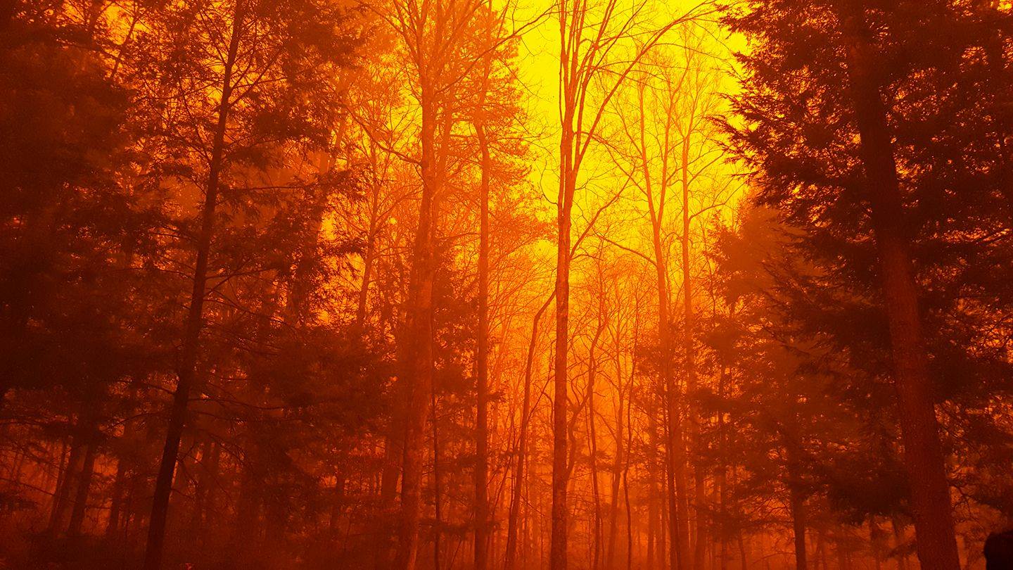
Gatlinburg Burning: How a Tennessee Wildfire Spread So Fast

Get the world’s most fascinating discoveries delivered straight to your inbox.
You are now subscribed
Your newsletter sign-up was successful
Want to add more newsletters?

Delivered Daily
Daily Newsletter
Sign up for the latest discoveries, groundbreaking research and fascinating breakthroughs that impact you and the wider world direct to your inbox.

Once a week
Life's Little Mysteries
Feed your curiosity with an exclusive mystery every week, solved with science and delivered direct to your inbox before it's seen anywhere else.

Once a week
How It Works
Sign up to our free science & technology newsletter for your weekly fix of fascinating articles, quick quizzes, amazing images, and more

Delivered daily
Space.com Newsletter
Breaking space news, the latest updates on rocket launches, skywatching events and more!

Once a month
Watch This Space
Sign up to our monthly entertainment newsletter to keep up with all our coverage of the latest sci-fi and space movies, tv shows, games and books.

Once a week
Night Sky This Week
Discover this week's must-see night sky events, moon phases, and stunning astrophotos. Sign up for our skywatching newsletter and explore the universe with us!
Join the club
Get full access to premium articles, exclusive features and a growing list of member rewards.
Great Smoky Mountain National Park is closed, and thousands of residents in the nearby towns of Gatlinburg and Pigeon Forge, Tennessee, have fled their homes after a wildfire from the park turned into a rapidly spreading inferno last night (Nov. 28).
At least 14,000 people have evacuated from the two resort towns, and hundreds of structures have been damaged or destroyed, according to the Tennessee Emergency Management Agency. But how did a forest fire spread so rapidly that it trapped some visitors inside a local hotel, filming the flames as the blaze approached the parking lot? [Natural Disasters: Top 10 US Threats]
Two words: drought and wind.
Dry year
Most of East Tennessee has been in exceptional or severe drought all summer, said Sam Roberts, a meteorologist at the National Weather Service forecast office in Morristown, Tennessee. At the Knoxville, Tennessee, airport monitoring station, precipitation is down 10.29 inches (26 centimeters) from the annual average, Roberts told Live Science. In the state's Tri-Cities area, about 80 miles (130 kilometers) from Gatlinburg, precipitation is down 9.65 inches (25 cm) over the yearly average. And in Chattanooga in the far southeast corner of the state, precipitation has been a whopping 21.5 inches (55 cm) below average.
"If they don't get too much more rain, this will be the driest year on record for them," Roberts said.
A ridge of high atmospheric pressure parked over the U.S. Southeast has kept rain at bay over the summer, Roberts said, setting the stage for the current conflagration. As of Nov. 23, a small section of the northeastern corner of Tennessee is in moderate drought, while the rest of the state struggles under severe, extreme or exceptional drought, according to the U.S. Drought Monitor. [Dry and Dying: Images of Drought]
Sudden spread
Wildfire activity has been above normal in the eastern part of the state, Roberts said, but even without precipitation, firefighting efforts seemed to have controlled the situation in recent days.
Get the world’s most fascinating discoveries delivered straight to your inbox.
"Over the past week or so, things had started to settle down a little bit," he said.
That is, they had until Monday night. On Sunday, a fire started at Chimney Tops, a popular hiking peak inside Great Smoky Mountains National Park. The blaze had spread to around 500 acres in size when a strong front traveling from the southwest brought gusty winds to the area, Roberts said.
"They were getting gusts up there to 40, 50, 60 mph [64 to 97 km/h]," he said. "Because the fuels were so dry because of the drought, the wind just absolutely accelerated these fires at a very, very fast pace."
The winds also sent the fire racing downslope, which is relatively rare, said Brad Panovich, the chief meteorologist at WCNC-NBC TV in Charlotte, North Carolina.
"Heat rises and so you tend to get fire burning up the slope," Panovich said. "It tends to burn downslope real slow."
But in Gatlinburg, the twin pressures of wind and blowing dry leaves sent the blaze downhill, with flaming leaves sparking the fire's spread. The winds also knocked over power lines, sparking new fires, Panovich told Live Science.
Nature offered a slice of relief between midnight and 7 a.m. local time today, as Gatlinburg got between an inch and three-quarters inches of rain [1.3 to 2 centimeters], Roberts said. That precipitation helped dampen ground fuels like leaf litter, but large logs, timber and structures are still hot, he said.
"Right now, things are in much better shape than they were last night, but they are still dealing with some hotspots," Roberts said.
The greatest danger to Gatlinburg and surrounding areas now is another front that will bring in gusts of winds of between 15 and 30 mph (24 and 48 km/h) tonight (Nov. 29), Roberts said. Perhaps an inch of rain will follow those winds, starting after midnight, and this should help firefighting efforts, he said.
"The precipitation will come in," Roberts said. "It's just [that] we're going to have to deal with the winds first."
Original article on Live Science.

Stephanie Pappas is a contributing writer for Live Science, covering topics ranging from geoscience to archaeology to the human brain and behavior. She was previously a senior writer for Live Science but is now a freelancer based in Denver, Colorado, and regularly contributes to Scientific American and The Monitor, the monthly magazine of the American Psychological Association. Stephanie received a bachelor's degree in psychology from the University of South Carolina and a graduate certificate in science communication from the University of California, Santa Cruz.
 Live Science Plus


