


Shrinking Arctic Ice Will Lead to Ice-Free Summers
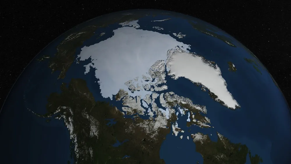
The Arctic is losing about 30,000 square miles (78,000 square kilometers) — an area roughly equivalent to the state of Maine — of sea ice each year, NASA scientists say. And while ice cover at the North Pole has rebounded from last year's record-setting lows, Arctic sea ice continues to retreat and thin at an alarming pace.
In 2012, the ice cap over the Arctic Ocean shrank to its lowest extent ever recorded. Measures of sea ice extent take into account the area of the Arctic Ocean on which ice covers at least 15 percent of the surface. This year's summer melting season is unlikely to break that record, but that does not necessarily herald good news, said Walt Meier, a glaciologist at NASA's Goddard Space Flight Center in Greenbelt, Md.
"This is not going to be as extreme a year as last year, but we're still seeing a strong downward trend," Meier told LiveScience. "We're still at levels that are much lower than average." [10 Things to Know About Sea Ice]
The Arctic Ocean's blanket of sea ice covered 2.25 million square miles (5.83 million square kilometers) on Aug. 21. For perspective, when the smallest extent was recorded last year, the Arctic's icy cover measured 1.32 million square miles (3.41 million square kilometers).
Ice-free summers
NASA began collecting detailed satellite records on Arctic sea ice beginning in the late 1970s, Meier said. Since then, researchers have watched glaciers hastily retreat and sea ice melt at increasingly rapid rates. In fact, since 1980, the Arctic has lost approximately 40 percent of its sea ice cover, Meier said.
"In the 1980s, the Arctic sea ice at the end of the summer was about the size of the lower 48 U.S. states," he explained. "If you imagine taking a road trip across the sea ice — say you want to go from Los Angeles to New York — you could have driven on the sea ice the whole way. Now, you'd reach the ice edge at around the middle of Nebraska, so we've lost everything east of the Mississippi [River], and even a bit west of the Mississippi."
Get the world’s most fascinating discoveries delivered straight to your inbox.
If current melting trends continue, the Arctic region will see completely ice-free summers in the future, he said.
"At this point, we're looking at 'when' as opposed to 'if,'" Meier said. "There's still a lot of uncertainty, because there's a lot of variation year to year, but it's definitely coming, and coming sooner than we previously expected."
Ten years ago, researchers predicted the Arctic could experience ice-free summers by the end of the century. "Now, it's really looking pretty likely that it could come mid-century at the latest, and perhaps even within the next couple of decades," Meier said.
Studies of the Arctic and Antarctic play an important role in global warming prediction. Scientists closely monitor the Earth's poles, because these regions tend to be extremely sensitive to climate changes.
"Polar regions tend to heat up faster than the rest of the planet," said Tom Wagner, manager of NASA's Cryosphere Program. "They're kind of the canary in the coal mine, and these regions are where you expect to see the warming effects take place."
Global consequences
And what happens to the Arctic has consequences for the rest of the world. With ice cover shrinking in the Arctic during the summer months, less sunlight is reflected off the icy surface, which means the ocean absorbs the sunlight instead. This heats up the ocean and surrounding area, and this effect has the potential to change global weather patterns, vary the flow of winds and alter the position of the jet stream, Wagner explained. The polar jet streams are narrow, fast-flowing rivers of wind high in the Earth's atmosphere that push cold and warm air masses around, playing an important role in determining the weather.
"The Arctic also has massive stores of methane in the permafrost and sea bed," Wagner said. "As we lose the sea ice, we have more heat going into the ocean, causing more permafrost to die, which can destabilize the sea bed and trip the release of this methane, which could cause spikes in temperature."
With less sea ice, storms can also kick up stronger waves that pummel and erode coastlines, the scientists said. The North Pole's shrinking ice cap has already affected some coastal cities in Alaska, Meier said.
NASA primarily uses satellites and specially designed airplanes to track the movement of Arctic sea ice. The agency's six-year Operation IceBridge mission conducts flights over the Arctic to measure ice thickness using laser instruments. In early 2016, a new satellite, called ICESat-2, will be launched into orbit to study how climate change is affecting ice at Earth's poles.
"All this data is giving us much better insight into how sea ice and the ice sheets are changing, and this will help us understand the processes and improve our models and forecasts," Meier said. "These campaigns are going to help us better predict the changes we may see on seasonal scales, and even decadal scales."
Follow Denise Chow on Twitter @denisechow. Follow LiveScience @livescience, Facebook & Google+. Original article on Live Science.

Denise Chow was the assistant managing editor at Live Science before moving to NBC News as a science reporter, where she focuses on general science and climate change. Before joining the Live Science team in 2013, she spent two years as a staff writer for Space.com, writing about rocket launches and covering NASA's final three space shuttle missions. A Canadian transplant, Denise has a bachelor's degree from the University of Toronto, and a master's degree in journalism from New York University.