It's quick and easy to access Live Science Plus, simply enter your email below. We'll send you a confirmation and sign you up for our daily newsletter, keeping you up to date with the latest science news.
Summer sea ice off the coast of Devon Island, Nunavut, Canada.
Canadian Arctic Research
(Image credit: True color image prepared by Alex Gardner, data downloaded from http://glovis.usgs.gov)
Landsat 7 ETM+ satellite image of the south-east Devon Island Ice Cap, Devon Island, Nunavut, Canada. The darker ice is the result of accumulated impurities at the surface.
Canadian Arctic Research
(Image credit: Alex Gardner)
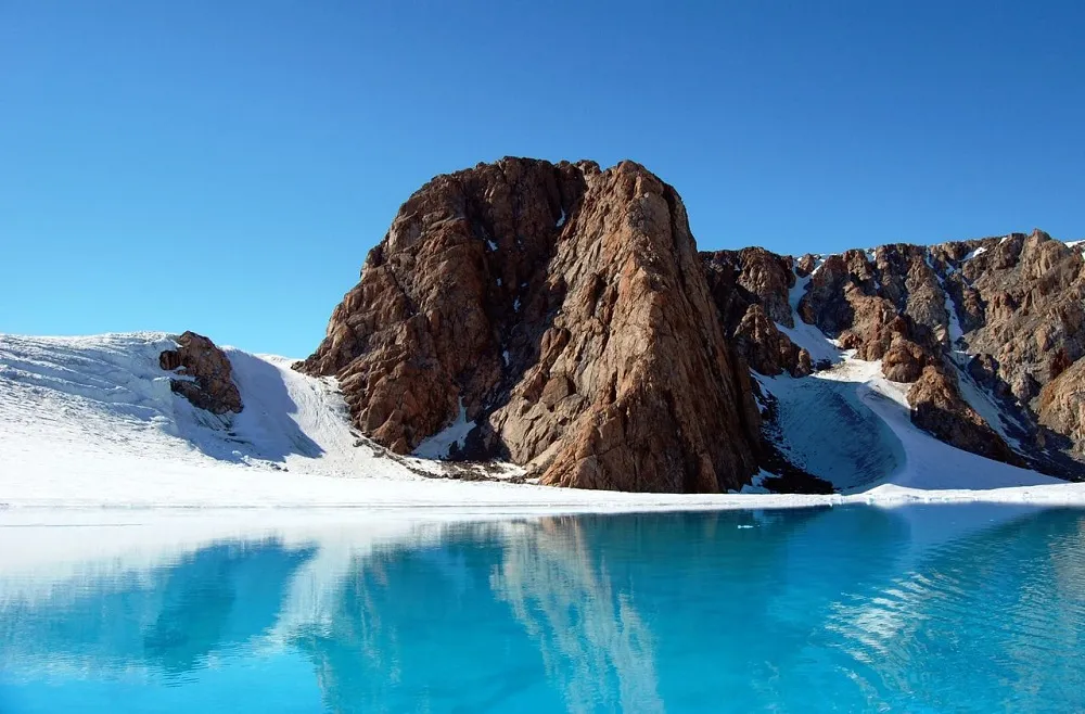
An ice cave or englacial melt channel. This ice cave was formed by meltwater flowing within the glacier ice. Belcher Glacier, Devon Island, Nunavut, Canada.
Canadian researcher Brad Danielson maintaining a time-lapse camera overlooking the Belcher Glacier, Devon Island, Nunavut, Canada. Monitoring the ice that breaks off from the glacier helps the researchers constrain how much ice is calving into the ocean.
Canadian Arctic Research
(Image credit: NASA/GSFC, MODIS Rapid Response: http://lance-modis.eosdis.nasa.gov/imagery/rapid/)
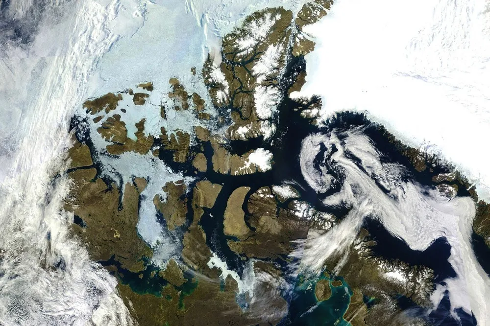
MODIS satellite true color image of the Canadian Arctic Archipelago.
Canadian Arctic Research
(Image credit: Angus Duncan)
Ice channel or supraglacial melt channel. This was formed by meltwater flowing along the surface of the glacier. Belcher Glacier, Devon Island, Nunavut, Canada.
Canadian Arctic Research
(Image credit: Angus Duncan)
Ice lake or supraglacial lake. Surface melt water can pond on the surface of the glacier forming large lakes that can drain catastrophically. Belcher Glacier, Devon Island, Nunavut, Canada.
Sign up for the Live Science daily newsletter now
Get the world’s most fascinating discoveries delivered straight to your inbox.
Canadian Arctic Research
(Image credit: NASA/GSFC, MODIS Rapid Response: http://lance-modis.eosdis.nasa.gov/imagery/rapid/)
MODIS satellite true color image of the Canadian Arctic Archipelago.
Canadian Arctic Research
(Image credit: Alex Gardner)
Canadian researcher maintaining one of several weather station on the Devon Island, Nunavut, Canada. The researchers camp can be seen in the foreground. Monitoring the meteorological conditions over the ice cap helps researchers to determine glacier responses to changes in climate.
Canadian Arctic Research
(Image credit: True color image prepared by Alex Gardner, data downloaded from http://glovis.usgs.gov)
Areal view of the Sverdrup Glacier, a river of ice that flows from the interior of the Devon Island Ice Cap into the ocean. Nunavut, Canada. Flow stripes are clearly visible on the surface of the glacier.
Jennifer Welsh is a Connecticut-based science writer and editor and a regular contributor to Live Science. She also has several years of bench work in cancer research and anti-viral drug discovery under her belt. She has previously written for Science News, VerywellHealth, The Scientist, Discover Magazine, WIRED Science, and Business Insider.