
 Live Science Plus


Soar through the 'Labyrinth of Night' — a Martian canyon the size of Italy — in thrilling new satellite video
See Mars' geology up close, thanks to decades of stunning images from the Mars Express satellite, in a new visualization of Noctis Labyrinthus, the 'Labyrinth of Night'.

By
Briley Lewis
published

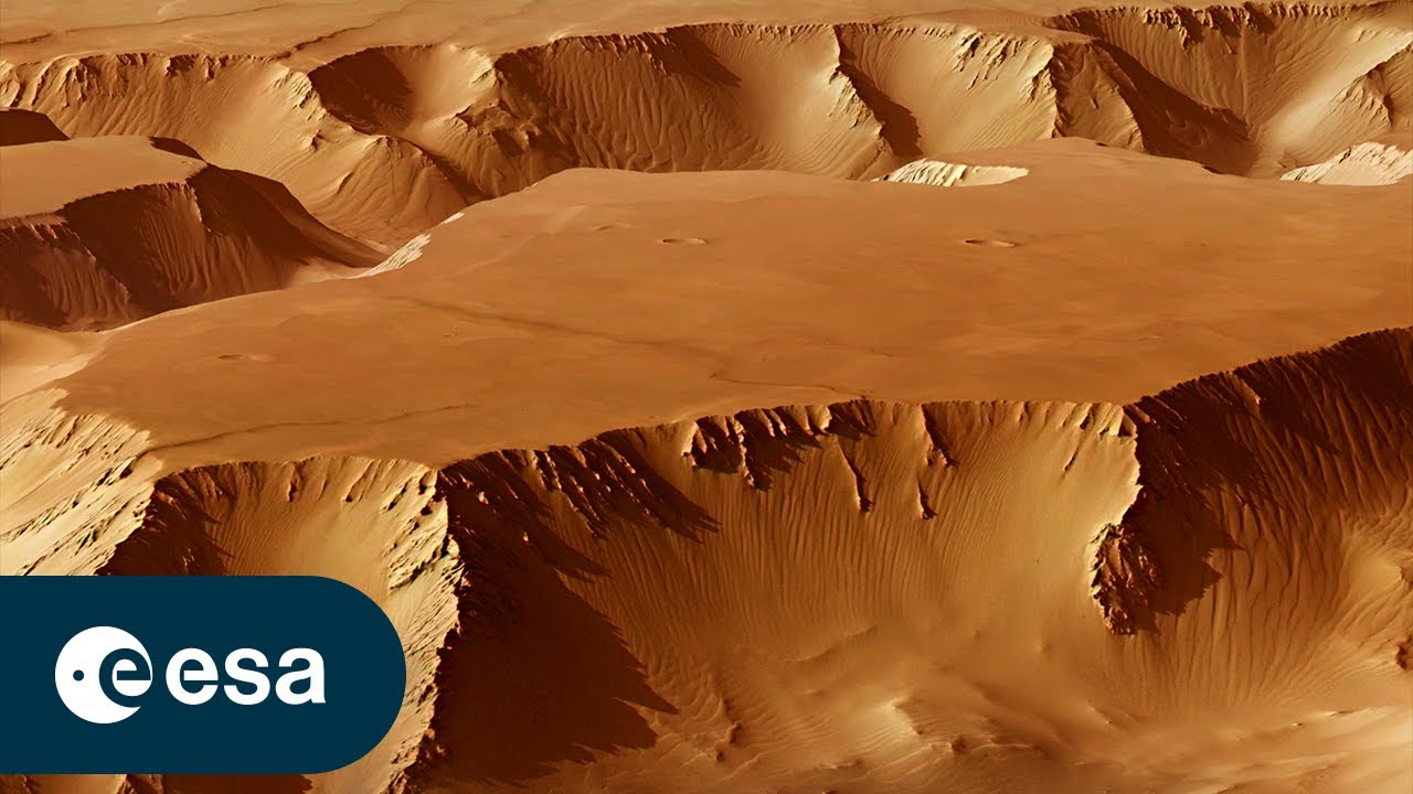
This mosaic shows part of the Noctis Labyrinthus region, the ‘Labyrinth of the Night’, on Mars.
(Image credit: ESA/DLR/FU Berlin (G. Neukum). Image mosaic assembled by Bill Dunford.)
A thrilling new video lets viewers fly through Mars' enormous "Labyrinth of Night," a system of extremely steep valleys about the length of Italy.
The criss-crossing valleys in Noctis Labyrinthus, which is Latin for "Labyrinth of Night," are up to 19 miles (30 kilometers) wide — a bit longer than Manhattan — and 5 miles (6 km) deep. In the video, released by the European Space Agency (ESA), you can also spot craters, the wreckage from huge landslides, and dunes from blowing sand.
TOPICS
