Ethereal ice swirls dance around Arctic peninsula in stunning new satellite image
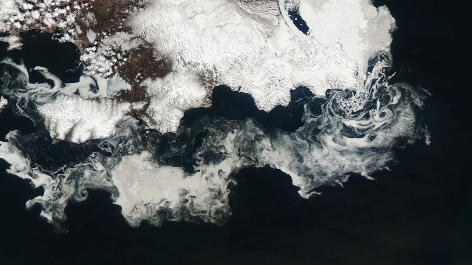
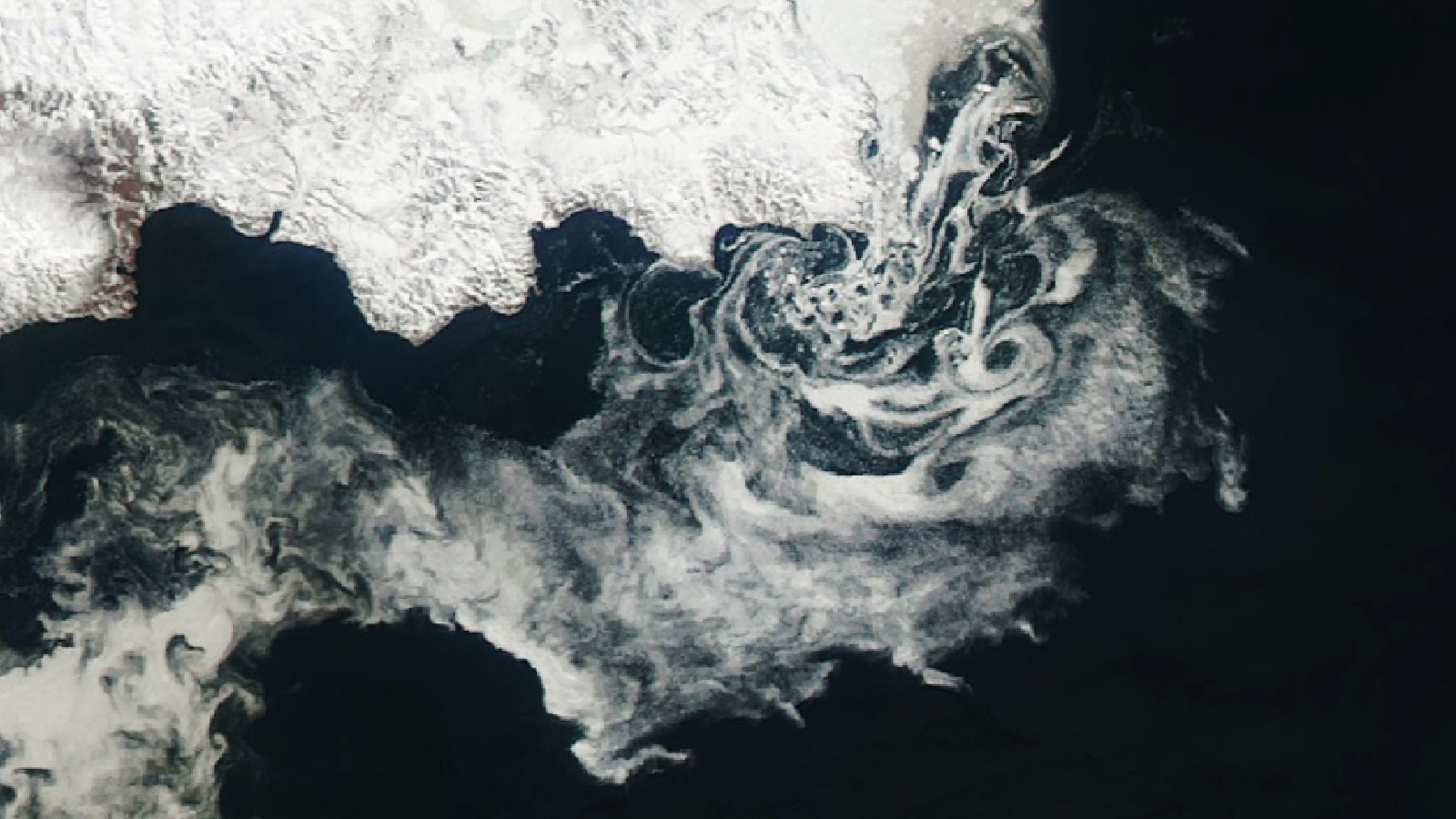
NASA's Aqua satellite spotted giant ice swirls stretching for hundreds of miles in the Sea of Okhotsk off Russia's P'yagina Peninsula.
Get the world’s most fascinating discoveries delivered straight to your inbox.
You are now subscribed
Your newsletter sign-up was successful
Want to add more newsletters?

Delivered Daily
Daily Newsletter
Sign up for the latest discoveries, groundbreaking research and fascinating breakthroughs that impact you and the wider world direct to your inbox.

Once a week
Life's Little Mysteries
Feed your curiosity with an exclusive mystery every week, solved with science and delivered direct to your inbox before it's seen anywhere else.

Once a week
How It Works
Sign up to our free science & technology newsletter for your weekly fix of fascinating articles, quick quizzes, amazing images, and more

Delivered daily
Space.com Newsletter
Breaking space news, the latest updates on rocket launches, skywatching events and more!

Once a month
Watch This Space
Sign up to our monthly entertainment newsletter to keep up with all our coverage of the latest sci-fi and space movies, tv shows, games and books.

Once a week
Night Sky This Week
Discover this week's must-see night sky events, moon phases, and stunning astrophotos. Sign up for our skywatching newsletter and explore the universe with us!
Join the club
Get full access to premium articles, exclusive features and a growing list of member rewards.
A stunning new satellite image shows an enormous mass of melting sea ice elegantly swirling around a Russian peninsula in the Arctic. Although beautiful, the scene is a sombre reminder of the ever-increasing effects of climate change.
NASA's Aqua satellite snapped the dazzling ice display on May 28 twirling around the Sea of Okhotsk for hundreds of miles, just off the coast of Russia's snow-covered P'yagina Peninsula. The image was released on June 12 by NASA's Earth Observatory.
The ethereal white swirls, which appear every year, are made up of melting sea ice being dragged around by ocean currents. The P'yagina Peninsula is a hotspot for these types of swirls because cold air and fresh water deposited into the sea by rivers help create particularly thick sea ice, some of which can still be seen hugging the peninsula's north coastline in the image.
When the sea ice melts in spring and summer, the fracturing ice chunks are pushed south by the wind into vortex-like ocean currents created by a group of small islands located to the south of the landmass' main point, according to the Earth Observatory.
Ice swirls like this can come in a range of shapes and sizes. In December 2022, an extreme cold snap in the U.K. created a host of mini ice swirls, or "ice pancakes," on rivers in Scotland that were formed by tiny spiraling currents known as eddies.
Related: Rare wispy ice formations streak across the sea near Antarctica in beautiful satellite images
The larger Russian swirls can sometimes persist for months and are occasionally pushed as far south as Japan. In 2018, several large swirls, each measuring more than 31 miles (50 kilometers) across, were spotted off the coast of Hokkaido, the country's northernmost island, Japanese news site The Mainichi reported at the time.
Get the world’s most fascinating discoveries delivered straight to your inbox.
The swirls are also appearing earlier every year because there is less sea ice developing in the Arctic over winter and what sea ice there is breaks up earlier due to the effects of human-caused climate change.
On March 6, the Arctic reached its annual maximum sea ice extent — the point at which the largest surface area of the ocean is covered by ice. This year's maximum extent was the 6th lowest on record, meaning there was a lot less sea ice than normal, according to the National Snow and Ice Data Center. Since then, the sea ice in the Sea of Okhotsk has melted away at a faster rate than the rest of the Arctic for unknown reasons, according to the NSIDC.
A study published Feb. 14 in the journal Atmosphere-Ocean revealed that the sea ice extent in the Sea of Okhotsk decreased by about 9% per decade between 1979 and 2010.
Sea ice is also disappearing in Antarctica. In February, the world's most southerly continent experienced a record-low minimum sea ice extent, where sea ice coverage reached its lowest point, for the second year in a row.

Harry is a U.K.-based senior staff writer at Live Science. He studied marine biology at the University of Exeter before training to become a journalist. He covers a wide range of topics including space exploration, planetary science, space weather, climate change, animal behavior and paleontology. His recent work on the solar maximum won "best space submission" at the 2024 Aerospace Media Awards and was shortlisted in the "top scoop" category at the NCTJ Awards for Excellence in 2023. He also writes Live Science's weekly Earth from space series.
 Live Science Plus


