


New Warning: U.S. Gulf Coast Faces High Tsunami Risk
Updated 3:00 p.m. ET
Scientists issued a fresh warning today: The northern Caribbean may be at a high risk for a major tsunami, based on historical records that date back to Columbus' arrival in 1492.
A tsunami in this region could affect more than 35 million people on the islands of the Greater and Lesser Antilles and along the east and Gulf coasts of the United States. The danger has been highlighted in previous research.

The major source for past tsunamis in the northern Caribbean has been movement along the boundary between the North American and Caribbean tectonic plates. This fault line stretches 2,000 miles (3,200 kilometers) from Central America to the Lesser Antilles, brushing up against the north coast of Hispaniola (the island of Haiti and the Dominican Republic).
Nancy Grindlay and Meghan Hearne of the University of North Carolina and Paul Mann of the University of Texas identified 10 significant tsunamis that have resulted from movement along this plate boundary. Six of these caused loss of life.
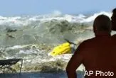
In 1692, a tsunami destroyed Port Royal, Jamaica; another killed at least 10 Jamaicans on the island's south coast in 1780. The most recent tsunami in 1946 was triggered by a magnitude 8.1 earthquake in the Dominican Republic. It killed around 1,800 people.
Jian Lin of the Woods Hole Oceanographic Institution believes that this sort of historical analysis can indicate how frequent big tsunamis are in a geographic region. It also gives an estimate of how large such events can potentially be.
Get the world’s most fascinating discoveries delivered straight to your inbox.
"The tectonic setting of the northern Caribbean is very similar to the Indian Ocean - except that the subduction zone is not as long," Lin told LiveScience in a telephone interview.
The subduction zone is where one plate dips below another. Lin, who was not involved in the recent research, explained that the longer a subduction zone is, the larger the earthquake that the zone is capable of producing.
"The [historical analysis] shows that the Caribbean zone is long enough to have greater than a magnitude 8.0 earthquake," Lin said."
In comparison, the Sumatra earthquake that unleashed last year's tsunami in the Indian Ocean had a magnitude of 9.3.
Besides the direct threat from plate movement, other research has shown that underwater landslides in the region - or even in the middle of the Atlantic - could trigger a giant tsunami.
"The recent devastating tsunami in the Indian Ocean has raised public awareness of tsunami hazard and the need for early warning systems in high-risk areas such as the Caribbean," Grindlay said in a statement.
There are meetings scheduled later this year to implement an Intra-Americas Sea Tsunami Warning Project, as approved by the Intergovernmental Oceanographic Commission. Such a warning system has been set up in the Pacific Ocean, and one is planned for the Indian Ocean. The United States has also proposed a global warning system.
A report by Grindlay and her colleagues will appear in the March 22 issue of Eos, the newspaper of the American Geophysical Union.
The research was supported by the National Science Foundation and the University of Puerto Rico SeaGrant program.
How Tsunamis Work Tsunami are sometimes called tidal waves. They are more like tidal surges, and they soar upon reaching land.
Pacific Northwest: Tsunami-Generating Earthquake Possibly Imminent
The Megatsunami: Possible Modern Threat
Mystery of Deadly 1946 Tsunami Deepens
Tsunami Special Report Complete covearge of the December, 2004 disaster and other tsunami research news.
