It's quick and easy to access Live Science Plus, simply enter your email below. We'll send you a confirmation and sign you up for our daily newsletter, keeping you up to date with the latest science news.
Since 2016, Szucs has been offering his maps on Etsy, where nearly 4,000 buyers seem to agree that he's done better. Selling the maps was originally just a hobby, he said, but "the whole thing exploded within weeks." News outlets (including Live Science) featured his work and brought in new customers. He decided to try to make a living with his art.
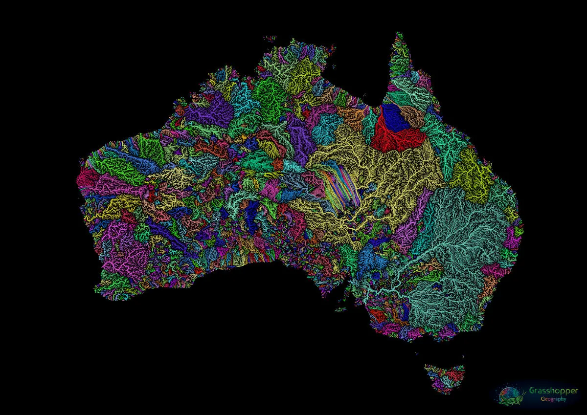
The world's rivers flow like so many rainbows in a map by Hungarian cartographer Robert Szucs
Szuc has since made maps of single U.S. states, entire countries, continents and even the whole globe. Each river basin is depicted in a color unique to that river, with thicker lines for larger waterways. It takes Szucs days to weeks to input data from various geographical sources and then tweak the size and colors of each line, he said.
"It's a beautiful marriage of science and arts, and that's where I'm at home," he said.
Szucs also makes maps of forest color, maps of elevation that reveal topography and maps showing population density. He does custom orders, he said, so there are always new countries or states to map. He's also got a few plans for the future.
Sign up for the Live Science daily newsletter now
Get the world’s most fascinating discoveries delivered straight to your inbox.
"As for new styles of maps," he said, "I only have about 17 ideas."
Stephanie Pappas is a contributing writer for Live Science, covering topics ranging from geoscience to archaeology to the human brain and behavior. She was previously a senior writer for Live Science but is now a freelancer based in Denver, Colorado, and regularly contributes to Scientific American and The Monitor, the monthly magazine of the American Psychological Association. Stephanie received a bachelor's degree in psychology from the University of South Carolina and a graduate certificate in science communication from the University of California, Santa Cruz.