Photos: Renaissance World Map Sports Magical Creatures
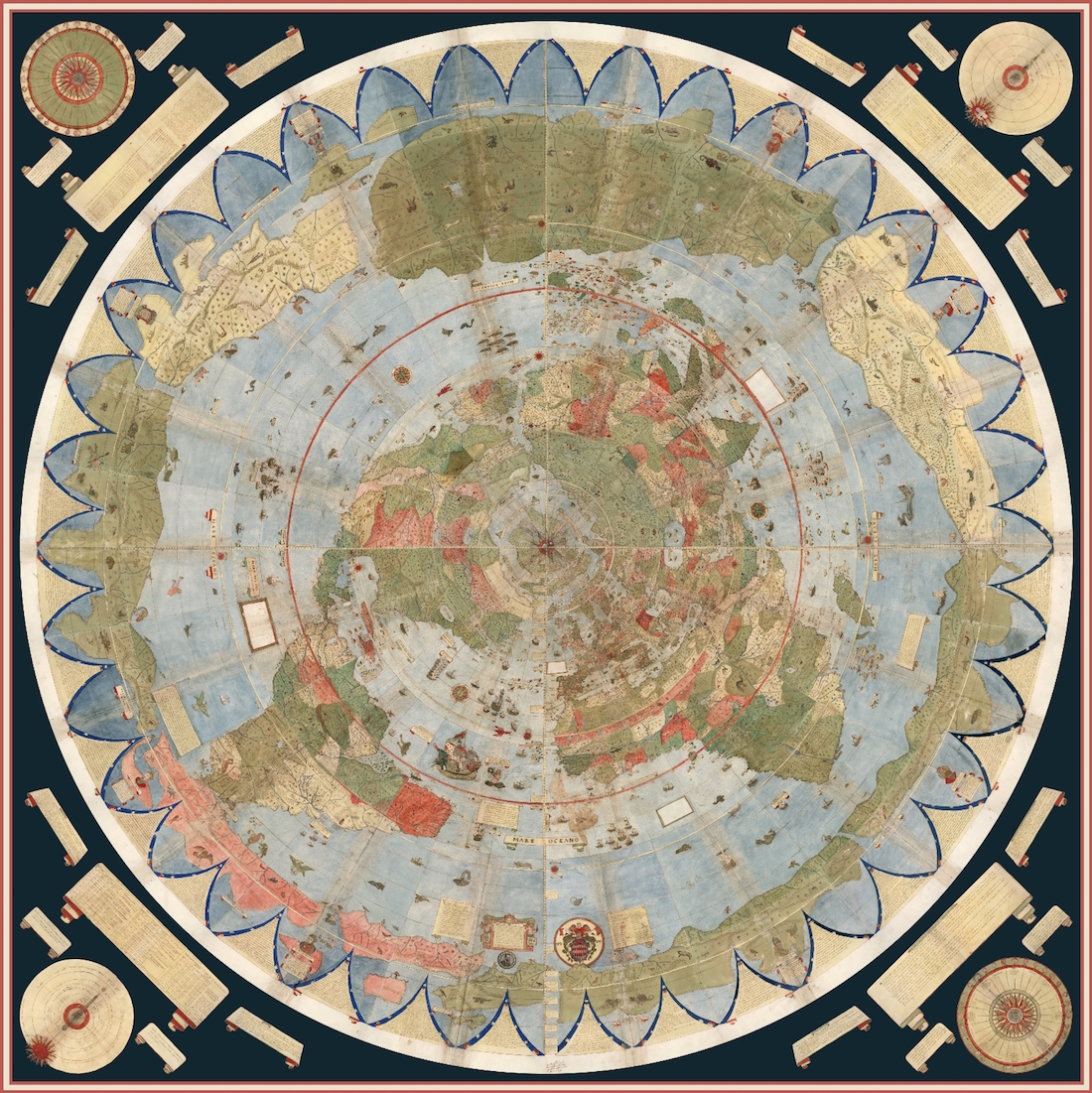
In 1587, Italian cartographer Urbano Monte completed a Renaissance map of the world with a unique perspective. Rather than drawing the Earth on a rectangular sheet, as many maps are displayed today, Monte drew the world on 60 different pages, and left instructions for how they should be displayed as if a viewer were looking down on the globe from the North Pole.
The map, acquired in September by the David Rumsey Map Center at Stanford University, is finally on exhibit as Monte wanted it. Scholars scanned the book and digitally assembled it according to Monte's instructions, allowing the public to see the world and the magical creatures Monte illustrated 430 years ago. [Read more about the Renaissance Map]
Central Africa
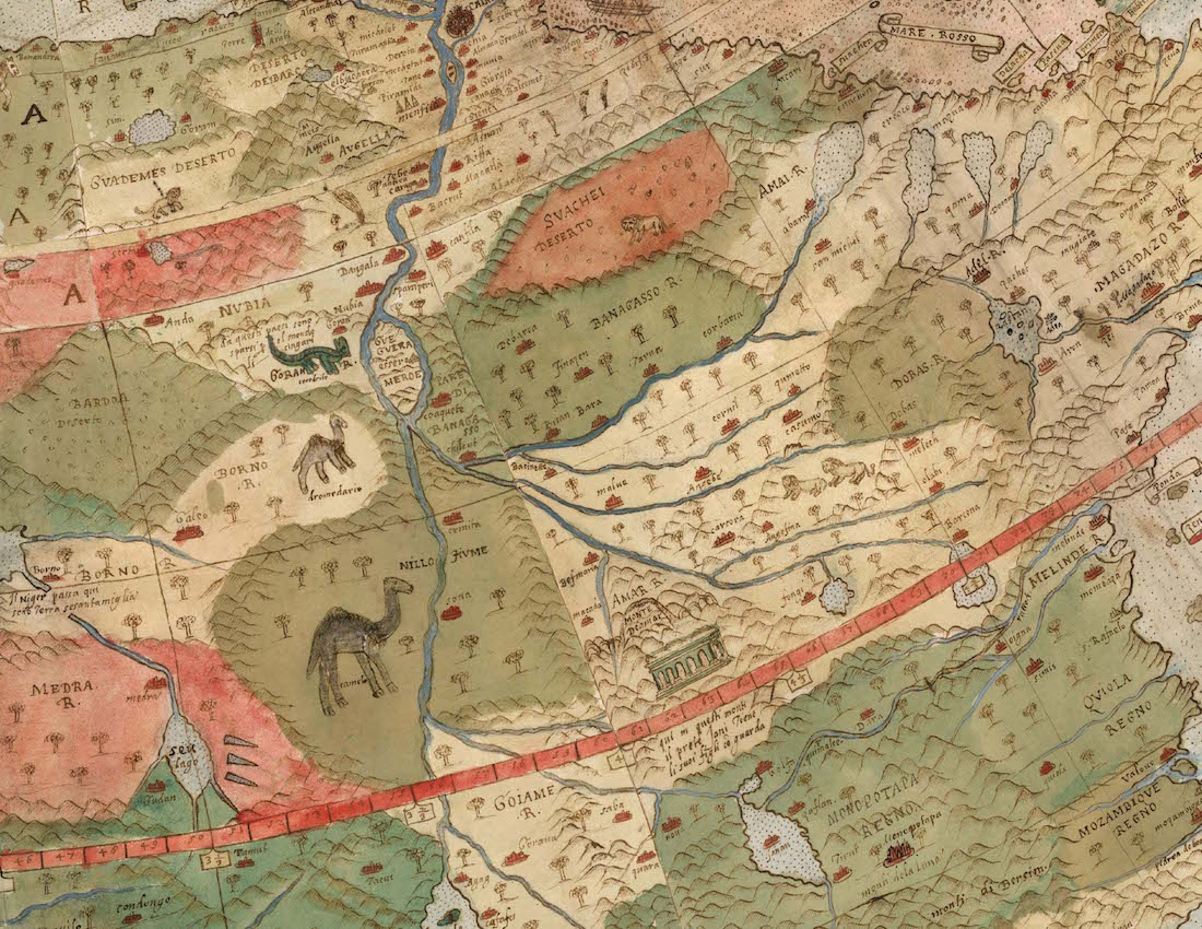
Notice the camels and other creatures drawn on this detail of Central Africa.
Northern Europe
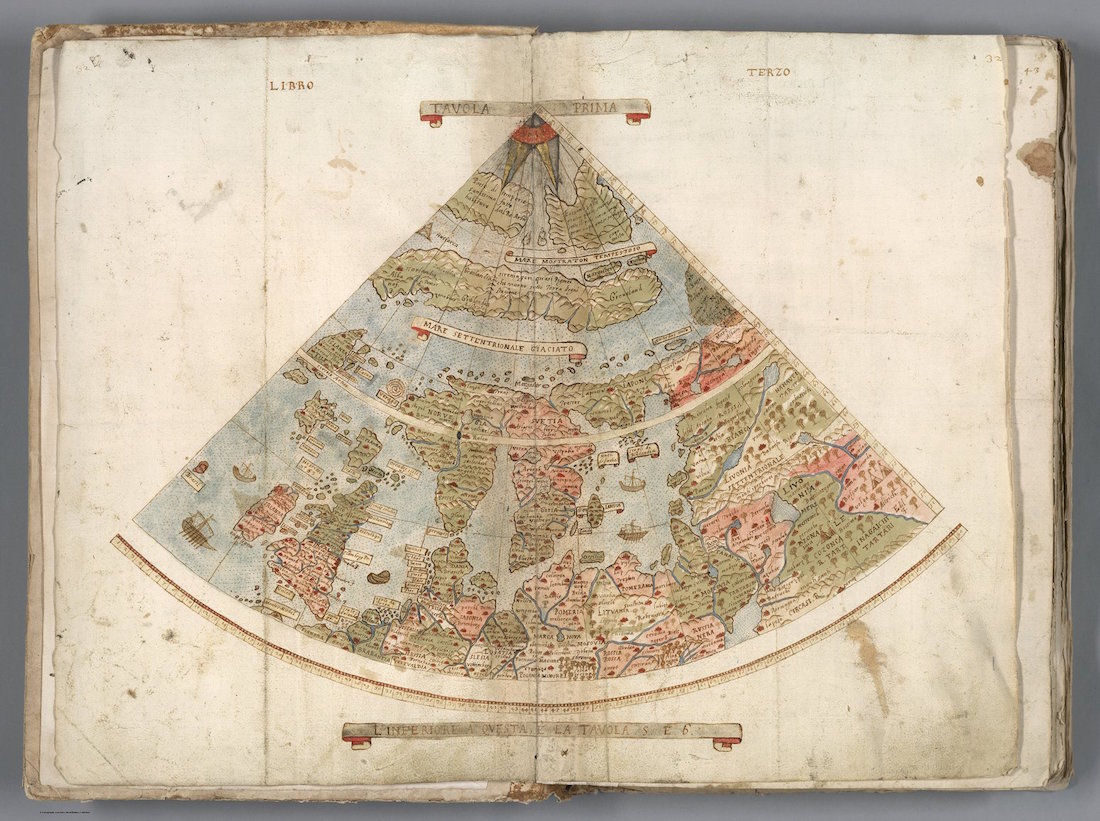
A depiction of Northern Europe, drawn by Urbano Monte (1544-1613).
Japan
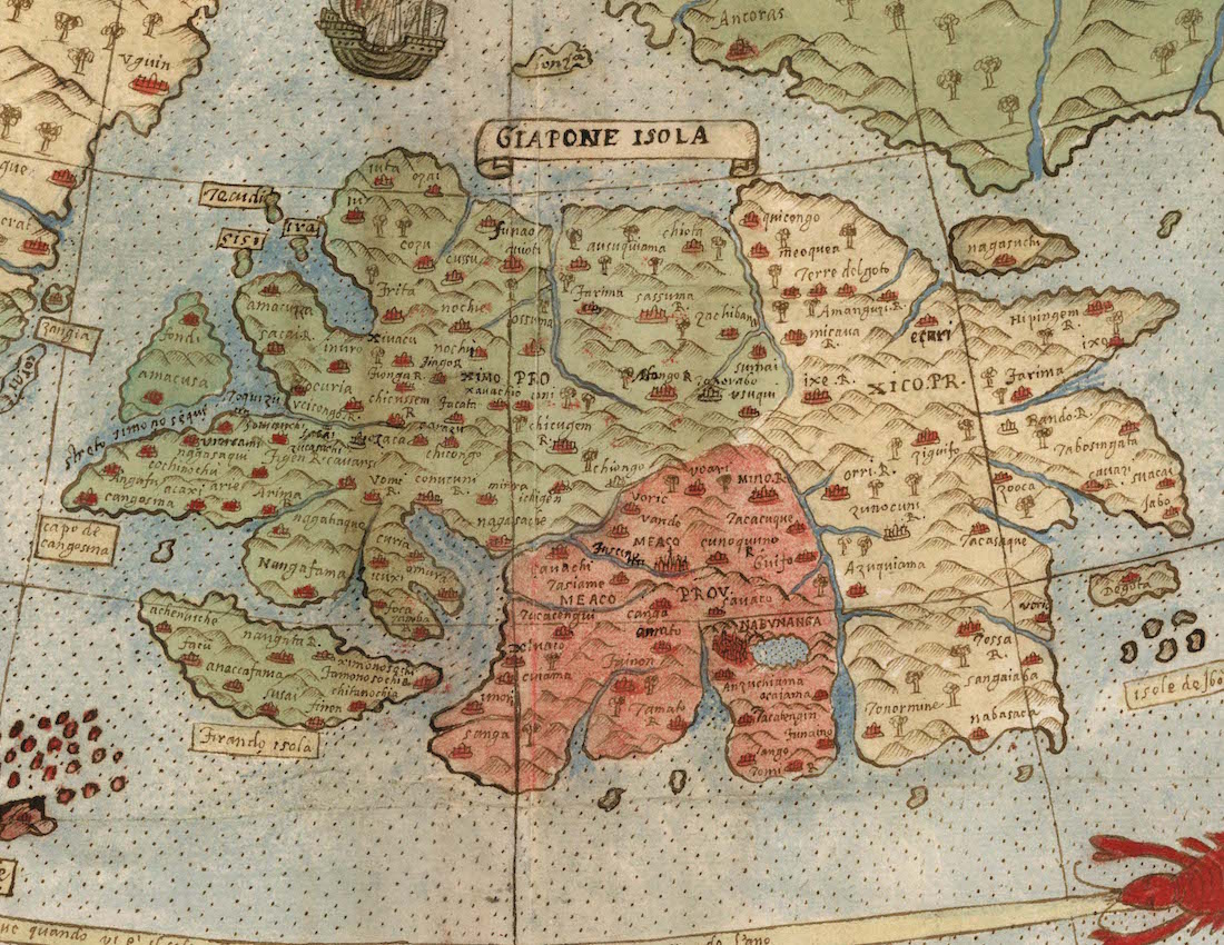
Monte had detailed knowledge about Japan because he met with a Japanese delegation in Milan, Italy in 1585. However, Monte drew the islands in a horizontal fashion, even though they are more vertically laid out on the globe.
United States
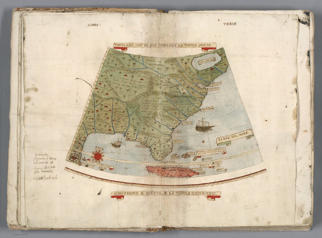
Monte's understanding of the geography of what is now the Eastern United States.
Unicorns and demons
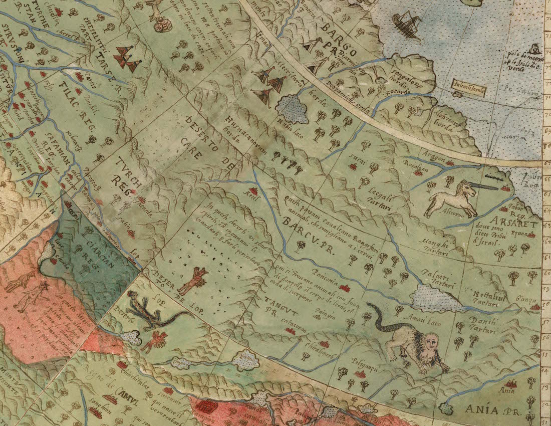
Monte drew a unicorn, demons and other fantastical creatures over the landscape of northern Siberia and Central Asia.
Get the world’s most fascinating discoveries delivered straight to your inbox.
[Read more about the Renaissance Map]
South America
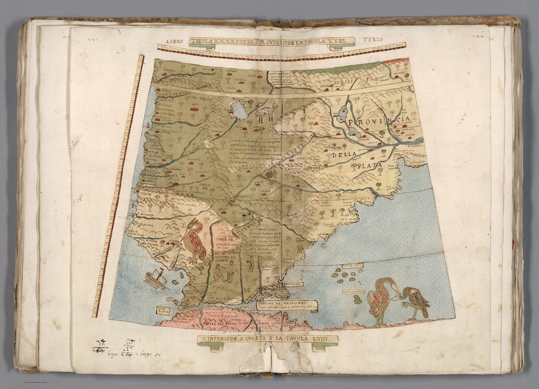
The cartographer illustrated giant birds over Argentina and southern Chile.
Sea monster
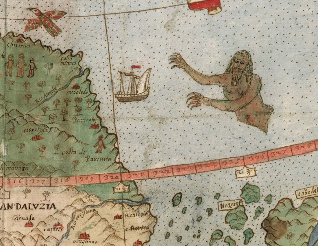
A giant sea monster lurks off the coast Venezuela and Guyana in South America.
Self portrait
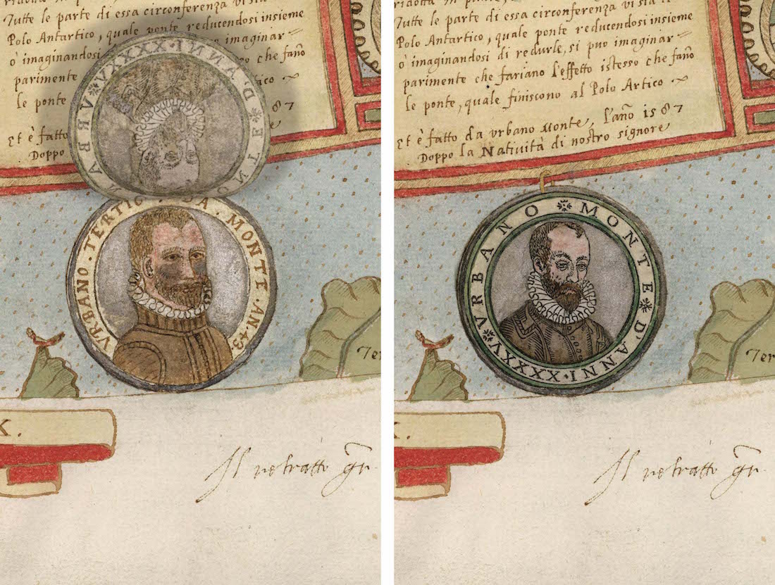
Monte drew a portrait of himself in 1587, when he first completed the map. Later, he redid the portrait in 1589, when he was 45 years old.
Antarctica
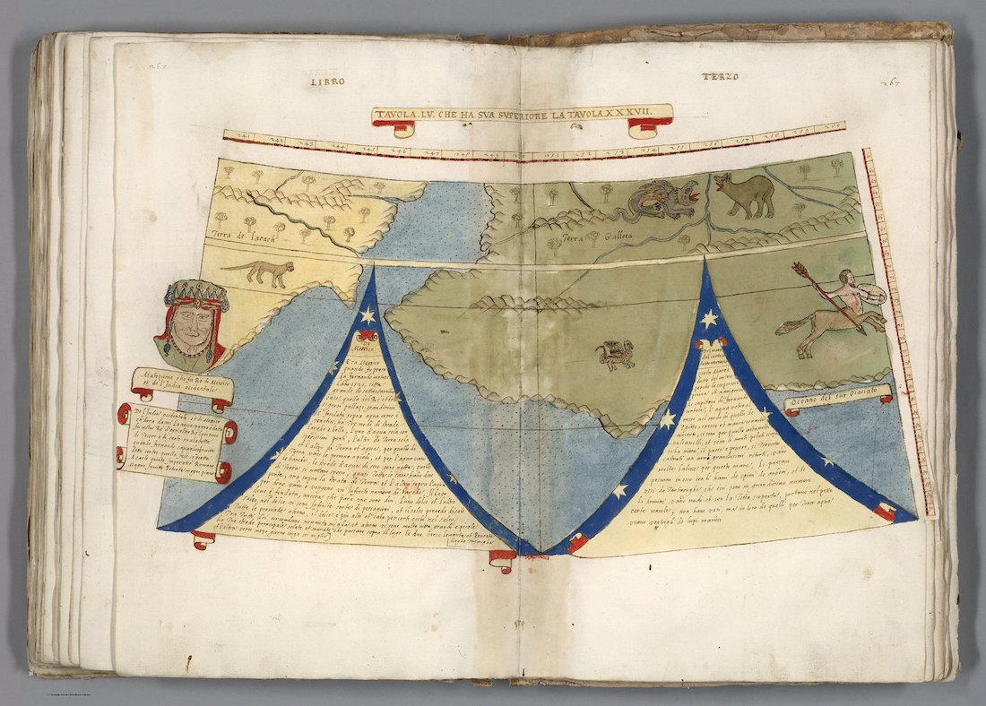
A centaur gallops through Antarctica. Notice how the atlas was assembled as a book, even though Monte wanted it to be displayed as a giant wall map.
Political figures
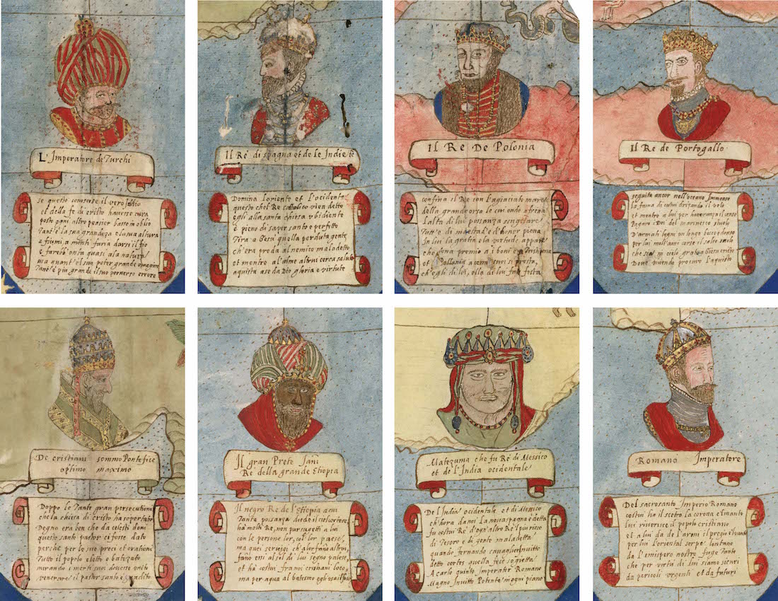
Monte drew the world's most powerful political figures on his map.

Laura is the managing editor at Live Science. She also runs the archaeology section and the Life's Little Mysteries series. Her work has appeared in The New York Times, Scholastic, Popular Science and Spectrum, a site on autism research. She has won multiple awards from the Society of Professional Journalists and the Washington Newspaper Publishers Association for her reporting at a weekly newspaper near Seattle. Laura holds a bachelor's degree in English literature and psychology from Washington University in St. Louis and a master's degree in science writing from NYU.
 Live Science Plus


