3 for 1: Space Station Eyes Hurricanes Lester, Madeline and Gaston
Get the world’s most fascinating discoveries delivered straight to your inbox.
You are now subscribed
Your newsletter sign-up was successful
Want to add more newsletters?
Join the club
Get full access to premium articles, exclusive features and a growing list of member rewards.
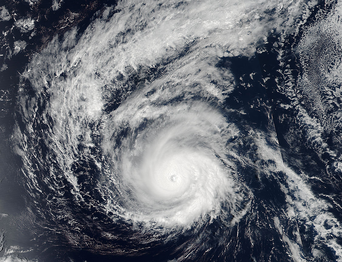
Cameras mounted on the outside of the International Space Station captured amazing views of three powerful hurricanes as they whisked across the Atlantic and Pacific Oceans on Aug. 30.
Hurricane Lester was the first tropical storm spied on by the space station's cameras. The Category 4 storm moved westward across the Pacific Ocean, generating powerful 125-mph (200 km/h) winds. The space station cameras captured jaw-dropping images of thick, stormy clouds swirling around the eye of the hurricane, fueling the storm.
Views of Hurricane Madeline can be seen following Hurricane Lester in NASA's time-lapse video. Hurricane Madeline was traveling west over the Pacific Ocean, with winds even stronger than those of Lester, at 130 mph (209 km/h).
Article continues below"Both storms were on a track that could threaten the big island of Hawaii in the days ahead," NASA officials said in the video description.
On Monday (Aug. 29), the Visible Infrared Imaging Radiometer Suite (VIIRS) instrument aboard NASA-NOAA's Suomi NPP satellite captured an image of Hurricane Madeline nearing Hawaii. This image showed that the storm's eye extended up to 13 nautical miles (24 kilometers) wide in diameter at the time the photo was taken. Because of this, a hurricane watch was issued for Hawaii County, Hawaii, according to a statement from NASA.
With such powerful winds, ocean swells are expected to reach the Hawaiian Islands and could cause damage along the coastline, NASA officials said in the statement.
As for the third hurricane, NASA's time-lapse video shows views of Hurricane Gaston as it traveled over the Atlantic Ocean that same day and created winds of up to 100 mph (160 km/h).
Get the world’s most fascinating discoveries delivered straight to your inbox.
Follow Samantha Mathewson @Sam_Ashley13. Follow us @Spacedotcom, Facebook and Google+. Original article on Space.com.
 Live Science Plus


