


Gallery: The 1964 Great Alaska Earthquake
Unmatched in U.S. History

The massive magnitude-9.2 Alaska earthquake changed the world by proving plate tectonics works. Since the quake struck on March 27, 1964, there has never been another earthquake as powerful. The remarkably low death toll of 131 people belies the quake's incredible effects on the Earth.
Raised seafloor

Uplifted seafloor at Cape Cleare, Montague Island, Prince William Sound, the flat rocky surface with the white coating is about a quarter of a mile (400 meters) wide. It was below sea level before the earthquake.
Sunk town

The village of Portage was abandoned after it sunk 6 feet (1.8 m) in the earthquake.

Deadly waves
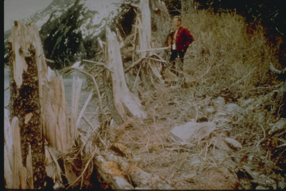
Underwater landslides triggered deadly tsunamis before the shaking stopped. Here, trees up to 101 feet (30 m) above sea level were splintered by the tsunami generated by an underwater landslide in Port Valdez, Prince William Sound.
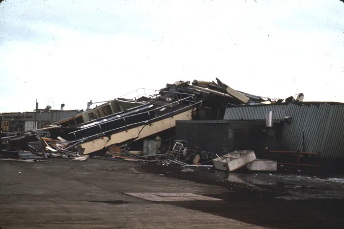
Tsunami damage

Tsunami damage along the waterfront at Kodiak.
Devastation

Another view of the tsunami destruction in Kodiak after the 1964 earthquake.
Oil fires

Oil tanks failed and caught fire at many coastal towns and villages, including Valdez, seen here. The fire burned for two weeks.
Get the world’s most fascinating discoveries delivered straight to your inbox.
Anchorage landslide

One of the iconic images of the 1964 earthquake is the collapse of Fourth Avenue near C Street in Anchorage from a landslide.
Liquefaction landslide
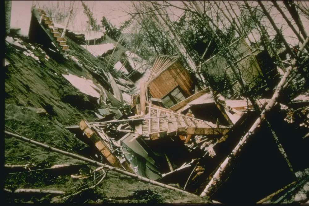
The Turnagain Heights landslide in Anchorage destroyed 75 homes when the wet, silty soil liquefied during the earthquake shaking.
Turnagain Heights collapse

An aerial view of the Turnagain Heights landslide in Anchorage. The area is now Earthquake Park.
Airport tower down
The Anchorage International Airport control tower collapsed, killing the air traffic controller on duty.
