
 Live Science Plus


Strong Earthquake Strikes Pakistan, Dozens Killed

published
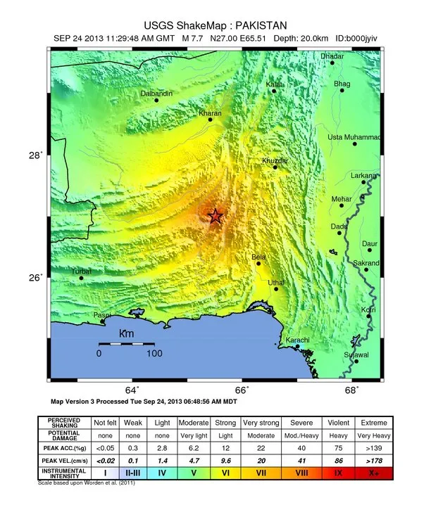
A map of the shaking intensity felt in different areas from the magnitude-7.7 earthquake that struck southern Pakistan at 7:28 a.m. EDT (11:28 UTC, or 4:28 p.m. local time) on Sept. 24, 2013.
(Image credit: USGS)
A large earthquake, with a magnitude of 7.7, according to the U.S. Geological Survey, has struck Balochistan Province in the southern portion of Pakistan. The temblor has killed dozens, most of whom perished when mud brick buildings collapsed, according to news reports.
The earthquake occurred at a depth of 12.4 miles (20 kilometers), a relatively shallow earthquake. The epicenter was 41 miles (66 km) north-northeast of Awaran, Pakistan. The area is known to have a high risk of seismic activity, thanks to the collisions of the Indian and Eurasian tectonic plates, which are also responsible for building the mountain ranges of the area, such as the Himalayas and Hindu Kush.

