Post-Sandy, NYC Issues New Hurricane Evacuation Zones
Get the world’s most fascinating discoveries delivered straight to your inbox.
You are now subscribed
Your newsletter sign-up was successful
Want to add more newsletters?
Delivered Daily
Daily Newsletter
Sign up for the latest discoveries, groundbreaking research and fascinating breakthroughs that impact you and the wider world direct to your inbox.
Once a week
Life's Little Mysteries
Feed your curiosity with an exclusive mystery every week, solved with science and delivered direct to your inbox before it's seen anywhere else.
Once a week
How It Works
Sign up to our free science & technology newsletter for your weekly fix of fascinating articles, quick quizzes, amazing images, and more
Delivered daily
Space.com Newsletter
Breaking space news, the latest updates on rocket launches, skywatching events and more!
Once a month
Watch This Space
Sign up to our monthly entertainment newsletter to keep up with all our coverage of the latest sci-fi and space movies, tv shows, games and books.
Once a week
Night Sky This Week
Discover this week's must-see night sky events, moon phases, and stunning astrophotos. Sign up for our skywatching newsletter and explore the universe with us!
Join the club
Get full access to premium articles, exclusive features and a growing list of member rewards.
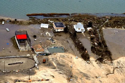
When Hurricane Sandy barreled into the Northeast coast last October, it brought with it an enormous storm surge, built up by its massive windfield. Coupled with a particularly high tide, the storm inundated vast swaths of coastline. In New York City, the flooding extended beyond the low-lying Zone A parts of the city, which were under a mandatory evacuation order.
The extent of the flooding damage, especially to places in Zone B (most of which were either higher or farther inland than the flooding was projected to reach), were part of the impetus for the city to revise their hurricane evacuation zone maps, with a more fine-grained set of zones, numbered 1-6. City officials said these will allow for more nimble planning when responding to specific storm threats. With the new zones, an additional 600,000 people are included in an evacuation zone area; the number of people in a zone accounts for 37 percent of the city's population. Zone 1 is the most at risk for flooding, and is home to an estimated 370,000 city residents. The total number of city residents in all six zones is 2,990,000, according to the NYC Office of Emergency Management. There are areas of the city that are high enough or far enough inland that they are not included in an evacuation zone.
In New York City and want to know if you're in an evacuation zone? Check the NYC Hurricane Evacuation Zone Finder.
Follow Andrea Thompson @AndreaTOAP, Pinterest and Google+. Follow us @livescience, Facebook & Google+.
Get the world’s most fascinating discoveries delivered straight to your inbox.

Andrea Thompson is an associate editor at Scientific American, where she covers sustainability, energy and the environment. Prior to that, she was a senior writer covering climate science at Climate Central and a reporter and editor at Live Science, where she primarily covered Earth science and the environment. She holds a graduate degree in science health and environmental reporting from New York University, as well as a bachelor of science and and masters of science in atmospheric chemistry from the Georgia Institute of Technology.
