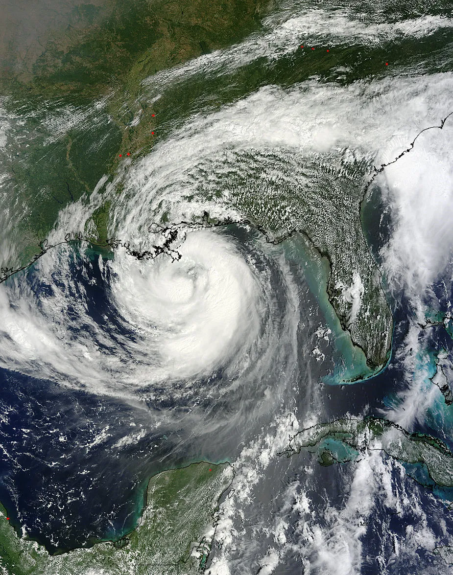
Several different satellites are keeping a keen eye on the Hurricane Isaac, which has made landfall along the Louisiana coast nearly seven years to the day after Hurricane Katrina began laying waste to New Orleans.
Imagery from NASA's TRMM and Terra satellites and the GOES-13 spacecraft, operated by the National Oceanic and Atmospheric Administration, showed Hurricane Isaac's outer bands lashing the Gulf Coast earlier today (Aug. 28) before the huge storm came ashore.
Isaac was upgraded from a tropical storm to a Category 1 hurricane today and currently has maximum sustained winds of 80 mph (130 kph). It is predicted to dum perhaps 20 inches (51 centimeters) of rain on some spots over the next few days.
The satellite shots show just how enormous Isaac is. As of this morning, tropical storm-force winds extended 205 miles (330 kilometers) out from Isaac's center, making the maelstrom 410 miles (660 km) wide, NASA officials said.
The Earth-observing spacecraft have been tracking Isaac's progress for a while, watching as it churned across the eastern Caribbean and tacked north toward Florida and the Gulf of Mexico.
The slow-moving maelstrom's trek toward the Gulf Coast is captured in GOES-13 footage from the last three days, which has been compiled into a minute-long video. Viewers can watch as Isaac's center passes 40 miles (64 km) south of Key West, Fla., on the afternoon of Aug. 26, before the storm turns toward the Mississippi Delta.
NASA's TRMM satellite captured this image of Isaac as it was approaching the northern Gulf coast at 4:01 UTC, August 28 (12:01 EDT). Heavy rainfall is shown in red, moderate rain in green and light rain in blue.
(Image credit: NASA/SSAI, Hal Pierce)
While experts are predicting heavy rainfall and flooding in Isaac's wake, the damage should not come close to what Hurricane Katrina wrought seven years ago. That storm registered as a Category 3 hurricane when it came ashore on Aug. 29, 2005, with sustained winds topping out around 127 mph (204 kph).
Sign up for the Live Science daily newsletter now
Get the world’s most fascinating discoveries delivered straight to your inbox.
Some experts estimate Katrina caused $125 billion in damage, making it the costliest natural disaster in United States history. The storm killed more than 1,800 people, most of them in Louisiana. Many of these people died after New Orleans' levee system failed and huge swathes of the city were flooded.
This story was provided by SPACE.com, a sister site to OurAmazingPlanet. Follow SPACE.com senior writer Mike Wall on Twitter @michaeldwallor SPACE.com @Spacedotcom. We're also on Facebookand Google+.
Michael was a science writer for the Idaho National Laboratory and has been an intern at Wired.com, The Salinas Californian newspaper, and the SLAC National Accelerator Laboratory. He has also worked as a herpetologist and wildlife biologist. He has a Ph.D. in evolutionary biology from the University of Sydney, Australia, a bachelor's degree from the University of Arizona, and a graduate certificate in science writing from the University of California, Santa Cruz.