


Photo: 'White Marble' Shows Arctic View of Earth
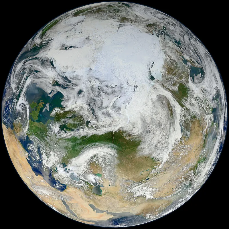
A newly released image from NASA shows off our home planet from an unfamiliar angle — our iconic blue marble, snapped by a satellite that circles the Arctic, is arrayed in frosty white.
The newly launched Suomi National Polar-orbiting Partnership (S-NPP) satellite, which was blasted into space on Oct. 28, 2011, circled the Earth 15 times to capture the visual data used for the stunning picture.
Although the bright swirl of Arctic ice dominates the top of the globe, looking a bit farther south, and toward the left side of the frame, one can see the green of England and Ireland peeking between clouds. But it's the vast, dry reaches of Asia, Saudi Arabia and the Sahara that dominate the rest of the image.
Arctic sea ice covers the very top of the planet, stretching across the Arctic Ocean and covering the North Pole. And although it looks like there's plenty of it, there's not nearly as much ice as there was in decades past.
Since satellites started sending data back in 1979, scientists have watched the total area of annual Arctic sea ice cover steadily decline. It reached the lowest extent ever recorded in 2007, and although it changes from year to year, the ice has continued to stay at historic lows.
As the ice has dwindled, it has sparked fears that the creatures that depend on it will be affected. Worries about the status of the polar bear have prompted action, and scientists have launched surveys to monitor threatened Arctic seals.
Get the world’s most fascinating discoveries delivered straight to your inbox.
