


Satellite Images Create Real Snow Globe
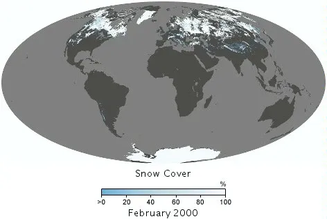
These snow cover maps are made from observations collected by the Moderate Resolution Imaging Spectroradiometer (MODIS) on NASA
(Image credit: NASA Earth Observations (NEO))
Snow globes, those favorite vacation souvenirs, let even those who live in warm climates see snow fall. From their vantage point in space, NASA satellites get to see a real snow globe, as they observe the seasonal falls that cover portions of the planet with the white stuff.
A set of observations collected between February 2000 and November 2011 by the Moderate Resolution Imaging Spectroradiometer (MODIS) on NASA's Terra satellite has been stitched together to create an animation of Earth's snow cover over the past decade.

TOPICS
