When Hurricane Irene strengthened into a major hurricane this week, satellites were there to capture the spectacle.
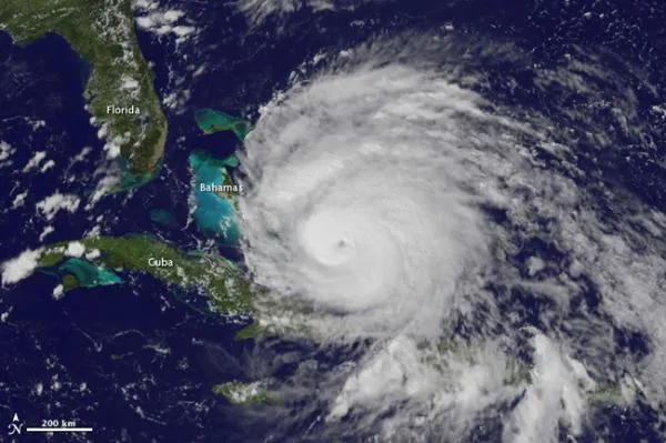
Irene reached Category 3 status on the Saffir-Simpson scale of hurricane strength with winds of 115 mph (185 kph) early yesterday (Aug. 24). Satellites could see that the hurricane was stronger because it's eye was visible from space.
An eye (the calm area at the center of a storm) typically only forms when a hurricane becomes strong and well-organized. Surrounding the eye is the eyewall, which is typically where the most ferocious winds of a storm are found.
Latest Videos From
The satellite's observations were assembled into a movie showing the Irene's intensification. [Watch the video here.]
The storm is currently lashing the Bahamas and is projected to hit the coast of North Carolina on Saturday. After that, it will follow the coastline northward and could make landfall on Long Island, posing a threat to the heavily populated area around New York City.
A hurricane watch is in effect from Surf City, N.C., to the North Carolina-Virgina border. This watch means that hurricane conditions are possible in the area in about 48 hours. Parts of the North Carolina coast have already issued mandatory evacuation orders for tourists and voluntary evacuation orders for residents.
Irene is the first hurricane and first major hurricane for what has been forecast to be an active season. The National Oceanic and Atmospheric Administration (NOAA) updated its forecast on Aug. 4, predicting 14 to 19 named storms (which include tropical storms and hurricanes), seven to 10 hurricanes and three to five major hurricanes. An average Atlantic hurricane season will see 11 named storms, six hurricanes and two major hurricanes. August through October are the peak months of the Atlantic hurricane season.

 Live Science Plus