


Missouri Flood Woes Continue
(Image credit: NASA/GSFC)
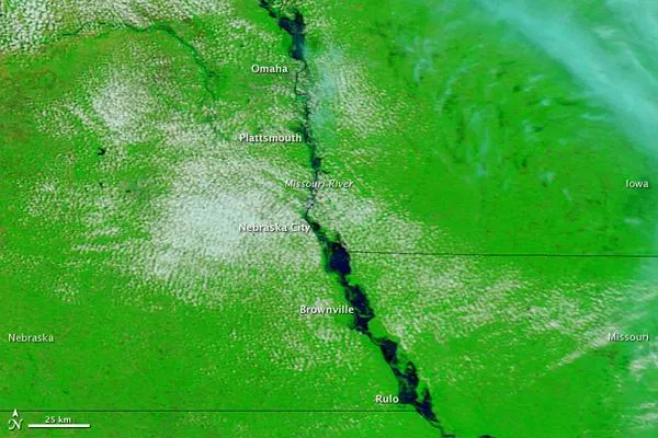
Flooding continued along the Missouri River in late June 2011, affecting multiple communities in Nebraska. On June 26, the Advanced Hydrological Prediction Service (AHPS) of the U.S. National Weather Service reported moderate flooding near Omaha and Brownville, and major flooding near Plattsmouth, Nebraska City, and Rulo.
The Moderate Resolution Imaging Spectroradiometer (MODIS) on NASA's Terra satellite captured these images on June 25, 2011 (top), and June 26, 2010 (bottom).


