


Tropical System Could Bring Early Start to Hurricane Season
Hurricane season doesn't start in the Northern Atlantic Ocean until June 1, but one low pressure system wants to make an early debut.
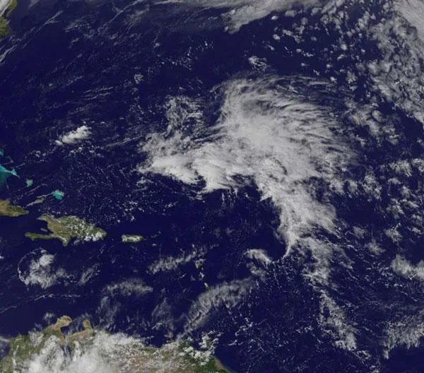
There's a low pressure area with a small chance for development north-northeast of Puerto Rico, and NASA's GOES-13 satellite captured a visible image of the storm.
The National Hurricane Center (NHC) issued a Special Tropical Weather Outlook yesterday, April 20, that noted the low pressure area was located about 460 miles (740 kilometers) northeast of San Juan, Puerto Rico at 3:35 p.m. EDT. The NHC noted that slow development is possible over next couple of days. The low is moving west -northwest at 10 mph (16 kph).
The NHC gives this low a 20 percent chance of development into a sub-tropical or tropical storm over the next two days before it hits wind shear, which will weaken it.
Last month, a rare kind of tropical storm formed off the coast of Brazil. Sub-Tropical Storm Arani was one of a handful of tropical storms to form in the South Atlantic ocean. It was only the third since 2004.
The 2011 hurricane season won't officially begin in til June, and it follow a very busy 2010 season .
- Weirdo Weather: 7 Rare Weather Events
- What U.S. Cities Are Most Vulnerable to Hurricanes?
- How Do Cyclones, Hurricanes and Typhoons Differ?
Get the world’s most fascinating discoveries delivered straight to your inbox.
