Our amazing planet.

Tropical Cyclone Yasi Swirls Toward Australia

cyclone-yasi-110131-02
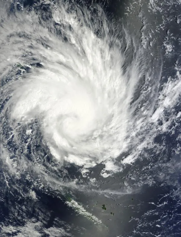
Tropical Cyclone Yasi, as seen by NASA's Terra satellite on Jan. 30. (Image credit: NASA Goddard Space Flight Center.)

A NASA satellite spotted Cyclone Yasi as the storm headed for Australia's flood-ravaged northeastern coast.

Officials ordered mass evacuations as Yasi approached, fearing that the storm could be the worst that the state of Queensland has ever seen, the Associated Press reported. The ongoing flooding has killed more than 20 people and affected more than 200,000 since December. [Related: When Will the Australia Flooding Stop? ]

Yasi is expected to pass over northern Queensland on Feb. 2, bringing destructive winds and heavy rains, The Australian reported. When the storm makes landfall it could bring wind gusts around 170 mph (275 kph), similar to those from Hurricane Katrina that blasted New Orleans in 2005.

Yasi follows on the heels of Tropical Cyclone Anthony , which hit parts of Queensland on Jan. 30. The storm brought winds of about 90 mph (150 kph), but no major damage was reported.

Reach OurAmazingPlanet staff writer Brett Israel at bisrael@techmedianetwork.com. Follow him on Twitter @btisrael.

Brett Israel was a staff writer for Live Science with a focus on environmental issues. He holds a bachelor’s degree in biochemistry and molecular biology from The University of Georgia, a master’s degree in journalism from New York University, and has studied doctorate-level biochemistry at Emory University.