
 Live Science Plus


Secondary Hurricane Season
This article was provided by AccuWeather.com.
Even though the peak of hurricane season has passed, there is sometimes a second pulse of tropical storms and hurricanes during October.
While it may seem the door has shut in the Atlantic Basin for this season, there are still some reasons to keep up the guard.

We have managed 15 named tropical systems this year in the Atlantic and have recently had one of the longest-lived tropical systems on record, Nadine.
During week two of this October, AccuWeather.com meteorologists do not expect a big new crop of tropical storms and hurricanes for the remainder of the season, but they are monitoring a couple of areas in the Atlantic.
One is an area of disturbed weather east of the Bahamas.
Another is a tropical wave over the Central Atlantic.
Get the world’s most fascinating discoveries delivered straight to your inbox.
According to Expert Senior Meteorologist Dan Kottlowski, Head of AccuWeather.com's Hurricane Center, "There is a chance that a tropical wave that recently moved off the coast of Africa could fail to curve northward before reaching the Caribbean this weekend."
If so, that feature may become a concern for areas closer to mainland North America next week.
It is possible this system may move westward at a time when the strong westerly winds aloft are in a phase where they are backing off over the Caribbean and the waters surrounding the Southeastern U.S.
Why a Second Spike in Atlantic Tropical Storm, Hurricanes?

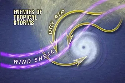
Hurricanes need warm water, weak upper-level winds and moist air to develop.
During October, ocean waters begin to cool and upper-level winds begin to increase. However, water temperatures often remain just warm enough for development. In addition, strong upper-levels winds can still be absent long enough to allow development.
During the peak of hurricane season, September, most tropical systems are born from disturbances moving westward off the coast of Africa. The disturbances are called tropical waves. While the number of waves tends to decline during October, there are still enough remaining to cause trouble occasionally.
Plenty of moist air also remains over the Atlantic well into autumn.

"During October, we begin to see more fronts move to and stall over the Gulf of Mexico and just off the Atlantic coast of the United States," Kottlowski said.
The fronts offer a means to spawn thunderstorms, which then gradually develop into a tropical system.
"We also tend to get more frequent, large areas of high pressure building over the United States," Kottlowski said, "The circulation around these fair weather systems can help to spin up tropical systems to their south and east over the warm Gulf and Atlantic waters."

While westerly winds aloft tend to strengthen and guide many tropical storms and hurricanes away from North America moving forward through the autumn, every once in a while, these winds back around and allow a tropical system to plow inland or parallel the coast.
There have been very costly October hurricanes in terms of lives lost and destruction to property.
1954's Hazel was one of the worst October hurricanes on record. The storm claimed over 1,000 lives (most of them in Haiti) and caused over $400 million (1954 dollars) in damage. Hazel was captured by strong upper-level steering winds and drawn northward at amazing speed along the Atlantic Seaboard of the U.S.
According to AccuWeather.com Chief Meteorologist Elliot Abrams, "The highest winds ever recorded, 94 mph, at Philadelphia International Airport, occurred as Hazel passed to the west. Hurricane-force winds occurred as far inland as Toronto, Canada, on the shores of Lake Ontario."
AccuWeather will have more on this historic hurricane on Monday, Oct. 15, 2012.
1964's Hilda curved in from the Caribbean, turned northward over the central Gulf of Mexico and slammed into Louisiana with 135-mph winds and tremendous storm surge. More than 35 people died in the storm.
Dangers from the tropics not only come from hurricanes, but also from tremendous moisture from a tropical storm or depression. As these tropical systems move into a cooler environment, they can no longer hold their moisture and release it in the form of tremendous rainfall and the risk of flooding.
1985's Juan dropped nearly a foot of rain on the north-central Gulf Coast. As many as 48 people died as a result of the storm. Damage approached $3 billion.
© AccuWeather.com. All rights reserved. More from AccuWeather.com.