Imagine zooming into Google maps and seeing live video, real-time updates of your friends' locations, and real-time movements of public transportation. Software developed by University of Southern California researchers is fusing real-time data with Google-like mapping software to enhance the utility of today's maps.
"The idea was to capture a real-world environment and then render it virtually so it feels like you are in that area. So you are immersed in that geographical area as if you are in the real world," study researcher Cyrus Shahabi said in a statement.
What makes Geo-Immersion unique is its capability to mesh existing information databases and social networks , and to integrate them with maps.
Latest Videos From
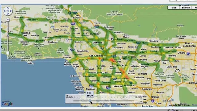
Geo-Immersion is the foundation of several applications Shahabi has in the works. One project, called the "clever transportation" takes real-time traffic data and overlays it onto the maps. "These historical patterns are created based on real-time data that we collect," Shahabi said. "[It] shows how the trend of traffic changes over the course of time."
The geo-immersion map uses this traffic information to decipher the fastest route from point A to point B at different times of the day. Google maps contains a traffic information overlay, but doesn't apply the information in its route-choice decision.
They've also used the geo-immersion capabilities in the application iCampus, in which USC students can see real-time updates and locations of their Twitter and Facebook friends, locations and estimated arrival times of the campus trams, which are equipped with GPS units. The same type of mapping application could be tailored to small cities and other college campuses.
You can follow LiveScience staff writer Jennifer Welsh on Twitter @microbelover. Follow LiveScience for the latest in science news and discoveries on Twitter @livescience and on Facebook.

 Live Science Plus