Deadly Tornado Outbreak Seen From Space (Video)

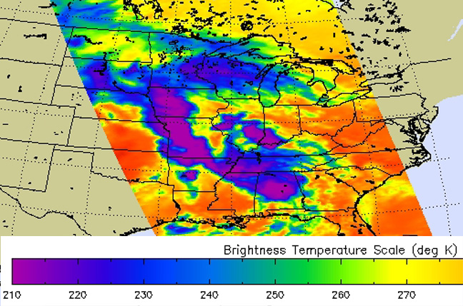
The deadly tornado outbreak that struck the southeastern United States Sunday was tracked from space, as seen in a satellite video released today (April 28) by NASA.
The video animation of the tornado captured the powerful storm system in visible and infrared weather satellite images as it churned across Arkansas and Oklahoma. The severe weather spawned 31 reported tornadoes, according to the National Weather Service's Storm Prediction Center. At least 14 people were killed in Arkansas by a tornado that touched down northeast of Little Rock around 7 p.m. local time, according to news reports.
Until this weekend, 2014 was one of the quietest tornado years on record, because of colder-than-average winter and spring temperatures, according to the National Weather Service. But recent warm weather finally brought the clash between cold and warm fronts that spawns tornado-brewing thunderstorms.
The same system that spawned the destructive tornadoes is expected to bring severe weather farther east tomorrow, between Cincinnati, Ohio and New Orleans, La.
Email Becky Oskin or follow her @beckyoskin. Follow us @livescience, Facebook & Google+. Original article on Live Science.
Get the world’s most fascinating discoveries delivered straight to your inbox.

 Live Science Plus


