Project to map entire ocean floor by 2030 passes 20% mark
The project includes maps of the deepest spots in all five oceans, thanks to an adventurous billionaire.

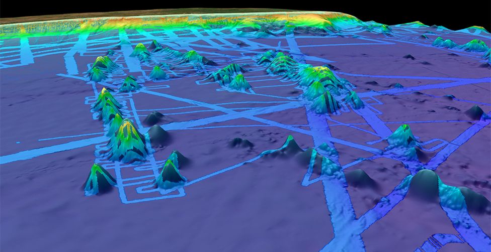
About 70% of Earth's surface is covered in water, and researchers are trying to map every last inch of it. On June 21 (that's World Hydrography Day, in case you forgot to update your Calendar of Very Nerdy Events), a group of international researchers announced that they are about one-fifth of the way to that goal, having mapped 20.6% of Earth's total underwater area using modern sonar techniques, according to a statement.
The project, called Seabed 2030, aims to map 100% of the global ocean floor by 2030 using largely crowd-sourced data from science vessels, corporations and private boat owners around the world. The current level of coverage shows a modest increase over last year's figure of 19% (research was hampered by COVID-19, project director and hydrographer Jamie McMichael-Phillips told the BBC), but the project has nevertheless seen huge gains since its inception four years ago.
"When Seabed 2030 was launched in 2017, only 6% of the oceans had been mapped to modern standards," the team wrote in the statement. In the last year, the team completed another 1.6% of the global ocean map, adding an area "roughly around half the size of the United States," McMichael-Phillips added.
Recent coverage includes some of the most hard-to-reach places on Earth, thanks to data shared by billionaire explorer Victor Vescovo and the crew of his ship, the DSSV Pressure Drop. In September 2019, Vescovo completed a personal mission to descend to the deepest points in all five of Earth's oceans aboard a small submersible. Vescovo's team also used bathymetric instruments aboard the Pressure Drop to map these bottom-of-the-world hotspots while the ship was in the neighborhood. The team's expeditions mapped an area equivalent to the size of France in roughly 10 months, more than half of which had never been seen before, the BBC reported.
Why map the entire ocean? It's not to uncover the lost city of Atlantis (at least, not officially). According to the Seabed team, a comprehensive understanding of the ocean floor is crucial to various scientific and commercial pursuits. On the business side, good seafloor maps can help vessels navigate more efficiently, and they can also aid endeavors like laying cables and constructing pipelines, the team said.
But more importantly, these maps can reveal previously unknown patterns in deep ocean currents, which are influenced by variations in the seafloor topography. Accurate information about currents can help improve climate change models, as the ocean plays a key role in moving heat around Earth, the BBC reported.
With a sluggish 2020 behind them, the Seabed team is optimistic that the project will reach 100% ocean floor coverage by 2030. For more project updates, tune in again next year on World Hydrography Day.
Get the world’s most fascinating discoveries delivered straight to your inbox.
Originally published on Live Science.

Brandon is the space / physics editor at Live Science. With more than 20 years of editorial experience, his writing has appeared in The Washington Post, Reader's Digest, CBS.com, the Richard Dawkins Foundation website and other outlets. He holds a bachelor's degree in creative writing from the University of Arizona, with minors in journalism and media arts. His interests include black holes, asteroids and comets, and the search for extraterrestrial life.


