Huge Icebergs Imaged from Space

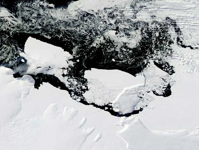
The Moderate Resolution Imaging Spectroradiometer (MODIS) on NASA's Aqua satellite captured this true-color image of Iceberg B-09B and the newly created iceberg off the Mertz Glacier. Out to sea, delicate white swirls indicate a relatively thin layer of sea ice. Occasional clouds floating overhead cast shadows on the ice surfaces below. (Image credit: NASA/Earth Observatory)

A newly created Antarctic iceberg and the giant berg that knocked it free are both visible in a new satellite image.

The two massive icebergs, each as big as a small state, drifted along the coast of East Antarctica when imaged on March 8.

In mid-February 2010, the Rhode Island-sized Iceberg B-09B collided with the protruding Mertz Glacier Tongue along the George V Coast. The Mertz Glacier was already in the process of calving an iceberg when the arrival of the B-09B accelerated the process, leaving two icebergs the size of small states off this part of Antarctica's coast.

Scientists say the collision is major event but a normal part of iceberg creation.

Between each iceberg and the coast float myriad smaller icebergs, many of them created in the collision.

{{adsense|premier|none}}

Live Science Staff
For the science geek in everyone, Live Science offers a fascinating window into the natural and technological world, delivering comprehensive and compelling news and analysis on everything from dinosaur discoveries, archaeological finds and amazing animals to health, innovation and wearable technology. We aim to empower and inspire our readers with the tools needed to understand the world and appreciate its everyday awe.