


Earthquake Shakes Hawaii on Sunday
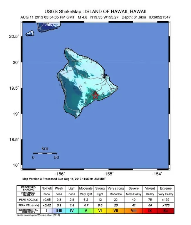
A deep magnitude-4.8 earthquake rattled Hawaii on Sunday (Aug. 11). The earthquake struck 5 miles (8 kilometers) south of Kilauea volcano's summit at 5:54 a.m. Hawaii Standard Time (11:54 a.m. EST). Several aftershocks followed, the largest of which was a magnitude 3.4. Residents of Hawaii and Maui reported feeling weak to light shaking on the U.S. Geological Survey's "Did You Feel It?" online survey form.
Geologists at the Hawaii Volcano Observatory (HVO) said magma moving beneath Hawaii's active volcanoes did not cause yesterday's earthquake, according to a press release from the observatory. Kilauea's volcanic plumbing is below and offset from the earthquake's location, Wes Thelen, HVO's seismic network manager, said in the statement. The temblor hit about 20 miles (32 km) below the surface, directly beneath Kulanaokuaiki campground within Hawaiʻi Volcanoes National Park. Instead, a nearly horizontal fault was the source of the quake, Thelen said. The fault, which has triggered earthquakes before, is a result of the island's massive weight compressing Earth's crust and mantle, the HVO said.

