














Typhoon Takes Aim at China, Vietnam

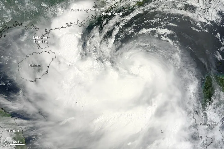
Typhoon Kai-tak, which strengthened from its former tropical storm status, was spotted by a NASA satellite today (Aug. 16) as it prepares to make landfall along the China-Vietnam border.
The typhoon is currently about 155 nautical miles south of Hong Kong and is moving to the west-northwest, which is expected to take it over China's Leizhou Bandao peninsula and northern Vietnam on Aug. 17 and 18, according to the U.S. Joint Typhoon Warning Center (JTWC).
Kai-tak's winds currently measure about 75 mph (120 kph), which would just make it a hurricane if it were in the Atlantic basin. The JTWC, run by the U.S. Navy and Air Force, expects the storm to strengthen a bit in the next 12 hours, then weaken rapidly as it begins to interact more with land, which disrupts tropical cyclones.
Typhoon Kai-tak will be the fourth typhoon to hit China in just over two weeks, after Typhoons Saola, Damrey, and Haikui all hit the country recently.
The state news agency Xinhua reported that China’s national disaster relief authority had issued an alert for Kai-tak on Aug. 15, according to a NASA image release. The typhoon was expected to impact Guangdong and Fujian Provinces, and bring as much as 16 inches (400 millimeters) of rain to the Pearl River Delta west of Hong Kong.
Kai-tak already dumped rain on the Philippines, which have also been much impacted by storms in recent weeks.
Get the world’s most fascinating discoveries delivered straight to your inbox.
