Google today (July 17) added historically significant imagery to its map of Antarctica so people anywhere are able to explore this remote destination.
The collection of panoramic images has also been added to Google's World Wonders site for users who want to learn more about South Pole exploration.
Latest Videos From
"Feel free to leave your boots and mittens behind, and embark on a trip to Antarctica," Alex Starns, Google's Street View technical program manager, wrote in a post.
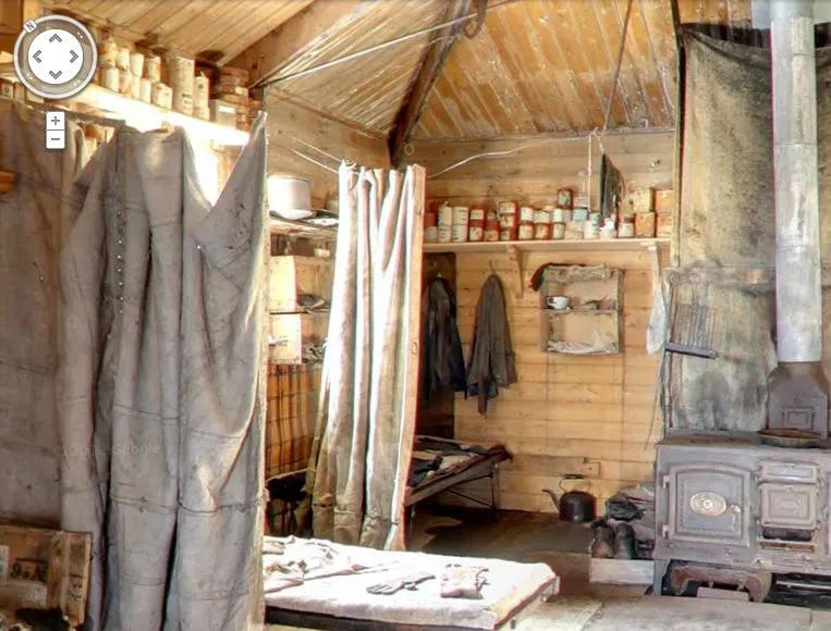
You can go inside places like polar explorer Ernest Shackleton’s hut and the other small wooden buildings that served as bases for landmark expeditions in the early 1900s. Built to withstand the drastic weather conditions for the few short years, the structures are still intact, along with well-preserved examples of the food, medicine, survival gear and equipment used during the expeditions.
You'll also see the South Pole Telescope, the hut of Robert Falcon Scott, who led Britain's 1901 Discovery Expedition, Cape Royds Adélie Penguin Rookery and the Ceremonial South Pole with its international flags planted in the frozen tundra.
The new photos were taken with a lightweight tripod camera using a fish-eye lens with help from the Polar Geospatial Center at the University of Minnesota and the New Zealand Antarctic Heritage Trust.
This article was provided by TechNewsDaily.com.


 Live Science Plus