 Live Science Plus


Hurricane season in the Atlantic brings a host of dramatic and dangerous weather, from whipping winds, torrential downpours, power outages and flash floods. And as climate change has been tied to an increase in hurricane intensity, these impacts could continue to worsen.
But when exactly does the Atlantic hurricane season of 2024 start, and how long does it last? And how do hurricanes form? What can people do to prepare in the face of the most dangerous storms on Earth? The 2024 Atlantic hurricane season is predicted to bring a record-breaking number of ferocious storms.
The National Oceanic and Atmospheric Administration has predicted an above-normal season, with up to 25 named storms, as a result of climate change and the transition from El Niño to La Niña.
Article continues belowWhat are hurricanes?
Hurricanes are tropical cyclones. When a tropical cyclone's sustained winds reach 39 to 73 mph (63 to 118 km/h), it is considered a tropical storm and it gets a name from a list put out by the World Meteorological Organization. Once those sustained winds reach 74 to 95 mph (119 to 153 km/h), that storm becomes a Category 1 hurricane. According to the Saffir-Simpson scale, here are the sustained winds linked to categories 2 through 5 hurricanes:
- Category 2: 96 to 110 mph (154 to 177 km/h)
- Category 3: 111 to 129 mph (178 to 208 km/h)
- Category 4: 130 to 156 mph (209 to 251 km/h)
- Category 5: 157 mph or higher (252 km/h or higher)
Named storms of 2024
- Tropical Storm Alberto — June 19 -20. This broad, but-short-lived storm affected parts of Louisiana, Texas and Mexico.
- Hurricane Beryl — June 28 - July 11 . This storm slammed into Grenada, Saint Vincent and the Grenadines as a Category 5 on July 2, pummeled Jamaica and the Cayman Islands before striking the Yucatán Peninsula as a Category 2. From there, it barreled across the Gulf of Mexico before making final landfall in Matagorda, Texas. Dozens of people died.
- Tropical storm Chris —June 30- July 1. This short-lived storm brought heavy rainfall to parts of Mexico.
- Hurricane Debby —Aug. 3 - 14. This slow-moving Category 1 hurricane dumped huge amounts of rain on Florida, Georgia, North Carolina, South Carolina and Virginia. Around 10 people died.
- Hurricane Ernesto —Aug. 12-20. This hurricane caused flooding in Puerto Rico before intensifying to a Category 2 storm and slamming into Bermuda as a Category 1.
- Hurricane Francine —Sept. 9 - 12. Hurricane Francine was a Category 2 hurricane that made landfall in Louisiana on Sept. 11 and then rapidly weakened over the next day.
- Tropical Storm Gordon —Sept. 11 - Sept. 17. This tropical storm formed in the middle of the Atlantic, far off the coast of Africa, before ultimately breaking up before ever making landfall.
- Hurricane Helene —Sept. 24 - Sept. 29. Hurricane Helene was a Category 4 storm that barreled toward Florida's Big Bend region with maximum wind speeds of 130 mph (210 km/h). This devastating storm made landfall around 11 p.m. EDT on Sept. 26 before lashing Georgia, Tennessee and Alabama with high winds and rain. Helene was huge, stretching around 400 miles (640 km) wide. It brought near-record storm surges, swamping the coast with water around 9 feet (2.7 m) above normal levels. The damage was catastrophic, and more than 230 people were killed across six states — making it the deadliest hurricane to hit mainland U.S. since Katrina in 2005.
- Tropical storm Isaac — Sept. 26 - Sept. 30. Tropical storm Isaac formed in the North Atlantic and reached maximum sustained wind speeds of 65 mph (104 km/h).
- Tropical storm Joyce — Sept 27 - Oct. 1. Tropical storm Joyce formed over the central tropical Atlantic Ocean with maximum wind speeds of 50 mph (80 km/h) before dissipating over the central Atlantic.
- Hurricane Kirk — Sept. 30 - present. Hurricane Kirk formed as a tropical depression in the North Atlantic between Senegal and the Caribbean. It strengthened to a tropical storm, before reaching hurricane strength on Oct. 1. On Oct. 4 it became a Category 4 hurricane with wind speeds of 145 mph (233 km/h). It began to lose strength on Oct. 6 as it veered north and then west towards Europe, where it's expected to make landfall on Oct. 9 or 10.
- Hurricane Leslie — Oct. 2 - present. Tropical storm Leslie formed in the eastern tropical Atlantic as a tropical storm before strengthening to a Category 1 hurricane. It then lost momentum and was downgraded to a tropical storm.
- Hurricane Milton — Oct. 5 - present. Hurricane Milton formed as a tropical depression in the Gulf of Mexico before strengthening rapidly to a hurricane on Oct. 6. It initially moved towards the north coast of the Yucatan Peninsula before veering toward central Florida. On Oct. 7 it rapidly strengthened to a Category 5 hurricane before being downgraded to a strong Category 4 on Oct. 8. It is currently barrelling toward Florida and is forecast to make landfall around the Tampa Bay area on Wednesday (Oct. 9). The entire west coast of Florida will face catastrophic conditions, with storm surges between 10 to 15 feet (3 to 4.5 m) in some areas.
How do hurricanes form?
Hurricanes are the most violent storms on Earth, according to NASA. At heart, hurricanes are fueled by just two ingredients: heat and water. Hurricanes are seeded over the warm waters above the equator, where the air above the ocean's surface takes in heat and moisture. As the hot air rises, it leaves a lower pressure region below it. This process repeats as air from higher pressure areas moves into the lower pressure area, heats up, and rises, in turn, producing swirls in the air, according to NASA. Once this hot air gets high enough into the atmosphere, it cools off and condenses into clouds. Now, the growing, swirling vortex of air and clouds grows and grows and can become a thunderstorm.
So, the first condition needed for hurricanes is warmer waters in the Atlantic Ocean, which cause a number of other conditions favorable to hurricanes.
"When the waters are warmer, it tends to mean you have lower pressures. It means a more unstable atmosphere, which is conducive to hurricanes intensifying," said Phil Klotzbach, an atmospheric scientist at Colorado State University. "These thunderstorms, which are the building blocks of hurricanes, are better able to organize and get going."
Another key factor: wind shear, or the change in wind direction with height into the atmosphere, Klotzbach said. "When you have a warm tropical Atlantic, you have reduced levels of wind shear," Klotzbach told Live Science. "When you have a lot of wind shear it basically tears apart the hurricane."
(Storms that form on different sides of the equator have different spin orientations, thanks to Earth's slight tilt on its axis, according to NASA.)

How climate patterns affect hurricanes
The individual ingredients for hurricanes, however, don't pop up at random; they are guided by larger weather systems. "There are two dominant climate patterns that really control the wind and pressure patterns across the Atlantic," said Gerry Bell, the lead seasonal hurricane forecaster for NOAA's Climate Prediction Center in Washington, D.C.
The first is the El Niño/La Niña cycle. During an El Niño, in which ocean water around the northwestern coast of South America becomes warmer than usual, Atlantic hurricanes are suppressed, while La Niña creates more favorable conditions for hurricanes, Bell said.
The second climate pattern is the Atlantic Multidecadal Oscillation (AMO), which is, as the name implies, a trend that lasts anywhere from 25 to 40 years and is associated with warmer waters in the Atlantic and stronger African monsoons, Bell said.
"When this pattern is in its warm phase, or a warmer tropical Atlantic Ocean, we tend to see stronger hurricane patterns for decades at a time," Bell told Live Science.
A warm-phase AMO conducive to hurricanes prevailed between 1950 and 1970 and since 1995, Bell said.

Hurricane outlook: 2024
The 2024 Atlantic hurricane season officially started on June 1 and will run until Nov. 30. In the Eastern Pacific Ocean, hurricane season begins May 15 and ends Nov. 30, according to the National Weather Service. However, most of these storms hit during peak hurricane season between August and October, on both coasts, according to NOAA's Climate Prediction Center.
The Climate Prediction Center classifies hurricane seasons as above-normal (between 12 and 28 tropical storms and between seven and 15 hurricanes); near-normal (between 10 and 15 tropical storms and between four and nine hurricanes) and below-normal (between four and nine tropical storms and two to four hurricanes).
The 2023 Atlantic hurricane season was predicted to be above-average, and that was borne out; a total of 21 tropical cyclones, 20 of which were named storms and seven of which were hurricanes, formed that year.
On May 23, NOAA said the forthcoming season was likely to be record-breaking. It predicted 17 to 25 named storms. According to the forecast, 13 of these storms will be hurricanes, with winds of 74 mph (119 km/h) or higher, and four to seven will be major hurricanes, with winds of 111 mph (179 km/h) or higher.
To make their predictions, scientists analyze a host of factors, from wind speed to sea-surface temperatures. Because the El Niño/La Niña cycle typically materializes in summer or early fall, forecasts done too early have limited meaning, Bell said.
In 2024, the strong El Niño of the prior season disappeared, and forecasts predicted its counterpart, La Niña, is coming. The latter leads to weaker trade winds, which means there is less wind shear to break up tropical storms.
However, as of late September, the bumper crop of tropical storms forecast has yet to appear. This may be in part because of an unusual monsoon season in Africa. The monsoon normally causes warm waves off Senegal and Gambia that fuel hurricanes. This year, the monsoon has hit further north, where cooler water contains less energy to fuel hurricanes.
Are hurricanes getting stronger?
Yes. On average, the world is seeing stronger tropical cyclones (a term that encompasses fast-rotating storms such as hurricanes and typhoons) more often than in decades past. According to an analysis of 4,000 tropical cyclones from 1979 to 2017, researchers concluded in 2020 that due to global warming these storms are not only getting stronger, but we are experiencing the strongest of the pack more frequently, Live Science reported. In another study, scientists discovered that compared with six decades ago, hurricanes that blast Bermuda are twice as strong, they reported online March 2, 2021 in the journal Environmental Research Letters.
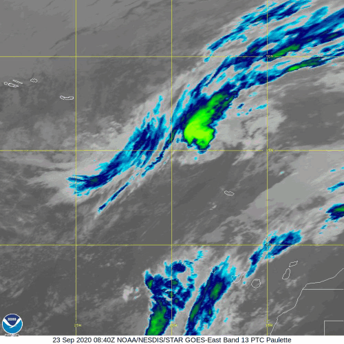
We can thank climate change for another hurricane downer: Global warming is leading to so-called zombie storms, or those that peter out and then get refueled to sort of rise from the dead, Live Science reported. For instance, in September 2020, the Category 1 hurricane Paulette made landfall in Bermuda, strengthened into a Category 2 and then weakened and died out some 5.5 days later. That wasn't the end of her story, though, because she regained strength and reached tropical storm strength about 300 miles (480 kilometers) off the Azores Islands. And according to scientists, such zombie storms could become more frequent, as waters warm up and give once-dead storms new life, according to Live Science.
Which cities have the most hurricanes?

According to HurricaneCity, a hurricane-tracking website, here are the top 10 cities most frequently hit or affected by hurricanes since record-keeping began in 1871:
- Cape Hatteras, North Carolina: Every 1.30 years (116 named tropical storms since 1871)
- Morehead City, North Carolina: Every 1.48 years (102 named storms)
- Grand Bahamas Island, Bahamas: Every 1.61 years (94 named storms)
- Wilmington, North Carolina: Every 1.66 years (91 named storms)
- Cayman Islands (most affected area in the Caribbean Sea): Every 1.68 years (90 named storms)
- Bermuda: Every 1.74 years (87 named storms)
- Great Abaco Island, Bahamas: Every 1.76 years (86 named storms)
- Andros Island, Bahamas: Every 1.86 years (81 named storms)
- Savannah, Georgia: Every 1.86 years (81 named storms)
- Myrtle Beach, South Carolina: Every 1.89 years (80 named storms)
The Saffir-Simpson Hurricane Wind Scale
Once a storm has wind speeds of 38 mph (58 km/h), it is officially a tropical storm. At 74 mph (119 km/h), the storm has reached hurricane levels. At that point, scientists use a 1 to 5 scale known as the Saffir-Simpson Hurricane Wind Scale to classify hurricane strength, with Category 1 being the least severe hurricanes and Category 5 being the strongest. Some scientists have also proposed adding a Category 6 to account for storms that are well beyond the highest sustained wind speed for a Category 5 hurricane.
| Category | Sustained wind speed (mph) | Potential damage |
| 1 | 74-95 | Minimal, with some roof leakage, gutter damage, snapped tree branches and toppled trees with shallow roots |
| 2 | 96-110 | Moderate, with major roof and siding damage; uprooted trees could block roads; power loss possible for days to weeks |
| 3 | 111-129 | Devastating damage, with gable and decking damage, many more uprooted trees and extended power outages |
| 4 | 130-156 | Catastrophic damage; roofs and exterior walls will be destroyed; trees will snap; power outages for weeks to months. Large area uninhabitable for weeks or months |
| 5 | 157 or higher | High fraction of framed houses will be destroyed; power outages for weeks to months; and huge swaths uninhabitable for same period |
Source: NOAA's National Hurricane Center
Scientists know that the scale has its limitations. "This scale does not take into account other potentially deadly hazards such as storm surge, rainfall flooding and tornadoes," according to the National Hurricane Center.
How are hurricanes named?
Hurricanes initially were named in honor of the feast day for a Catholic saint. For instance, Hurricane San Felipe occurred on Sept. 13, 1876, or the feast day of Saint Phillip, according to the National Hurricane Center. Hurricanes that struck on the same day would be distinguished by a suffix placed on the later one, Live Science previously reported. For example, a storm that struck on Sept. 13, 1928, was dubbed Hurricane San Felipe II, to distinguish it from the 1876 storm.
However, by the 1950s, the naming convention changed and in the U.S., hurricanes were given female names based on the international alphabet, according to the NHC. The practice of calling storms by female names only was abandoned in 1978.
Despite the seemingly open-ended possibilities, meteorologists do not have free reign in deciding names. The World Meteorological Organization (WMO) has a long list of alphabetical storm names that repeats on a six-year cycle. The organization aims for clear and simple names. Names are in English, Spanish, Dutch and French, to account for the many languages spoken by people potentially affected by hurricanes.
"Experience shows that the use of short, distinctive given names in written as well as spoken communications is quicker and less subject to error than the older, more cumbersome, latitude-longitude identification methods. These advantages are especially important in exchanging detailed storm information between hundreds of widely scattered stations, coastal bases and ships at sea," the WMO said.
If a storm was so devastating that using the name again would be insensitive, the group meets and agrees to strike the name from the list.
For instance, people don't have to worry about facing the wrath of a Hurricane Katrina, Ike, Hattie or Opal again, because those names have been retired, according to the NHC.
For the 2024 Atlantic hurricane season, meteorologists prepared the following list of names for storms in the North Atlantic, Caribbean and Gulf of Mexico, according to the National Hurricane Center:
- Alberto
- Beryl
- Chris
- Debby
- Ernesto
- Francine
- Gordon
- Helene
- Isaac
- Joyce
- Kirk
- Leslie
- Milton
- Nadine
- Oscar
- Patty
- Rafael
- Sara
- Tony
- Valerie
- William
How to prepare for a hurricane
Staying safe during the hurricane season starts with a simple step: Have a plan. People can plan for hurricanes using a simple guide at Ready.gov. Plans need to be worked out for all family members. And for those animal lovers out there, Fido and Mr. Whiskers also need an escape plan.
This plan includes figuring out how to determine whether it's safe to hunker down at home during a storm or whether you are in an evacuation zone. If so, there is likely a specific route you should take in the event of an evacuation, as many roads may be closed, Live Science previously reported.
If you are in an evacuation zone, you also need to figure out accommodations during the storm — this could be anything from staying with family and friends to renting a motel to staying in a shelter.
Family members often have trouble reaching each other during hurricanes, so determining a preset meeting place and protocol can be helpful. Sometimes, local cellphone lines are overloaded during a storm, so consider texting. Another alternative is to have a central out-of-state contact who can relay messages between separated family members.
During a storm, pets should be leashed or placed in a carrier, and their emergency supplies should include a list of their vaccinations as well as a photo in case they get lost, according to the Humane Society for the United States. Also important is finding someone who can care for them, in the event that a hotel or shelter does not accept pets. During an emergency, they should also be wearing a collar with the information of an out-of-state contact in case they get separated from you, according to the HSUS.
How to storm-proof your home
Anyone who lives in a hurricane-prone area would do well to protect their property in advance of a flood. Because hurricanes often cause their damage when trees fall on property, homeowners can reduce the risk of damage by trimming trees or removing damaged trees and limbs, according to Ready.gov.
Another easy step is to make sure rain gutters are fixed in place and free of debris. Reinforcing the roof, doors and windows, including a garage door, is also important, according to Ready.gov.
Power generators can also be an important tool if the power is cut off for long periods of time. A power generator needs to be kept outside, as they produce dangerous levels of carbon monoxide.
People who are very serious about prevention may even consider building a "safe room" — a fortified room designed to withstand the punishing winds of a tornado or hurricane, according to the Federal Emergency Management Agency pamphlet .
List of emergency supplies
People living in hurricane country also need to have a stash of emergency supplies, ideally placed in multiple locations throughout a dwelling. According to Ready.gov, a basic disaster kit should include:
- A gallon of water per person per day for at least three days
- A three-day supply of non-perishable food
- A battery-powered or hand-crank radio
- A flashlight with extra batteries
- A first aid kit
- A whistle to get help
- Dust mask
- Moist towelettes, garbage cans and plastic ties for sanitation
- A wrench or pliers for turning off busted pipes
- Maps
- A can opener for food
- Cellphone chargers

