
 Live Science Plus


Satellite Spies Sunny Skies over Pacific Northwest
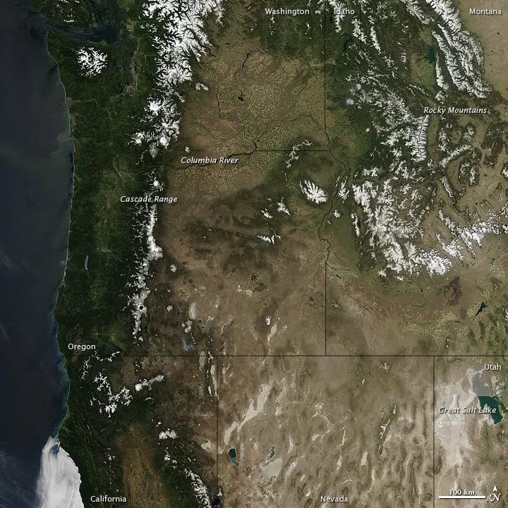
The Moderate Resolution Imaging Spectroradiometer (MODIS) on NASA's Aqua satellite caught this image of a clear day in the Pacific Northwest on May 12.
(Image credit: NASA)
Clear skies gave NASA's Aqua satellite an unobstructed view of the famously cloudy Pacific Northwest from Washington to Utah on May 12.
Snow caps the peaks of the Rocky Mountains, the Cascades, and isolated mountains outside these ranges. Snow cover recedes in these mountain ranges as summer progresses, but some peaks sport ice year round, and both the Cascades and the Rockies are home to multiple glaciers.
