


Massive Dust Storm Roils Middle East Skies
Last week, a satellite spied turmoil in the skies over the Middle East as a massive dust storm swept across the region. At one point, the colossal storm's reach crossed the boundaries of four countries simultaneously.
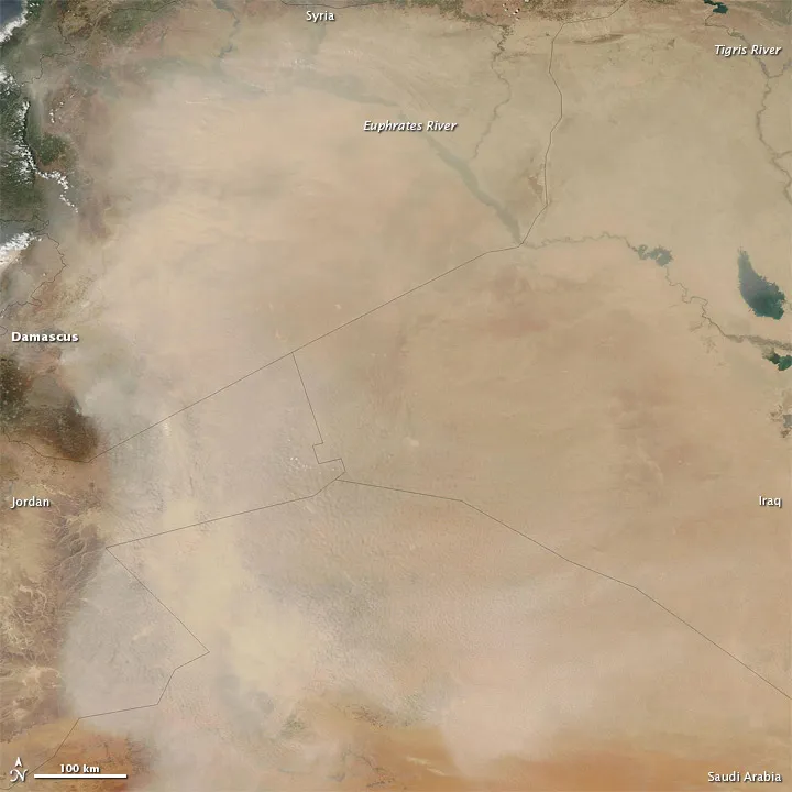
In this image, captured May 11, the dust plume covers nearly all of Syria, and extends into Iraq, Saudi Arabia and Jordan. The dust was thickest in the west, especially over Jordan and northern Saudi Arabia, and thinned toward the east.
The vast sand seas of the Arabian Peninsula provide plentiful material for dust plumes like this one. In addition, fine sediment from seasonal rivers and salty lakes, as well as the Tigris and Euphrates floodplains, can help fuel dust storms.
A recently-published study from the University Corporation for Atmospheric Research examined what materials comprised dust storms that swept across Iraq from December 2008 through March of the following year.
The researchers found that the particles were, from most to least abundant, silt, clay and sand. Clay and silt particles are much smaller than sand grains, and they can be lofted into the air by lighter winds and thus may occur more frequently in dust storms.
Follow OurAmazingPlanet for the latest in Earth science and exploration news on Twitter @OAPlanet and on Facebook.
Get the world’s most fascinating discoveries delivered straight to your inbox.
