
 Live Science Plus


Rina Becomes Sixth Hurricane of 2011 Season

published
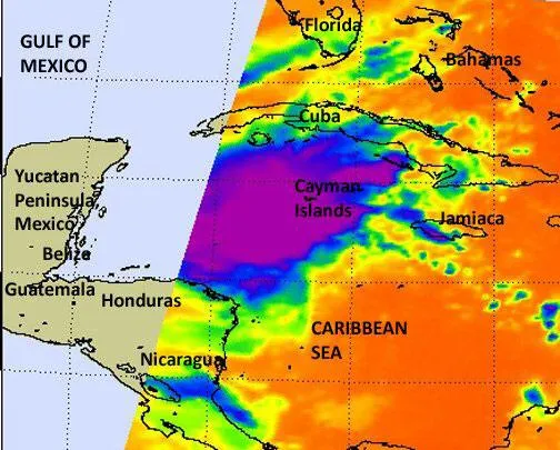
This infrared image of the eastern half of Tropical Storm Rina was taken on Oct. 24 at 2:47 a.m. EDT from the AIRS instrument on NASA's Aqua satellite. It shows a very large area of strong convection and thunderstorms around the center (purple) of circulation. Cloud top temperatures were colder than -63F (-52C) in that area, indicating strong thunderstorms and heavy rainfall.
(Image credit: NASA/JPL, Ed Olsen)
Less than a day after Tropical Storm Rina formed, it has strengthened into a hurricane, the sixth of the 2011 Atlantic hurricane season.
Rina formed over the northwest Caribbean Sea, and is currently about 190 miles (305 kilometers) southwest of Grand Cayman and 370 miles (595 kilometers) of Chetumal, Mexico. The storm has winds of 75 mph (120 kph) is heading toward Belize and the Yucatan Peninsula of Mexico.

