What was once Hurricane Paula, the ninth hurricane of the 2010 season, has now weakened and reverted back to tropical storm status.
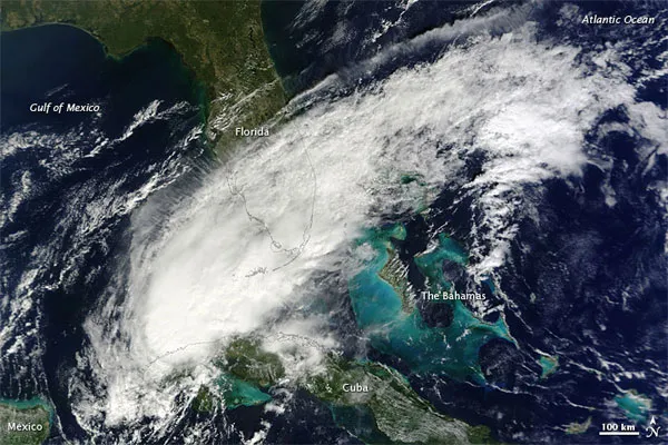
Though Paula has lost steam, the storm is still a threat, with its high winds, heavy rains and storm surges. This image, taken by NASA's Terra satellite, captured this natural-color image of Tropical Storm Paula at 12:05 p.m. ET on Oct. 14. The storm stretched from the Gulf of Mexico across southern Florida to the Atlantic Ocean.
At 11:00 a.m. that day, the U.S. National Hurricane Center (NHC) reported that Paula was located roughly 110 miles (180 kilometers) west-southwest of Havana, Cuba, and had maximum sustained winds of 70 miles (110 kilometers) per hour.
Latest Videos From
They warned that tropical-storm-force winds would likely spread across Cuba. Paula was predicted to produce up to 10 inches (25 centimeters) of rain in some places, with the potential for dangerous flash floods and landslides. In addition, forecasters were calling for a storm surge of 2 to 4 feet (0.6 to 1.2 meters) above normal tide levels.
Paula is the 16th storm to be named this hurricane season, which has been an especially busy one, as was predicted by forecasters . The average hurricane season usually has about 11 named storms.
Hurricane season runs from June 1 to Nov. 30.