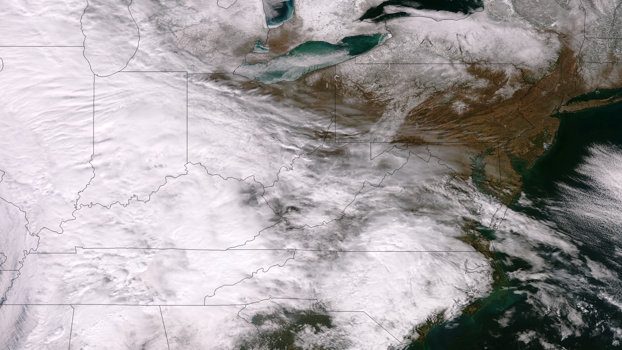
Snowstorm Threatening East Coast Seen from Space

Get the world’s most fascinating discoveries delivered straight to your inbox.
You are now subscribed
Your newsletter sign-up was successful
Want to add more newsletters?
Join the club
Get full access to premium articles, exclusive features and a growing list of member rewards.
The latest in a series of late-season snowstorms is barreling toward the East Coast, dumping nearly a foot of snow on some locales as it passes.
The National Weather Service predicts 8 to 12 inches (20 to 30 centimeters) of snow could fall in the Mid-Atlantic states tonight (March 5), with up to 18 inches (45 cm) in West Virginia. Tomorrow (March 6), traffic snarls are expected along Interstate 95 as the system collides with warm air over the East Coast, pummeling northern Virginia, Washington, D.C., Maryland, N.Y.'s Long Island and southern Connecticut with heavy, wet snow.
The Washington Post's Capital Weather Gang blog, which dubbed the storm "Snowquester," said thundersnow was possible in the D.C. area. Thundersnow, or a snow thunderstorm, rumbles when air from the ground rushes upward to high levels of the atmosphere, paired with temperatures at or below freezing.
Article continues belowNASA's Suomi NPP satellite snapped a picture of the storm from space today as the wintry weather blasted across the plains. Clouds obscure the Midwest in the image, where parts of North Dakota and Minnesota were blanketed with 10 inches (25 cm) of snow, the NWS reported.
By tomorrow night and early Thursday morning, the gale will move offshore and high winds could whip up storm surges, the NWS predicts. Mid-Atlantic coastal communities have received flood watches and gale warnings in advance of the storm. Wind gusts of 45 to 50 knots (83 to 92 kph) were expected in the waters off New York, the NWS said.
Email Becky Oskin or follow her @beckyoskin. Follow us @OAPlanet, Facebook or Google+. Original article on LiveScience's OurAmazingPlanet.
Get the world’s most fascinating discoveries delivered straight to your inbox.

 Live Science Plus


