Hindsight is 20/20, the saying goes, and new research shows that may be the case in the devastating earthquake and tsunami that struck Japan's Tohoku region in 2011.
Before that quake, seismic hazard maps for the area said there was no danger of a large earthquake along the Japan Trench, the subduction zone responsible for the 2011 event. (A subduction zone is an area where one of Earth's tectonic plates dives beneath another.) Now, geologists working in Tohoku have identified ancient deposits tied to a comparably large earthquake and tsunami in AD 869.
Had researchers and officials known this before last year's temblor, they likely could have improved emergency plans before the earthquake, said Yuki Sawai, a paleoseismologist with the Geological Survey of Japan, who led the new study.
Latest Videos From
"Tsunami geology had the potential to provide estimates of the recurrence of past great Tohoku earthquakes and the minimum inland extent of their accompanying tsunamis," Sawai wrote in a report published Nov. 9 in the journal Geophysical Research Letters. It also "might have reduced casualties by improving evacuation maps and informing public-awareness campaigns," he wrote.
The 869 Jogan quake
Sawai's team examined sand deposits from historical tsunamis along the eastern coast of Japan's Honshu Island. Using stratigraphy and radiocarbon dating, they were able to tie one of those deposits to the Jogan earthquake, which struck Tohoku in 869.
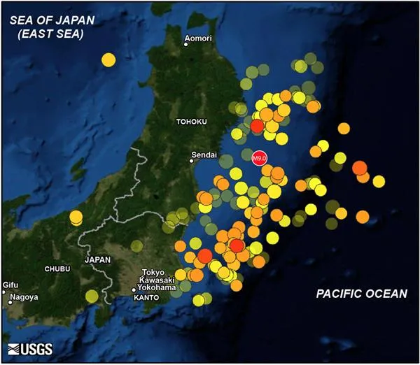
The Jogan deposit underlies the city of Sendai and extends approximately 62 miles (100 kilometers) along the Honshu coast and 1.1 miles (1.8 km) inland. Sawai's team used this data to model the parameters of the Jogan earthquake. They estimate it had a magnitude of at least 8.4 and accompanied a rupture in the Japan Trench at least 124 miles (200 km) long and 62 miles (100 km) wide. (The 2011 earthquake was a magnitude 9.0 and ruptured a fault segment about 190 miles (300 km) long.) [In Pictures: Japan Earthquake & Tsunami]
The new findings indicate that major quakes occur in this region every 500 to 800 years — more frequently than researchers had previously estimated.
Estimating future hazards
Until now, researchers had not been able to estimate the magnitude of the 869 earthquake.
Sawai's team has nailed down the minimum magnitude of 8.4 for that quake, but a maximum magnitude will be hard to calculate, he said.
One reason is that researchers don't know how far tsunami floodwaters from the Jogan event may have extended beyond the sand deposit. "We cannot reconstruct water inundation from geology, so far, so we had to model flooding adjacent to the sandy tsunami deposit," Sawai said.
This means they likely underestimated the size of the Jogan tsunami — the 2011 tsunami extended significantly beyond its sand deposit. The team may have also underestimated the north-south extent of the sand deposit, since they couldn't pinpoint its edges.
The new findings should help improve seismic hazard assessments for the Tohoku region, Sawai said.
"Estimating potential tsunami inundation will help make better evacuation maps," he told OurAmazingPlanet, "and estimating potential earthquake magnitude will be important for urban design and recovery plans."
This story was provided by OurAmazingPlanet, a sister site to LiveScience. Follow OurAmazingPlanet for the latest in Earth science and exploration news on Twitter @OAPlanet. We're also on Facebook & Google+.

 Live Science Plus