-
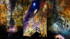 Thríhnúkagígur: The only volcano on Earth where you can descend into a magma chamber
Thríhnúkagígur is a volcano near Reykjavík in Iceland with an empty magma chamber decorated with vivid colors that scientists and tourists can access via an open cable elevator.
4 Comments -
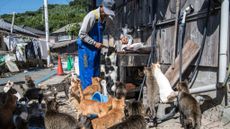 Aoshima: Japan's tiny 'Cat Island' where felines hugely outnumber humans
Once a thriving sardine fishing island, today Aoshima is home to roughly 80 cats and just a handful of people who look after the felines with the help of food donations from around Japan.
-
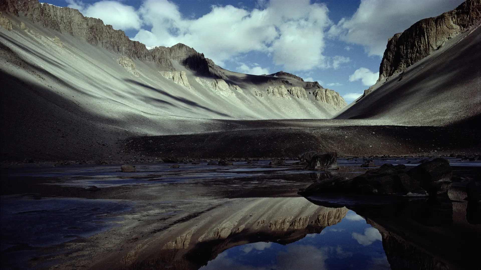
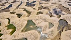 Lençóis Maranhenses: Brazil's dune-filled expanse that sits at the intersection of 3 biomes
Lençóis Maranhenses National Park hosts sand-dune fields that fill up with lagoons every wet season, but the reserve also has mangrove swamps where species such as the scarlet ibis thrive.
-
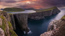 Sørvágsvatn: The lake that 'floats' above the ocean thanks to a unique optical illusion
Sørvágsvatn, also called Leitisvatn, is the largest lake in the Faroe Islands. Viewed from a certain angle, one side appears to hover above the Atlantic Ocean.
-
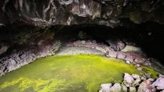 Bandera Volcano Ice Cave: The weird lava tube in New Mexico whose temperature is always below freezing
Due to a weird quirk of geology, New Mexico's Bandera Volcano Ice Cave never warms above 31 degrees Fahrenheit, even when temperatures outside exceed 100 F in summer.
2 Comments -
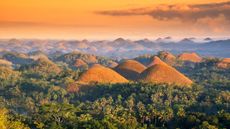 Chocolate Hills: The color-changing mounds in the Philippines that inspired legends of mud-slinging giants
The Chocolate Hills are 1,776 mounds on Bohol Island in the Philippines where grassy cover turns brown during the dry season.
-
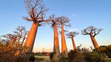 Avenue of the Baobabs: Madagascar's natural monument with dozens of 'mother of the forest' trees
The Avenue of the Baobabs preserves the remnant trees of an ancient tropical forest on Madagascar.
-
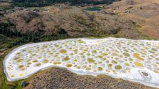 Spotted Lake: Canada's soda lake with colorful brine pools that are smelly and slimy 'like the white of an egg'
Spotted Lake is a soda lake that evaporates every summer, leaving a white crust with circular brine pools that can appear blue, green or yellow.
-
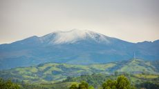 Coconucos volcanic chain: Colombia's stunning cluster of volcanoes, lost in an otherworldly landscape
The Coconucos volcanic chain is a mountain ridge dotted with at least 14 volcano craters, including one that is active and erupted in December 2025.


