The Holy Land: 7 Amazing Archaeological Finds
Holy Land archaeology

The "Holy Land" refers to modern-day Israel, the Palestinian Territories and, by some definitions, areas close to them. This part of the world is of great religious importance for Christianity, Judaism and Islam. In this gallery LiveScience takes a look at seven amazing archaeological discoveries made in the region, some very recently. The finds date from the Early Bronze Age (more than 4,000 years ago) up to the time the Byzantine Empire controlled the Holy Land, about 1,500 years ago.
Ketef Hinnom silver amulets
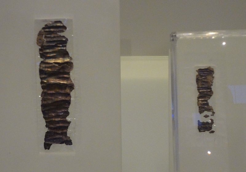
In 1979 two silver mini scrolls (actually amulets in antiquity) were discovered at Ketef Hinnom, an archaeological site that now has been incorporated into the Menachem Begin Heritage Center in Jerusalem. Dating to around 2,600 years ago they are written in paleo-Hebrew and contain the oldest biblical passage that survives to present day, part of a priestly blessing found in Numbers 6:24-26. The amulets say that Yahweh is stronger than evil and a "rebuker of evil." Researchers think the amulets would have offered protection to those who wore them.
Khirbet Qeiyafa
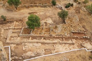
Khirbet Qeiyafa flourished almost 3,000 years ago and is located about 19 miles (30 kilometers) southwest of Jerusalem. A casemate city wall with two gates surrounds the 6-acre (2.3 hectares) settlement, and some researchers claim it is the biblical city of Sha'arayim. The site may also have played an important role during Israel's "United Monarchy" period and, in July 2013, researchers announced they had identified a structure more than 10,000 square feet (1,000 square meters) in size as a palace that may have been used by King David himself.
Massive 'Sea of Galilee' Structure
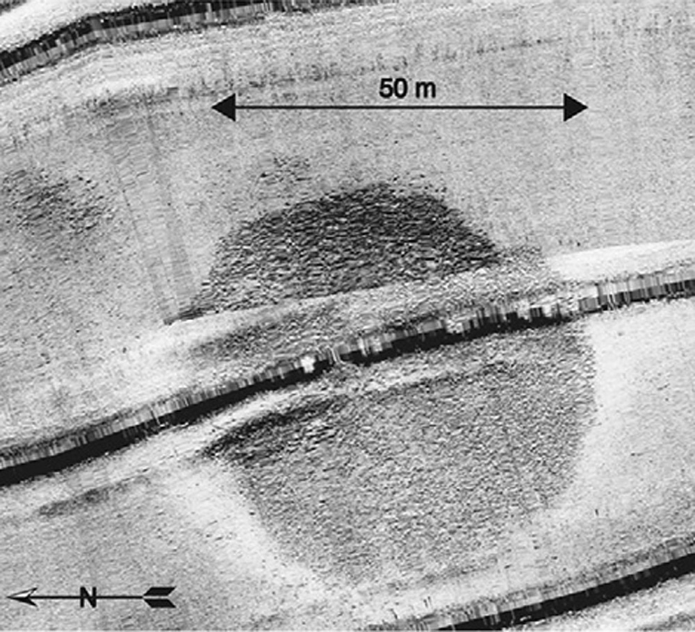
In 2013, researchers reported the discovery of a massive stone cairn beneath the waters of the Sea of Galilee. Rising 32 feet (10 meters) off the seafloor the structure has a diameter of 230 feet (70 m), twice the size of the outer circle of tonehenge. It's estimated to weigh about 60,000 tons, heavier than most modern-day warships. Researchers think it may be more than 4,000 years old, dating to a time when the water levels of the sea were lower and a city called "Bet Yerah" or "Khirbet Kerak" stood a mile to the south of the structure. The purpose of the structure is unknown, but cairns, in some instances, were used to mark burials in the ancient world.
Sea of Galilee boat
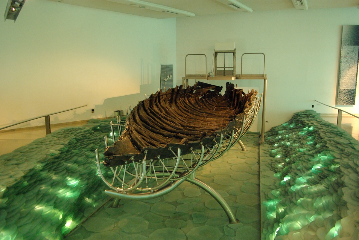
In 1986 two amateur archaeologists, exploring the Sea of Galilee coast at a time when the water level was low, found the remains of a small wooden boat buried in sediment. Professional archaeologists soon excavated it and found it dates to around 2,000 years ago. That date has led some to refer to the remains as the "Jesus boat," although there is no evidence that Jesus or his apostles used this specific vessel. Recently archaeologists discovered a town dating back more than 2,000 years that was located on the shoreline where the boat was found.
Dead Sea Scrolls
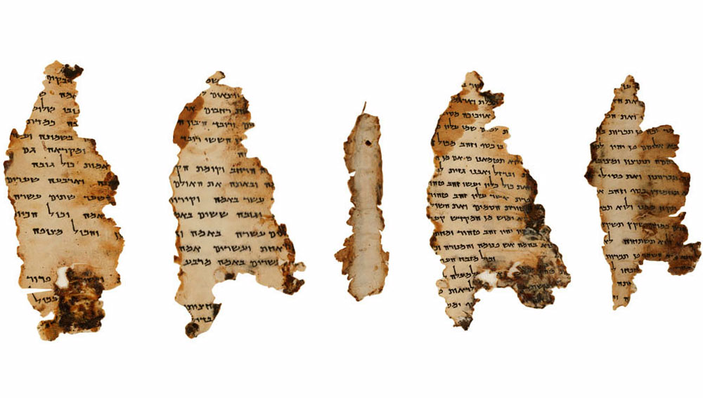
A young shepherd named Muhammed Edh-Dhib first discovered the Dead Sea Scrolls in 1946 or 1947 near the site of Qumran in what is now the West Bank. Over the next decade, scientists and Bedouin would discover more than 900 manuscripts located in 11 caves. They include canonical works from the Hebrew Bible, including Genesis, Exodus, Isaiah, Kings and Deuteronomy. They also include calendars, hymns, psalms, apocryphal (non-canonical) biblical works and community rules. One scroll is made of copper and describes the location of buried treasure. The texts date from between roughly 200 B.C. up until about A.D. 70 when the Romans put down a revolt in Jerusalem and Qumran was abandoned. The authorship of the scrolls is a source of debate. A popular theory among scholars is that a monastic sect called the Essenes lived at Qumran, and they wrote and collected the texts.
Masada Fortress
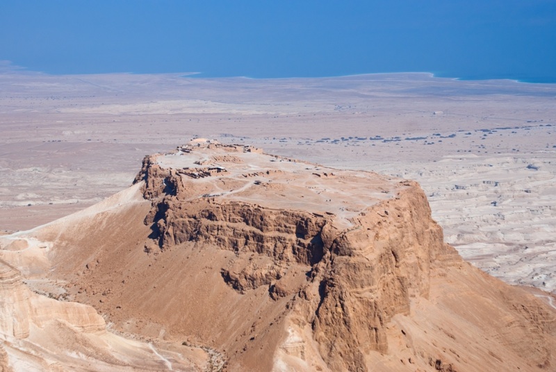
First identified in 1838, the cliff-top fortress of Masada is located in Israel near the Dead Sea and was the site of a last stand during a rebellion against the Romans. A team led by archaeologist Yigael Yadin carried out the most intensive excavations there in the 1960s. Research reveals that King Herod (74 B.C.– 4 B.C.) built two palaces with support buildings surrounded by a wall, nearly a mile long, with 27 towers. The site would gain its greatest fame when, after a rebellion against the Romans was crushed in A.D. 70, a group called the Zealots occupied the fortress with 960 people and tried to hold it against a Roman army of about 9,000. In A.D. 73 or 74 the Romans succeeded in building a siege ramp up to the wall, and the remaining defenders decided to take their own lives rather than surrender.
Get the world’s most fascinating discoveries delivered straight to your inbox.
Madaba Map
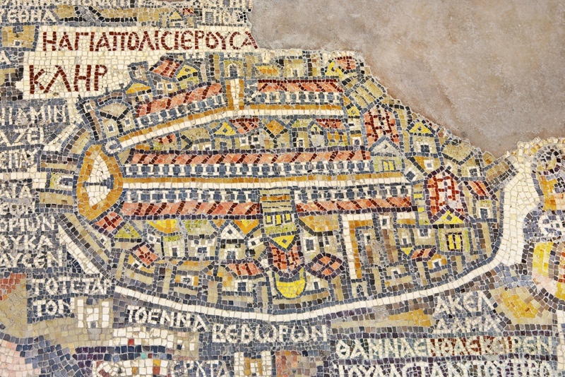
Discovered in a church in Madaba, Jordan, in 1884, the Madaba Map is the oldest surviving cartographic depiction of the Holy Land. Created in the form of a mosaic it dates to somewhere between A.D. 560-565 and originally showed an area that stretched from southern Syria to central Egypt. By the time it was discovered much of the map was already gone, however its remains include a detailed depiction of Jerusalem. "The bird's-eye view shows an oval-shaped walled city in the very center of the map with six gates and twenty-one towers, the colonnaded main thoroughfare … and thirty-six other identifiable public buildings, churches and monasteries," writes Jerome Mandel in an article published in the book "Trade, Travel and Exploration in the Middle Ages: An Encyclopedia" (Routledge, 2000). At the time it was created the Byzantine Empire ruled the Holy Land.

Owen Jarus is a regular contributor to Live Science who writes about archaeology and humans' past. He has also written for The Independent (UK), The Canadian Press (CP) and The Associated Press (AP), among others. Owen has a bachelor of arts degree from the University of Toronto and a journalism degree from Ryerson University.
 Live Science Plus


