A major earthquake cracked the walls of the San Diego and San Juan Capistrano missions on Nov. 22, 1800. The temblor was one of the first damaging quakes ever recorded in the San Diego area, yet for more than 200 years, no one had been able to pinpoint the fault that caused it.
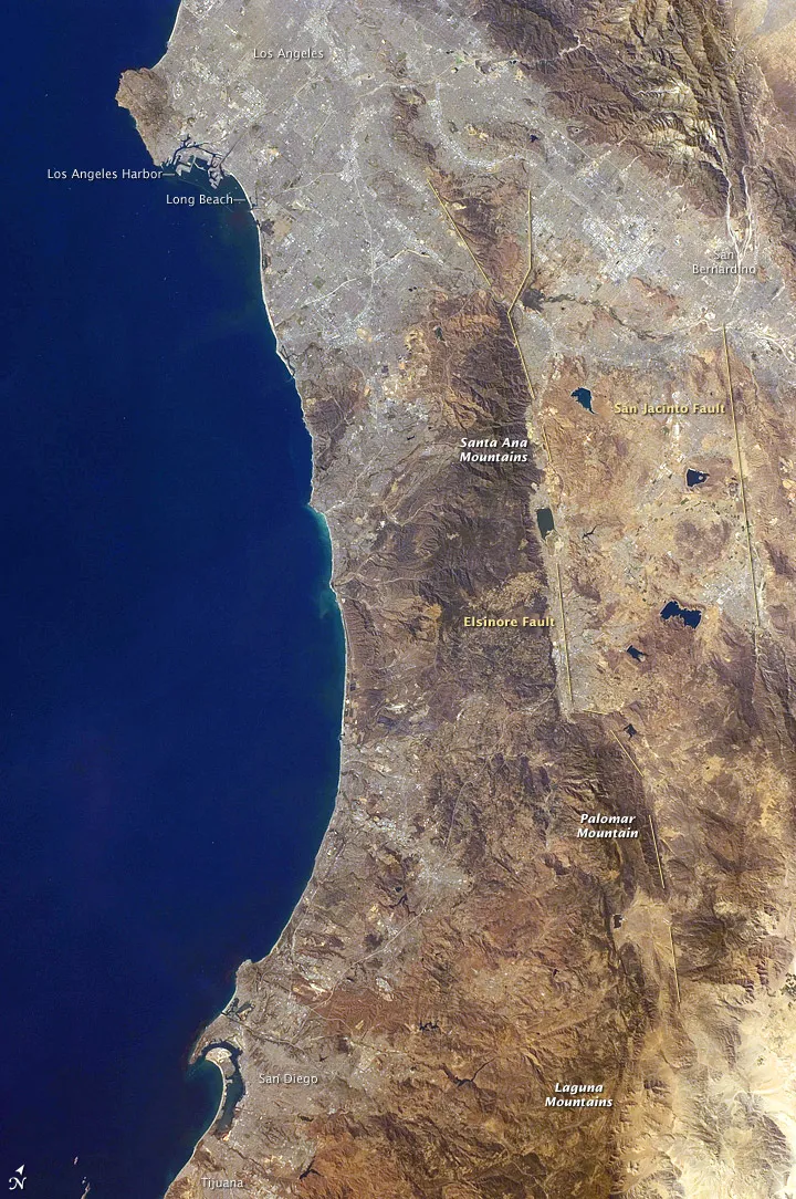
Now, through a bit of old-fashioned geologic detective work and a relatively new laser tool known as LiDAR, scientists may have finally tracked down the rupture that shook those Southern California missions: an active piece of the San Jacinto Fault Zone known as the Clark Strand, near California's Anza-Borrego area.
The techniques they used to find the mystery rupture may someday help scientists make better earthquake forecasts around the globe, the researchers say.
Latest Videos From
"We're focused on making accurate forecasts of earthquakes, and that relies heavily on the past behavior of the fault," said James Salisbury, an earthquake geologist at Arizona State University who led the study published this month in the Bulletin of the Seismological Society of America. "This is certainly a step towards more reliable earthquake forecasts."
Seeing through the trees
Salisbury's team used a technology known as light detection and ranging, or LiDAR, to map the Clark Strand from the air.
In LiDAR, a laser scanner strapped to the bottom of a small plane sends pulses of light to the ground — about 10,000 of them every second. As the laser pulses return to the plane, the instrument records the three-dimensional coordinates of whatever the light beams bounce off of near the ground. This technology is particularly useful for geologists because they can correct for any interference from vegetation, essentially letting them see through the trees to the fault line itself.
To check that their LiDAR measurements were accurate, Salisbury's team then trekked into the field to measure each feature their LiDAR scans had recorded.
"A lot of the really subtle features are more easily identified with LiDAR," Salisbury told OurAmazingPlanet, "like smaller scarps [steep banks caused by fault ruptures] that you would probably just walk over, on the order of 5 or 10 centimeters in size."
Tracking the historical quake
One feature they found was a 13-foot (3.9 meters) displacement that could be traced back to the mystery quake on Nov. 22, 1800.
Combining their LiDAR and field measurements with radiocarbon dating of older sediments along the Clark Strand, Salisbury's team found evidence of an earthquake that occurred sometime around 1790 (plus or minus several years). The shaking associated with that quake would have been strong enough to damage the two southern California missions in 1800. [13 Crazy Earthquake Facts]
"All our data seemed to tie the story together very well," Salisbury said.
If they're correct, then it's been more than 210 years since the Clark Strand's last major earthquake. That's also the average time between major quakes on the fault — in other words, the Clark strand may be due for another big shaker.
"Unfortunately this approach doesn't help us predict earthquakes," Salisbury cautioned, "but it substantially increases our confidence in our forecasts for earthquakes, and that's really what we're going for."