What the Heck Is This?

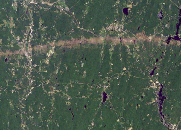
The green and brown is probably a pretty good giveaway, but do you know exactly what you're looking at?
On June 1 a thunderstorm in western Massachusetts developed into a supercell, which is science-speak for "trouble." Now can you guess?
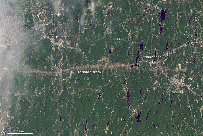
See the full image, and more description, below.
The storm produced a tornado that carved a 39-mile (63-kilometer) track, which is what you see here. The image was taken from a satellite.
The Massachusetts tornado was about a half-mile wide at one point. It was rated an EF-3, with winds of up to 160 mph (257 kph). There were two smaller tornadoes in the state that same day.
Isn't that rare for Massachusetts. Yes, but not unprecedented. In 1953, one of the deadliest tornadoes in U.S. history hit Worcester, Mass., killing 94 people.
Got a strange or interesting photo related to science, nature or technology? What the Heck, send it to me, and maybe I'll use it. Or follow me on Twitter, or Facebook.
Get the world’s most fascinating discoveries delivered straight to your inbox.
Robert is an independent health and science journalist and writer based in Phoenix, Arizona. He is a former editor-in-chief of Live Science with over 20 years of experience as a reporter and editor. He has worked on websites such as Space.com and Tom's Guide, and is a contributor on Medium, covering how we age and how to optimize the mind and body through time. He has a journalism degree from Humboldt State University in California.
 Live Science Plus


