Update: The launch of the U.S. spy satellite was aborted just 7 seconds before liftoff.
The U.S. government is putting something big and secret in orbit tonight (Sept 30).
Such classified launches aren't all that rare. The military and various intelligence agencies routinely put satellites and other cargo into space without telling anyone what they're for. But any orbital mystery is interesting, and there are a few details we can glean from what's been made known about tonight's scheduled launch, a mission designated NROL-44.
Latest Videos From
The satellite's main job is probably 'signal intelligence'
NROL-44's cargo belongs to the National Reconnaissance Office (NRO), the intelligence branch that maintains the nation's spy satellites. NRO satellites perform all sorts of functions, like snapping high-resolution photographs, studying ground sites with radar and watching for missile launches.
Related: Top 10 ways to destroy Earth
This launch doesn't fit any of those profiles, however. NROL-44 will loft cargo into a geosynchronous orbit that keeps it over a particular part of the Earth at all times. At low orbits, satellites will circle the planet many times a day. To remain stationary relative to the spinning planet below, a satellite must orbit about 22,000 miles (36,000 kilometers) above Earth — 9.2% of the way to the moon. GPS satellites orbit at that altitude. The International Space Station, by way of contrast, orbits at about 254 miles (408 kilometers) above Earth.
Satellites that take high-resolution images of the planet tend to orbit at space station-like altitudes; that way they are close enough to show clear details in images. An NRO satellite launched in 2013 known as USA-245, for example, orbits between 171 and 627 miles (276 and 1,010 km) in altitude on a path that takes it over the poles. Analysts believe its job is to take high-resolution pictures, as The Los Angeles Times reported.
A geosynchronous orbit is probably too high up for high-quality imagery. But it's a great place for intercepting radio waves from anyone the NRO wants to spy on, as Spaceflight Now reported.
Whatever it is, it's probably pretty heavy
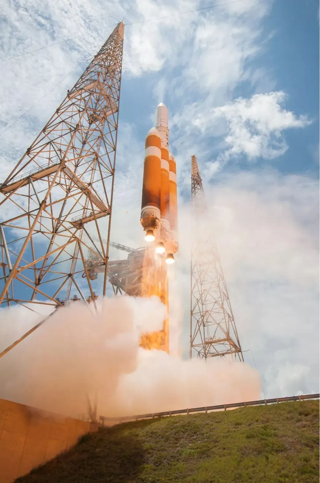
Assuming all goes well, the satellite will ride a United Launch Alliance (ULA) Delta IV Heavy rocket from Cape Canaveral Air Force Station in Florida into orbit at 11:54 p.m. EDT (0354 UTC).
(Success is not guaranteed. As Live Science sister site Space.com reported, NROL-44 was originally scheduled to launch on Aug. 29, but a computer aborted the launch just 3 seconds before liftoff due to a problem in the rocket. It was then scheduled to launch last night, Sept. 29, but was delayed for bad weather and a hydraulics issue.)
ULA, a joint project of Boeing and Lockheed Martin to compete for space projects, is phasing out the Delta IV Heavy, but it's still one of the most powerful heavy lifters in the U.S. toolkit. Only the SpaceX Falcon Heavy can lift more mass into space.
We don't know the exact mass of the satellite, but the Delta IV Heavy can carry up to 14,880 lbs. (6,750 kilograms) all the way into geosynchronous orbit. The NRO pays ULA $440 million each time the Delta IV Heavy launches, according to Space News. So the office likely only uses the Delta IV Heavy for tasks that require that much power. There are cheaper rockets available that can handle launches to geostationary orbit, like the $110 million-per-launch Atlas-V. But they carry much less weight.
Originally published on Live Science.