Golden river of toxic waste from South African mining disaster visible from space
A collapsed dam at a diamond mine in South Africa recently released a torrent of mining waste into the surrounding area. A new satellite image shows the trail of dried and potentially toxic mud left behind.
All that glitters is not gold. Sometimes, it's a river of mining waste.
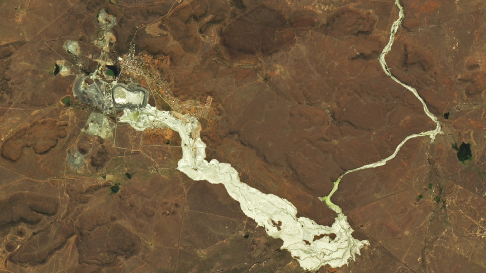
A satellite photo taken after a devastating mining disaster in South Africa revealed a golden river of dried mud glimmering on the landscape. But its gleaming shine was caused by a torrent of potentially toxic sludge.
On Sept. 11, a dam at a diamond mine in Jagersfontein, South Africa collapsed, releasing a deluge of mining waste, known as tailings, which swept through the outskirts of the town and into the surrounding countryside. The disaster killed three people and injured around 40 others, according to Bloomberg. The flooding also destroyed dozens of houses, damaged cell phone towers, shut down roads, temporarily polluted drinking water and washed away hundreds of sheep, Reuters reported.
Tailings are a muddy mix of dust, crushed rock, water and other byproducts left over from mining. The surplus slurry often contains trace quantities of metals such as copper, mercury, cadmium and zinc, as well as other compounds including petroleum, sulfuric acid and even cyanide, according to Earthworks, a U.S.-based organization that supports communities impacted by mining and fossil fuel extraction.
Related: Stunning 'sunglint' turns the sea's surface into a swirling silver mirror
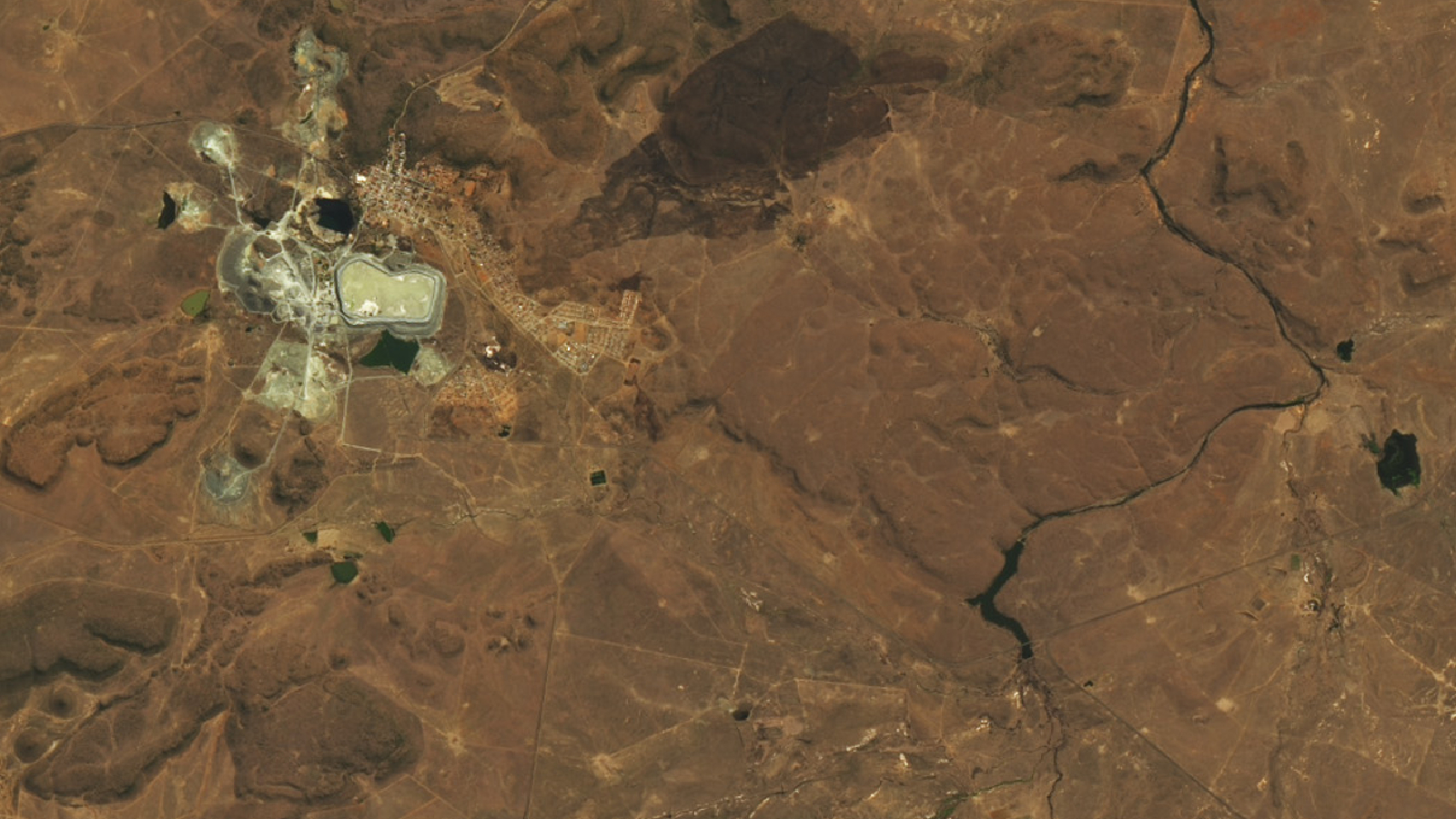
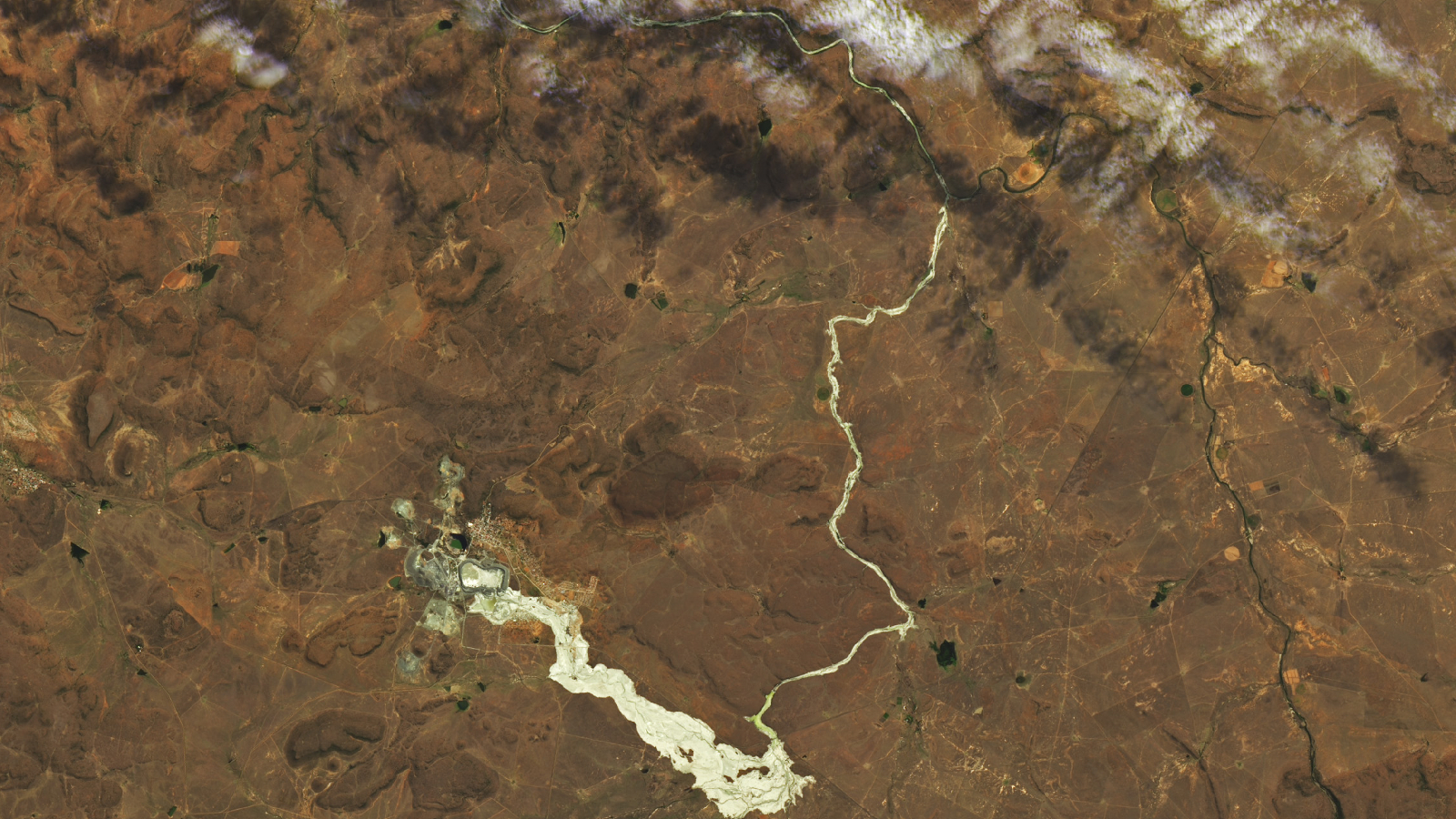
A satellite image taken Oct. 4 by the Landsat 9 satellite, which is co-owned by NASA and the U.S. Geological Survey, shows a golden river of mud that was left behind as the spilled tailings flowed away from the mining town and eventually dried out. The striking image was released online Oct. 20 by NASA's Earth Observatory. Another photo of the area, taken by the Landsat 8 satellite the day before the dam collapsed, was also released for comparison.


In the new image, the break in the southern dam wall is clearly visible. From there the tailings flowed down the hillside in a massive, mile-wide (1.6 kilometers) wave that eventually funneled into the nearby Walwas Dam before spilling over into the adjoining Prosesspruit river, according to Earth Observatory.
Get the world’s most fascinating discoveries delivered straight to your inbox.
In total, the dried tailings covered around 10 square miles (26 square km) of farmland, according to Earth observatory. Parts of the Prosesspruit also appear to have widened, suggesting that the torrent of mining waste may have eroded away the river's banks.
This golden river won't be around for long. The dried tailings will eventually begin to crumble and will either be blown away by the wind or washed away by the rain, according to Earth Observatory.

Harry is a U.K.-based senior staff writer at Live Science. He studied marine biology at the University of Exeter before training to become a journalist. He covers a wide range of topics including space exploration, planetary science, space weather, climate change, animal behavior and paleontology. His recent work on the solar maximum won "best space submission" at the 2024 Aerospace Media Awards and was shortlisted in the "top scoop" category at the NCTJ Awards for Excellence in 2023. He also writes Live Science's weekly Earth from space series.
 Live Science Plus


