Photos: Devastating Caldor wildfire threatens Lake Tahoe
The devastating wildfires are closing in on Lake Tahoe.
Get the world’s most fascinating discoveries delivered straight to your inbox.
You are now subscribed
Your newsletter sign-up was successful
Want to add more newsletters?

Delivered Daily
Daily Newsletter
Sign up for the latest discoveries, groundbreaking research and fascinating breakthroughs that impact you and the wider world direct to your inbox.

Once a week
Life's Little Mysteries
Feed your curiosity with an exclusive mystery every week, solved with science and delivered direct to your inbox before it's seen anywhere else.

Once a week
How It Works
Sign up to our free science & technology newsletter for your weekly fix of fascinating articles, quick quizzes, amazing images, and more

Delivered daily
Space.com Newsletter
Breaking space news, the latest updates on rocket launches, skywatching events and more!

Once a month
Watch This Space
Sign up to our monthly entertainment newsletter to keep up with all our coverage of the latest sci-fi and space movies, tv shows, games and books.

Once a week
Night Sky This Week
Discover this week's must-see night sky events, moon phases, and stunning astrophotos. Sign up for our skywatching newsletter and explore the universe with us!
Join the club
Get full access to premium articles, exclusive features and a growing list of member rewards.
The Caldor wildfire ignited near the Sierra town of Pollock Pines, California on Aug. 14, then exploded in size thanks to high winds just a few days later. As of Aug. 31, the fire had burned through 191,000 acres (77,200 hectares) and was less than 20% contained. In the last three weeks it has grown explosively, thanks to hot, parched conditions, and has destroyed several rural mountain towns. It is now advancing towards the iconic vacation spot of South Lake Tahoe. On Aug. 30, tens of thousands of people were ordered to evacuate from the South Lake Tahoe region.
California burns
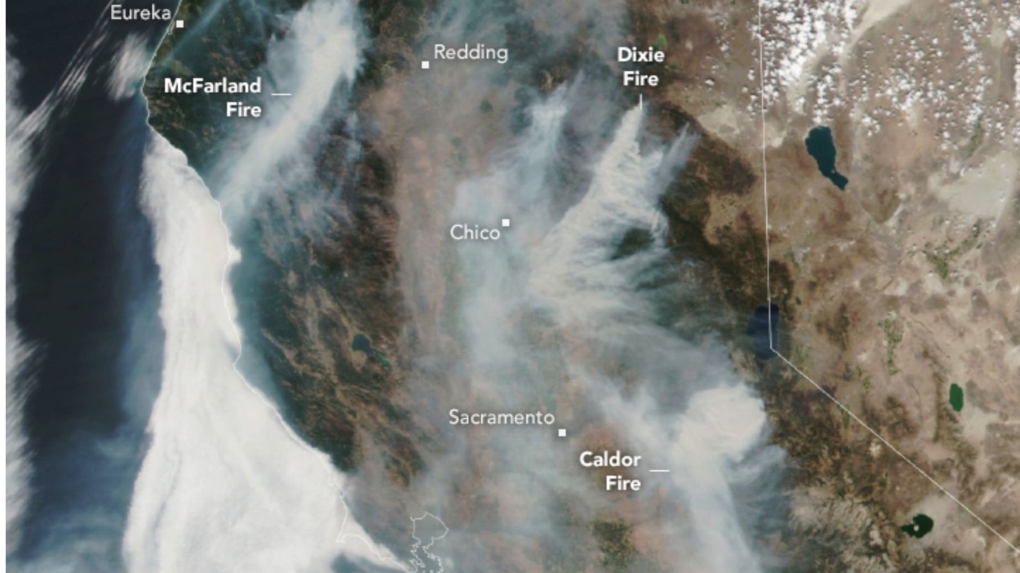
Landsat satellites captured dramatic images of California's wildfires from space, revealing the extent of the devastation. This image, captured on Aug. 19, shows huge plumes of smoke spreading across much of California, including the newly formed Caldor fire, which "exploded in size on August 16 as winds picked up," according to NASA.
Tearing through homes
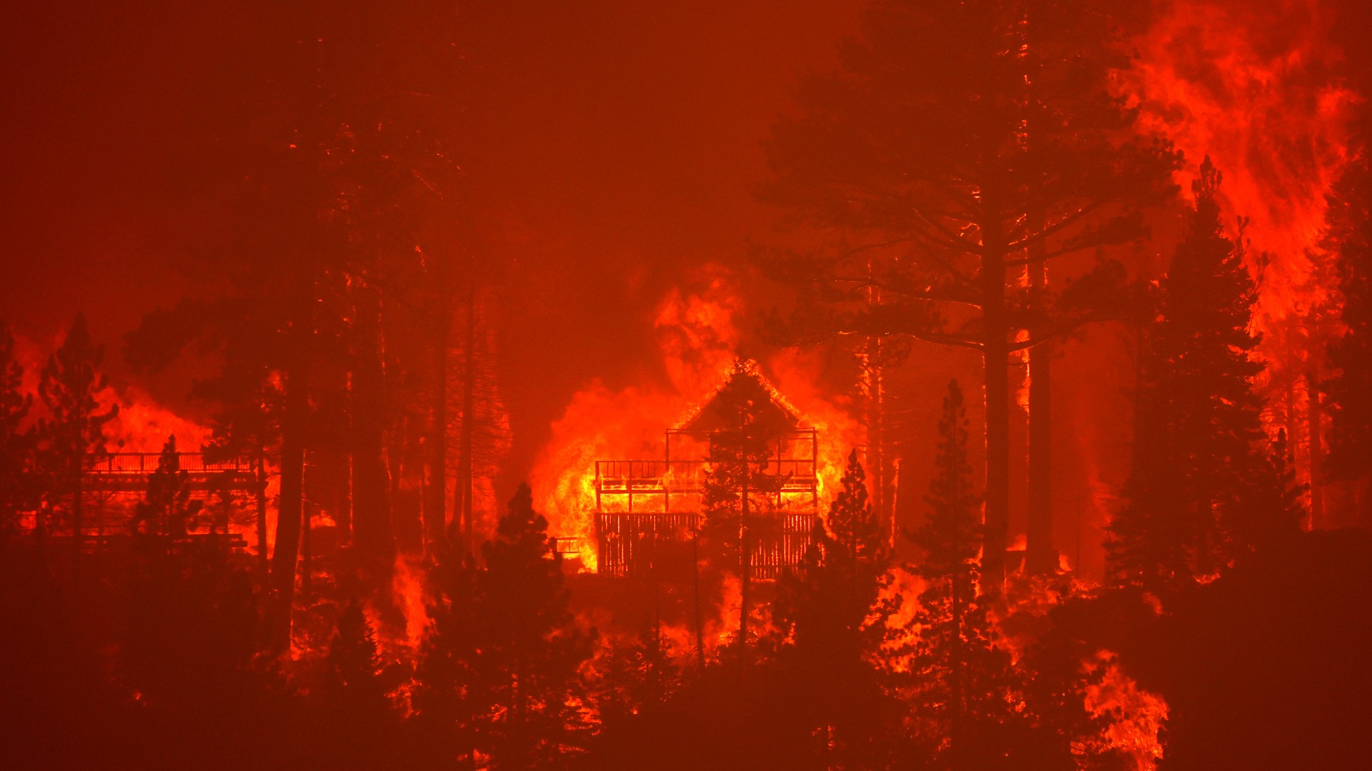
The Caldor fire burns homes along a ridge on Aug. 30, near South Lake Tahoe. The fire advanced toward South Lake Tahoe and a red flag warning was issued as high winds began to kick up. The fire has already destroyed hundreds of homes, and is threatening about 20,000 in the region, according to The New York Times.
Fire encircles iconic resort
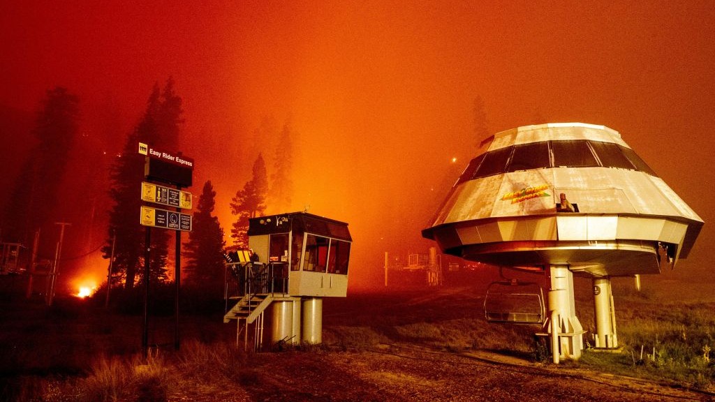
Flames surround a chair lift at the Sierra-at-Tahoe ski resort, during the Caldor fire in Twin Bridges on Aug. 30. The ski resort was surrounded by a "wall of fire" but escaped destruction for now, and its chair lifts are now being used by firefighters to reach remote and otherwise inaccessible areas of the fire, according to the San Francisco Chronicle. South Lake Tahoe is usually bustling with tourists, but mandatory evacuation orders have been issued for areas on the southern and western sides of the lake.
Strawberry ablaze
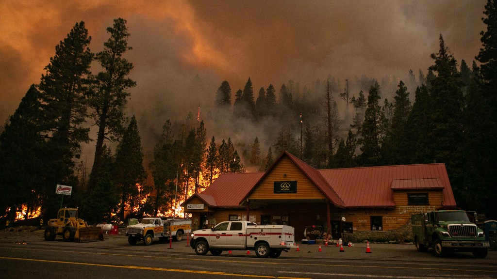
In this image, firefighters work to protect the Strawberry Station General Store, near a spot fire that started on a ridge behind the business on Aug. 28. Firefighters are battling the Caldor fire as it creeps closer to South Lake Tahoe. As of Aug. 31 at 10:45 a.m. local time, the fire was 16% contained, according to CalFire.
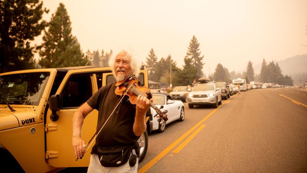
Fiddle while Caldor burns
Mandatory evacuation orders were issued on Aug. 30 and the one highway out of the region was clogged with traffic. This image shows a man named Mel Smothers playing the violin while stuck in traffic with evacuees, as residents fled the Caldor fire in South Lake Tahoe that day.
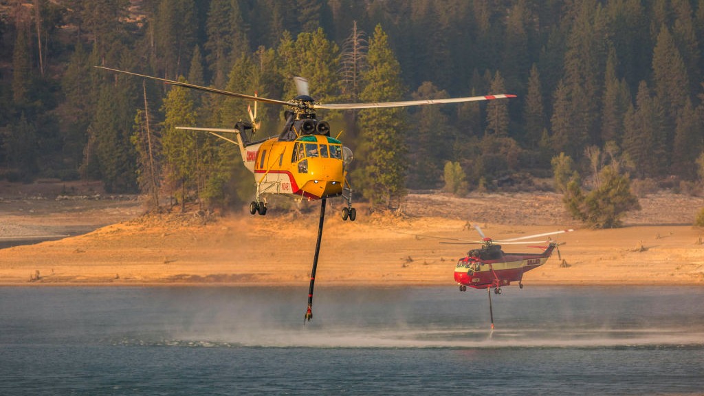
Filling up
Two helicopters draw water from a drought-affected reservoir. Helicopters are a key tool to tackle wildfires from the air and target less-accessible areas. The Caldor fire has grown quickly due to parched conditions and hot, gusty winds.
Get the world’s most fascinating discoveries delivered straight to your inbox.
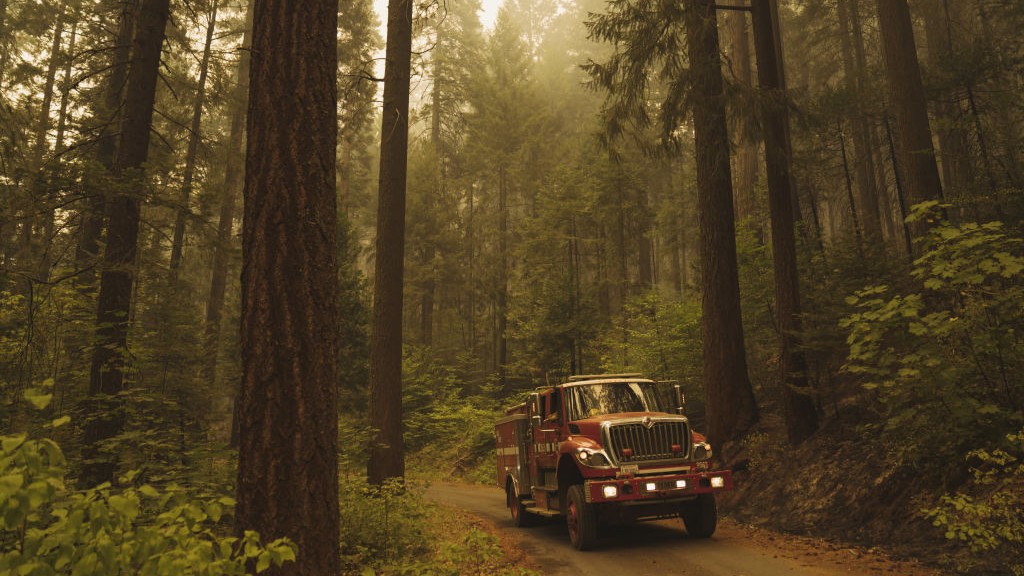
Emergency response
A fire truck heading to the Caldor fire in Riverton on Thursday, Aug. 19. Dry winds raking Northern California helped the Caldor fire east of Sacramento explode from 6,500 acres Tuesday (Aug. 17) to more than 65,000 acres by Thursday morning (Aug. 19), all but destroying the town of Grizzly Flats and hospitalizing two people with serious injuries.
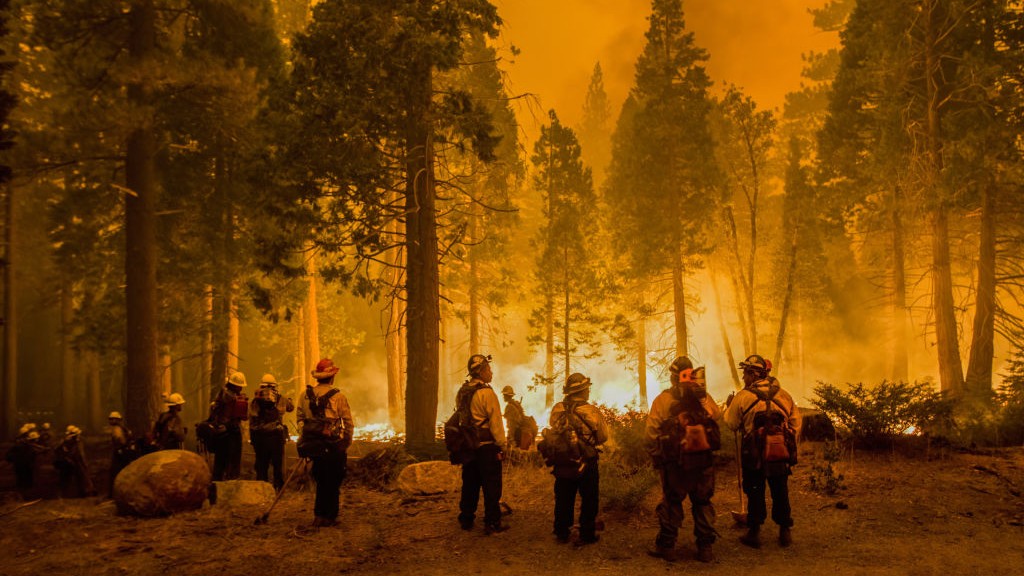
Fighting the fires
Firefighters stand by flames at the Caldor fire after starting a backfire. A backfire is "a fire set along the inner edge of a fireline to consume the fuel in the path of a wildfire or change the direction of force of the fire's convection column," according to the National Wildfire Coordinating Group.
Left in ruin
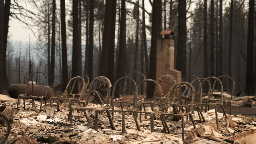
Chairs from the Grizzly Flats Community Church are still standing after the church was completely destroyed on Aug. 18.
Charred vehicles
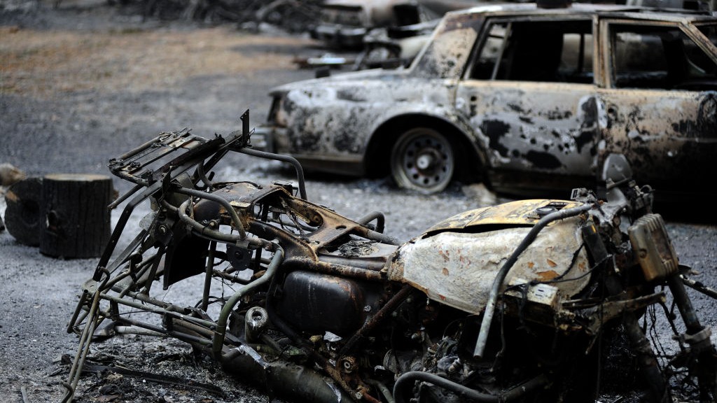
The wildfire ripped through Grizzly Flats, leaving very little standing in the small mountain community in the El Dorado National Forest in California on Aug. 20. Here, the burned-out husks of cars are left behind as the fire continues its destructive march.
The smoke spreads
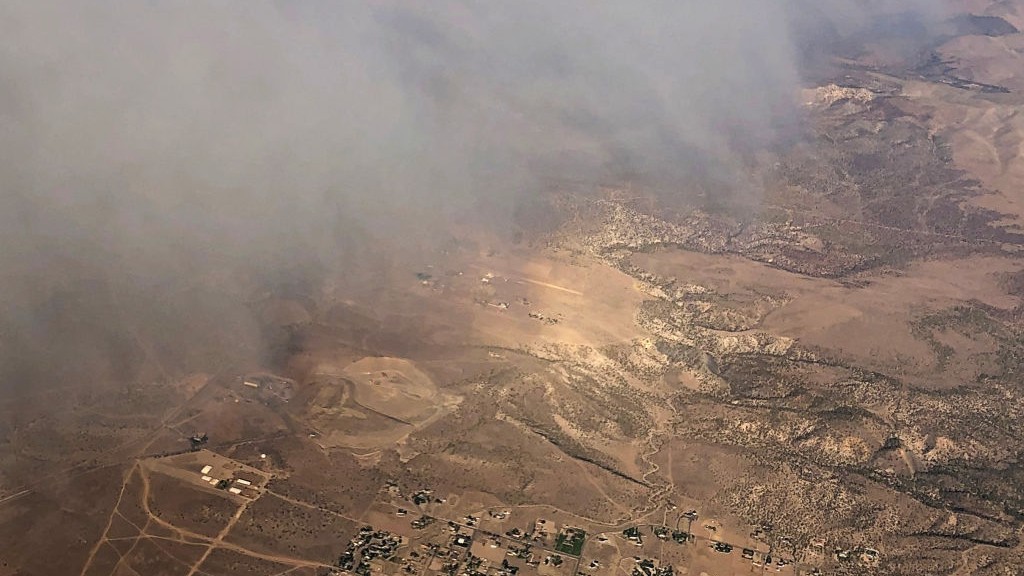
Smoke from the Caldor fire blankets the Lake Tahoe Basin and spreads across the state line into Nevada. Air quality has rapidly deteriorated and at one point, air in the South Lake Tahoe region was the most hazardous in the country, SF Gate reported. Firefighters tackling the Caldor Fire have priority over available resources, as the blaze has become "the number one fire in the country right now in terms of priorities for values at risk," according to El Dorado National Forest supervisor Jeff Marsolais.
Originally published on Live Science.
 Live Science Plus


