Soviets Hid Nuclear Bunkers in Poland's Forests (Photos)
Get the world’s most fascinating discoveries delivered straight to your inbox.
You are now subscribed
Your newsletter sign-up was successful
Want to add more newsletters?

Delivered Daily
Daily Newsletter
Sign up for the latest discoveries, groundbreaking research and fascinating breakthroughs that impact you and the wider world direct to your inbox.

Once a week
Life's Little Mysteries
Feed your curiosity with an exclusive mystery every week, solved with science and delivered direct to your inbox before it's seen anywhere else.

Once a week
How It Works
Sign up to our free science & technology newsletter for your weekly fix of fascinating articles, quick quizzes, amazing images, and more

Delivered daily
Space.com Newsletter
Breaking space news, the latest updates on rocket launches, skywatching events and more!

Once a month
Watch This Space
Sign up to our monthly entertainment newsletter to keep up with all our coverage of the latest sci-fi and space movies, tv shows, games and books.

Once a week
Night Sky This Week
Discover this week's must-see night sky events, moon phases, and stunning astrophotos. Sign up for our skywatching newsletter and explore the universe with us!
Join the club
Get full access to premium articles, exclusive features and a growing list of member rewards.
Keeping secrets
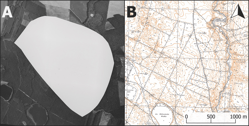
The left image shows a censored aerial photograph of the Podborsko nuclear military base from 1975, while the image to the right exhibits part of a 1970s civilian topographical map. The presence of any military installations is absent. [Read more about the hidden bunkers]
Hidden structures
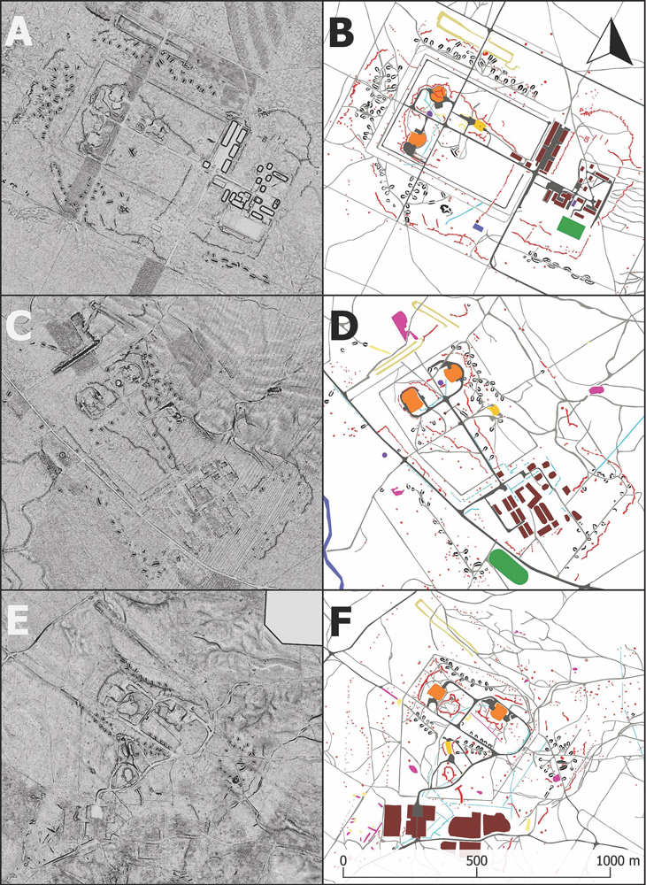
Using airborne laser-scanning data visualizations with positive openness (seen on the left), experts created vectorized plans of several Russian military nuclear bases in Poland. Seen on the right, at the top, is the Podborsko base; in the center is the Brzezńica Kolonia base; and near the bottom is the Templewo base.
Heavily protected
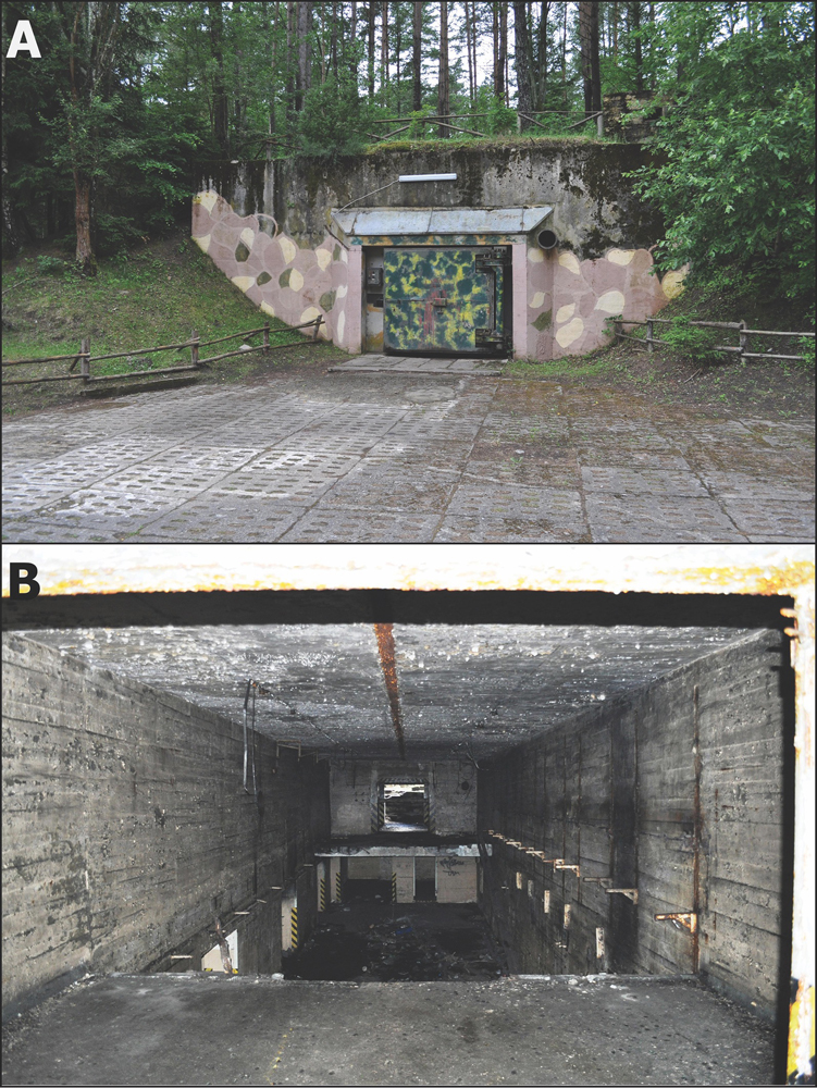
The upper image displays a "Monolit" bunker in its original condition at Podborsko nuclear military base site. A modern fluorescent lamp has been added to the exterior of the bunker and a recent paint job reveals a failed attempt to reconstruct the camouflage pattern. The lower image reveals a plundered "Monolit" bunker at Brzezńica Kolonia.
A day in the life
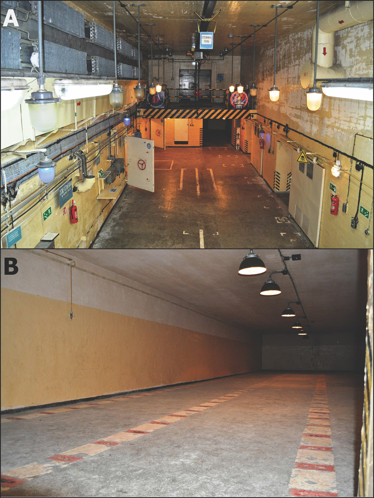
These photos exhibit a Podborsko "Monolit" bunker, including original furnishings. The main chamber holds a crane and loading ramp, as well as a cooling and ventilation system. The second image shows one of four rooms that were used to store nuclear warheads.
Slow and steady expansion
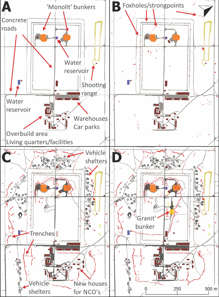
These figures were created from airborne laser-scanning data and satellite images. They depict four consecutive building and explasion phases of the Podborsko base.
Obscured evidence
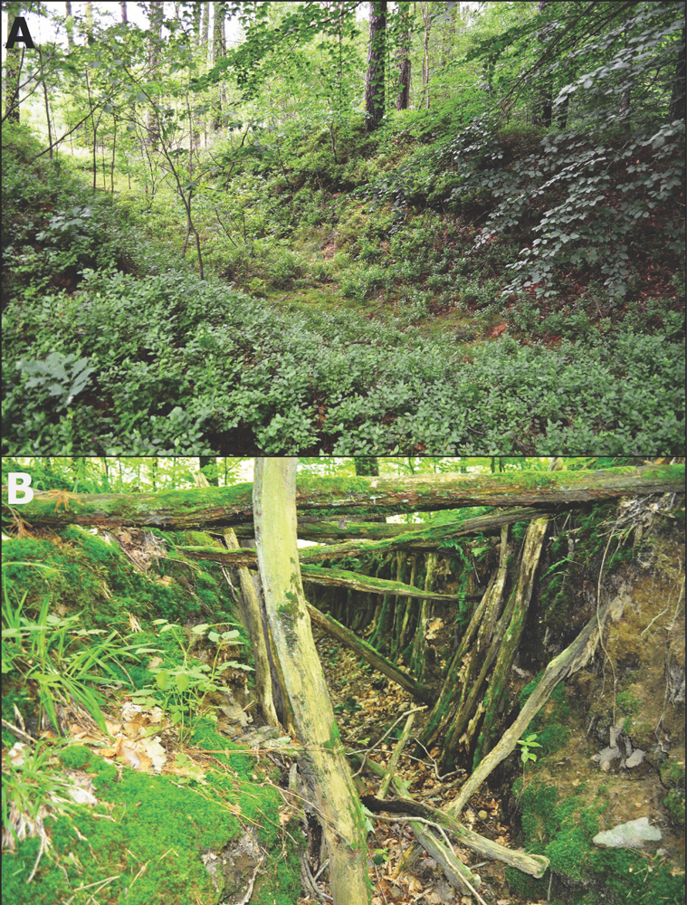
In the top image, a vehicle shelter lies in ruins at Podborsko. In the lower image, remnants of trenches at Templewo base are visible.
Strongholds
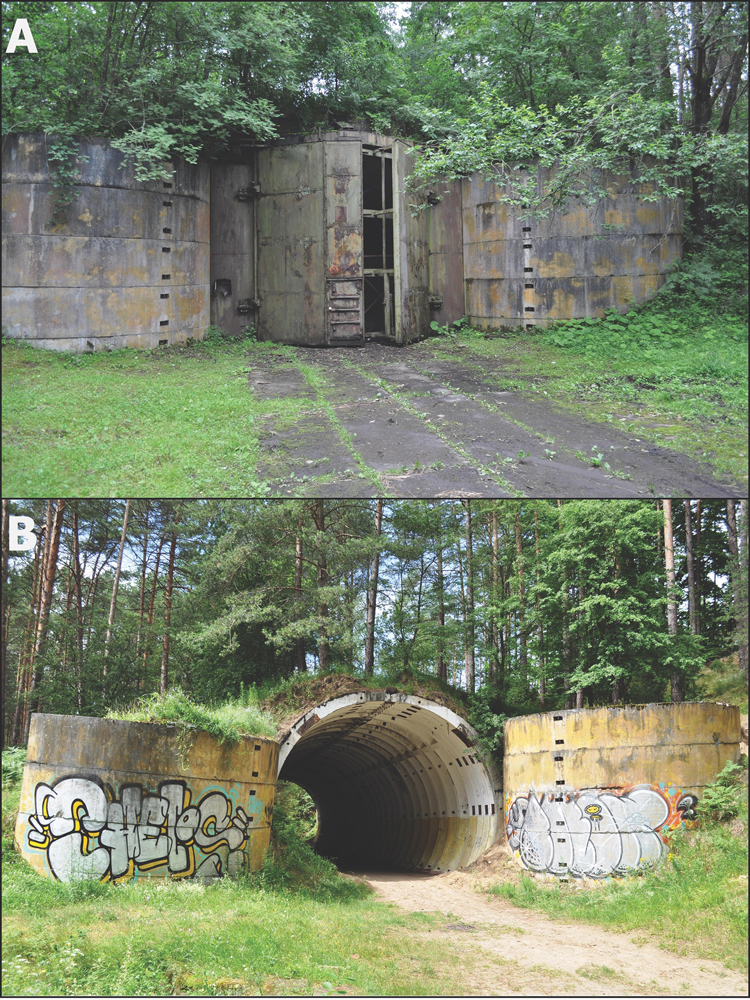
These images show bunkers at Podborsko (top photo) and Brzezńica Kolonia. These bunkers were one-story structures buried under a thick layer of earth, and made with prefabricated concrete elements. The graffiti is a modern-day addition.
Get the world’s most fascinating discoveries delivered straight to your inbox.
Work and play
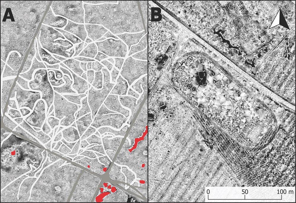
In figure A of this set of images, patrol paths were discovered using airborne laser-scanning with derivative-positive openness. Figure B depicts the remains of Brzezńica Kolonia's football pitch and running track, which were first seen in 1984 by the Landsat satellite program, overseen by NASA and the U.S. Geological Survey.
Secret but known
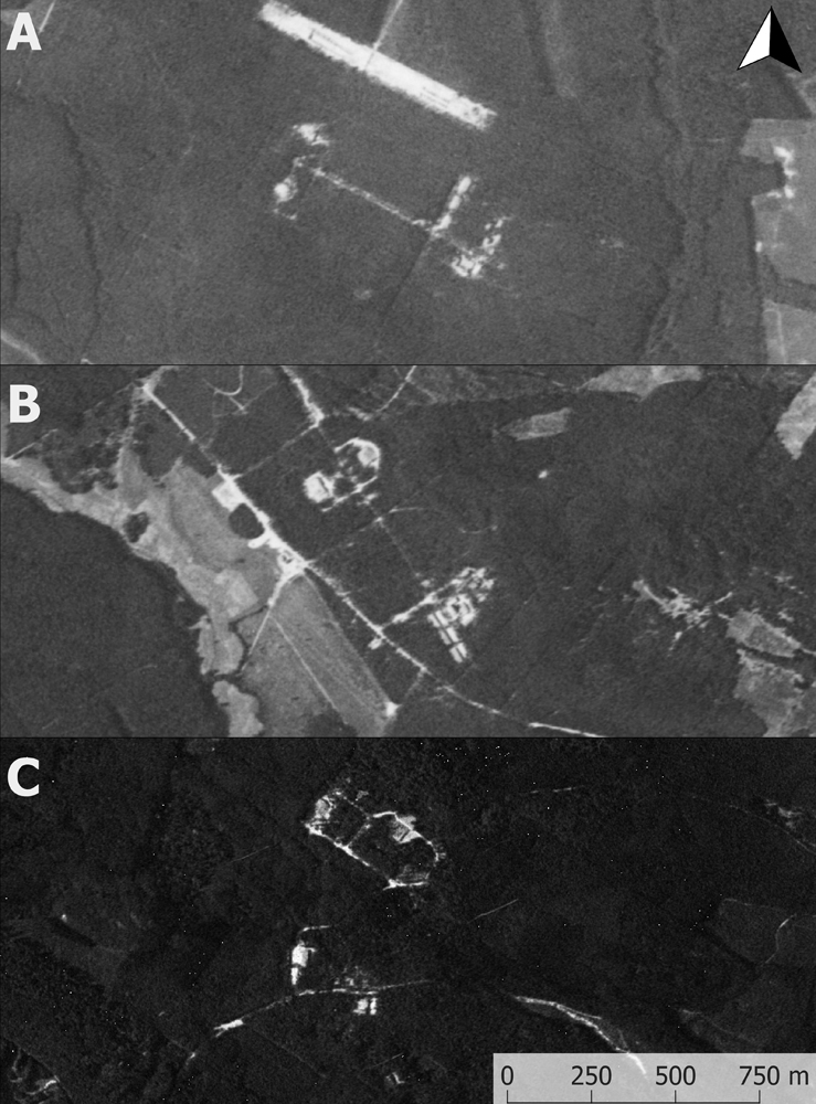
These three images reveal declassified U.S. spy satellite images of Soviet nuclear military bases at, from top to bottom: Podborsko, Brzezńica Kolonia and Templewo.
Bird's eye view
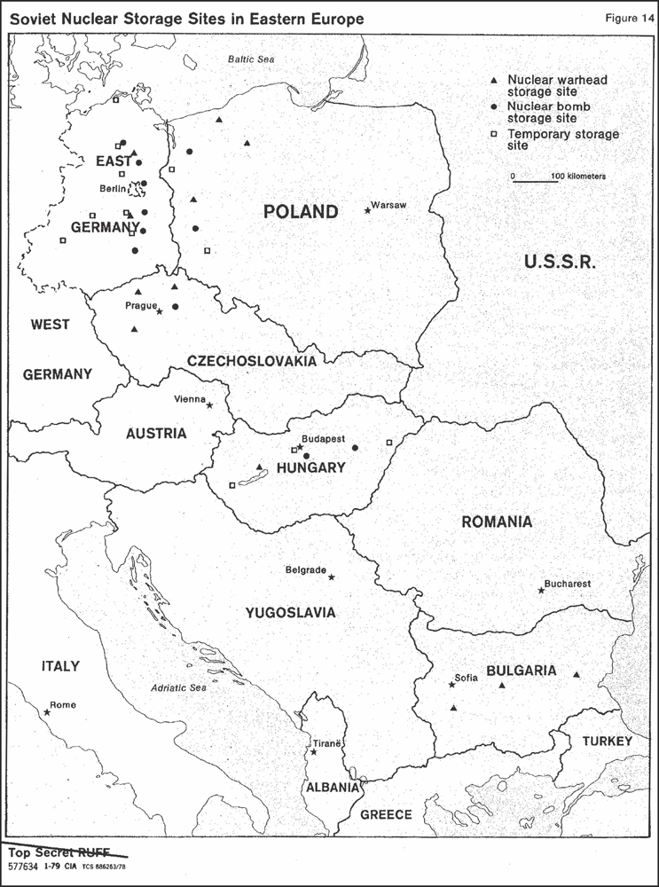
A declassified CIA report entitled "Warsaw Pact Forces Opposite NATO' from Jan. 31, 1979, disclosed this map, with the nuclear bases noted.
 Live Science Plus


