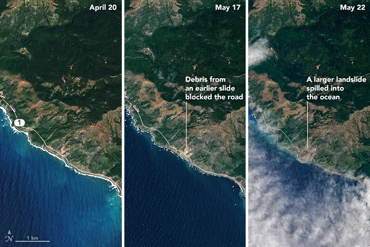
Jaw-dropping before-and-after satellite images capture the magnitude of a massive landslide along California's Big Sur coastline.
The landslide, which sent more than 1 million tons of rocks and dirt across California's scenic coastal Highway 1, occurred on the night of May 20. Before the huge rockfall, a smaller one occurred earlier in the spring.
"This is a large slide preceded by smaller slides, which is not uncommon," Thomas Stanley, a geologist and researcher for NASA, said in a statement. “Much of the California coastline is prone to collapse, so it’s fortunate that this landslide happened in an unpopulated location.”
Latest Videos FromLive Science
The dramatic collapse covered about 0.3 miles (0.5 kilometers) of the scenic byway in 35 to 40 feet (10.6 to 13.7 meters) of rubble. It also created 16 acres of land that jut out from the Big Sur coastline, the San Jose Mercury News reported.
The massive landslide was captured in images taken by the Operational Land Imager (OLI) on Landsat 8, an Earth-observing satellite operated by NASA and the U.S. Geological Survey. The before picture was captured on April 22, while images of the smaller rock slide were taken on May 17 and the massive slide was captured on May 22.
The massive landslide could close Highway 1 for a year, according to Caltrans, the California department of transportation.
The area is still vulnerable to further landslides.
“There’s still little rocks coming down and you can hear it," Susana Cruz, a Caltrans spokeswoman, told the San Jose Mercury News.
Originally published on Live Science.