Massive Dust Storm Swirls in New Photo from Space

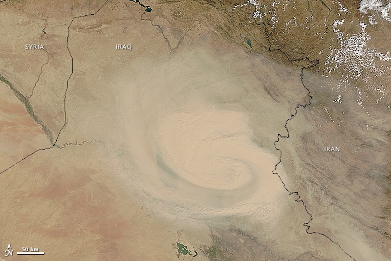
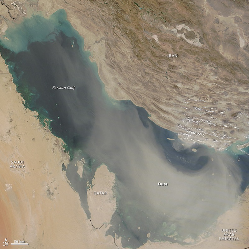
The Middle East is known to experience dust storms, but new satellite images captured dramatic aerial views of a dust storm that recently blanketed and rolled across Iran, Iraq and the Persian Gulf.
The veil of dust first appeared in satellite photos along the Iraq-Syria border on Aug. 31, according to NASA, and by the next day, it took on a cyclonic shape, similar to a tropical storm. By Sept. 2, the dust cloud reached the Persian Gulf and began to spread out across the gulf's basin the following day.
This storm pattern exhibited characteristics of a haboob, which is a sudden and massive dust storm that usually lasts only about a half-hour, according to NASA. But agency officials said the storm also resembled a shamal, a dust storm that can last for days and is associated with a northwest wind that blows through the lower valley of the Tigris-Euphrates river system and the Persian Gulf. [Fishy Rain to Fire Whirlwinds: The World's Weirdest Weather]
A haboob forms after a severe thunderstorm collapses and the rain-cooled air plummets to the ground at speeds of up to 100 mph (160 km/h). This air carries a lot of momentum, which means it hits the ground and kicks up dry, loose sand.

The recent storm spotted by NASA's Terra satellite seems to have been triggered by a surface low-pressure system, or an area where warm and cold air masses meet and shift to create a temperature equilibrium. The storm system moved from the northwest toward the Persian Gulf — a trajectory NASA officials said suggests the possibility of late-summer shamal winds.
According to anecdotal evidence and media reports in recent years, large dust storms appear to be more common in Iraq and Iran because much of northern Iraq is in exceptional drought, NASA officials said. The parched conditions could also be a result of the destruction of wetlands in the Tigris-Euphrates watersheds through natural phenomena and human use, the agency said.
Another unseasonal and dense yellow dust storm hit large parts of Lebanon, Syria, Israel and Cyprus yesterday (Sept. 8). So far, the storm has caused two deaths, but hundreds are reported to be suffering from respiratory problems. The storm's effects were felt particularly strongly in the dozens of informal camps in Lebanon where hundreds of thousands of Syrian refugees are living with limited shelter, according to Discovery News.
Get the world’s most fascinating discoveries delivered straight to your inbox.
Follow Elizabeth Newbern @liznewbern. Follow Live Science @livescience, Facebook & Google+. Original article on Live Science.

 Live Science Plus


